Thursday, January 25, 2018

EAST OSCEOLA VIEW LEDGE: 1/25/18


Mark Klim and I enjoyed great snowshoe bushwhacking conditions on a trek up a northern ridge of East Osceola to a ledge with a beautiful view down Mad River Notch. A sunny but cold and windy day.

The thaws and refreezes have set up a solid snowpack in the woods.


Heading up the ridge, into the sun.


Bent tree.


Good whackin'!


Blowdown from the October storm.


A nice open corridor that didn't last long.


A fallen bird's nest.


Steep and prickly on the push up to the ledge. The final flat approach was very thick.


It took 2 1/2 hours to ascend what seemed like a long 1 1/2 miles. As we hoped, despite a temp in the single numbers, it was reasonably warm here in the sun and out of the bitter NW wind.


The view over the Greeley Ponds and Mad River Notch is one-of-a-kind. This was my third visit here on snowshoes within the last 5 years.


A favorable angle on the Tripyramids.


East Osceola looms impressively, close at hand.


An icy slide on East Osceola. This is occasionally skied, but not right now.


The winds really picked up while we were at the ledge (gusting to 91 mph on Washington), forming a snow plume on East Osceola.


On the east side of the notch is the western knob of Mt. Kancamagus, and the K2 Cliff.


Parting shot, after a 1 1/2 hour sojourn on the ledge.


The arrow shows the location of the ledge, as seen from Lower Greeley Pond.


The NW wind blasted us as we descended the steep, thick and sunless slope behind the ledge. This was as cold as I've been all winter.


Mark checks out a pole that was bent while descending the steep section.


I had a pretty good frost beard going.


An impressive rootball.


Good woods for a bit on the gentle part of the ridge.


Friday, January 19, 2018

WEST OF TRIPYRAMID: 1/18/18


 I enjoyed sunny skies and fresh powder for a snowshoe ramble up Slide Brook on the Livermore and Mount Tripyramid Trails, then some great hardwood bushwhacking on the west slope of South Tripyramid. I tried but failed to find a small cliff up there that I had spotted from other summits.

Mt. Osceola was looking good in the morning. Later in the day the summit was socked in.


Flume Peak rising above Depot Camp on the Livermore Trail.


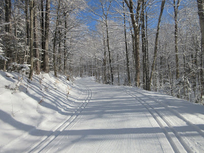
The fresh snow on Livermore was beautifully groomed by Waterville Valley XC.


White Cascade on Slide Brook was running strong.


Livermore Trail past the grooming, showing an old postholed track.


Heading onto the Mount Tripyramid Trail.


The immediate challenge was the crossing of Avalanche Brook.


I used this island of ice to fashion the crossing. It required several steps in the water, which of course led to massive snow clumping on my snowshoes.


I was pleased to see evidence of an old snowshoe track under the new snow.


Moose tracks and a mini ground blizzard from snow falling off overhead branches.


There's a nice backcountry feel out here.


A small cascade on Slide Brook.


I was pleased to be making first tracks in the 4-5" of new snow.


Several sections of the trail were minefields of frozen moose postholes. C'mon, Bullwinkle, wear your snowshoes!


 Trail crossing of Cold Brook. Wet snowshoes again.


Looking down Black Cascade, named for its dark gabbro bedrock.


Slide Brook above the cascade.


Nice brookside lunch spot.


I left the trail above Black Cascade and bushwhacked east up the slope through acres and acres of open second-growth hardwoods.


This area was heavily logged in the 1930s, as shown on this photo from Mt. Tecumseh that I found on ebay.


Looking back at a winding snowshoe track.


The hardwoods go ever on.


Looking back towards Mt. Tecumseh.


At 2800 ft. the slope steepened and conifers mixed in.


I was hoping to find what appeared to be a ledge or small cliff band, seen as a small white streak directly under Middle Tripyramid in this photo taken from Dickey Mountain. I had an estimated waypoint for this, but after 45 minutes of weaving up through gnarly spruce terrain, I saw no sign of a cliff. Maybe it was still higher up, but the snowshoeing was getting sketchy.


So I retreated to the friendly, sunny hardwoods and headed down.


I wandered across the slope to cross Cold Brook well above the trail. This stream flows from a high basin enclosed by the three Tripyramids. According to an early Waterville Valley guidebook by A.L. Goodrich, a good part of this stream flows underground.


This old logging road parallels Cold Brook on the north side. It's shown on the 1958 USGS Mt. Chocorua quadrangle.


A weathered stump from the old logging days.


Late afternoon sun.


Leaving a favorite corner of the Sandwich Range Wilderness.