
On a cool, partly sunny day I headed out to do some wandering below and around the South Slides of Mount Tripyramid, and ended up doing the loop over the three summits and down the Scaur Ridge Trail. It was a fine combination of brook, slide and mountain scenery.
My obligatory photo of White Cascade on Slide Brook, beside the Livermore Trail.

Livermore Trail.

In we go.
Gateway to the Sandwich Range Wilderness.

A mile or so up the Slide Brook valley I left the trail, bushwhacked across to Slide Brook, and followed its course upstream, looking for evidence of the great slides that fell in 1869 and 1885. Accounts of explorations following each of these slides told of swaths of destruction extending two miles or more downstream from the slide proper. The corridor in this photo has the look of an old logging road, but its location adjacent to the current brookbed suggests that it is a sparsely vegetated portion of the old slide track.

Another presumed swath of the old slide track.

A mossy sluice on Slide Brook.

In this section some of the bedrock exposed by the slides is still visible under its mossy cloak.

The slides cut quite a swath through here.

Upstream, the track narrows.

Mossy beauty has softened the gouge carved by the slides.

Terraced bedrock.

I stayed to the side so as not to trample this beautiful mossy bed.

The track soon split, and I took to the woods to follow alongside the joint track of the 1885 (Second) and 2011 (Third) South Slides.

I passed by the lowest remaining open patch of the 1885 South Slide, most of which is grown to dense spruce.

Emerging at the base of the relatively short 2011 South Slide, which was triggered by Tropical Storm Irene.

A short but powerful slide.

Canada Goldenrod, I believe.

Pearly Everlasting grows in profusion on this slide. This hardy herb was found on 17 of 22 White Mountain slides surveyed by researcher Edward Flaccus in the 1950s.

A tan-colored aplite dike - an intrusion of a fine-grained granite that cuts across the monzonite bedrock.

View from the ledges of the 2011 South Slide.

Heading across one of several tracks from the 1869 (First) South Slide, with a distant view of Mount Moosilauke through Thornton Gap, between Mounts Tecumseh and Osceola.

Slides, slides, everywhere slides.

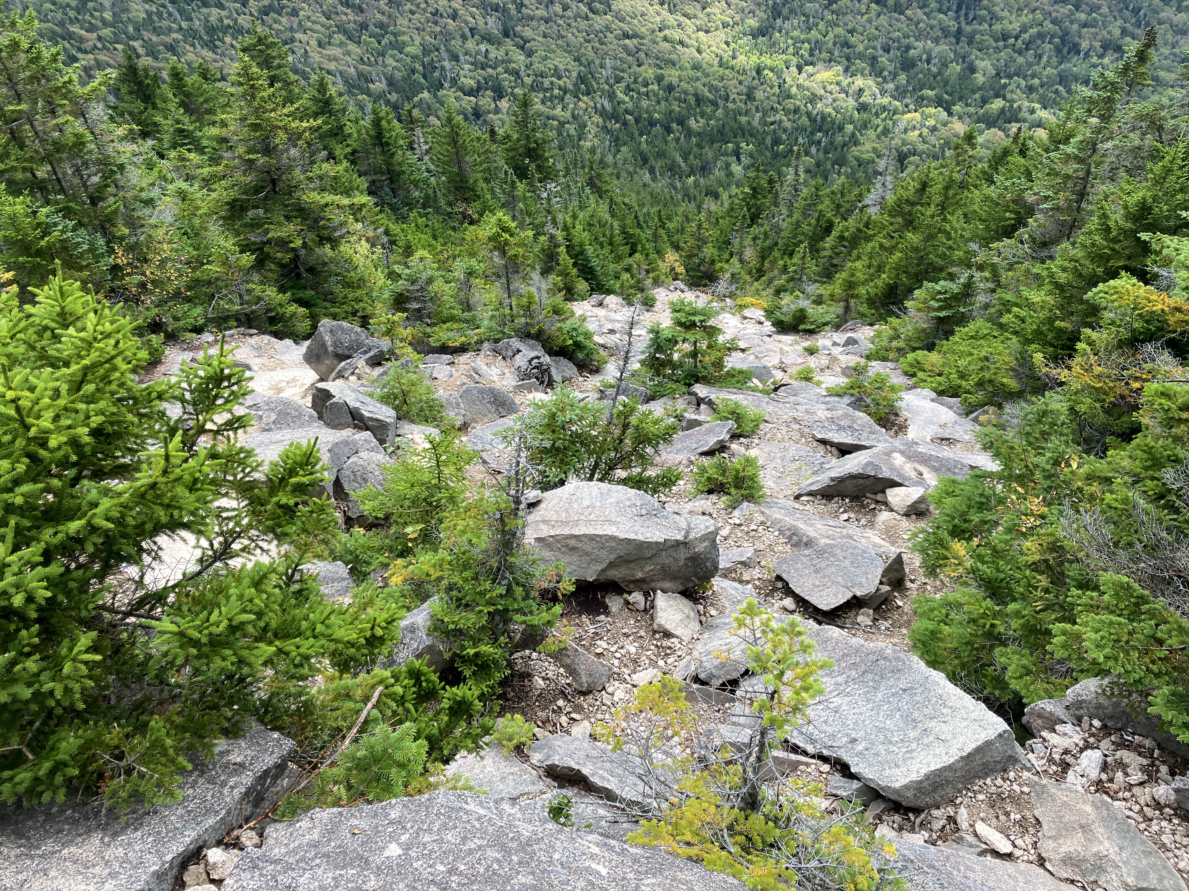
Ascending a narrow slide track just to the east of the Mount Tripyramid Trail.

A thriving white pine, far from its usual habitat.

Rejoining the Mount Tripyramid Trail, halfway up its route along the 1869 South Slide. Sandwich Dome looms large in the distance.

Looking down at the trickiest scramble on the 1869 South Slide. Above here I chatted with a couple who had ascended the North Slide and said it was quite tricky with water running down parts of it from rain the previous two days.

Approaching the top of the 1869 South Slide and the junction with the Kate Sleeper Trail.

A patch of ferns flourishing amidst the broken rock.

Beautiful view over the remote Lost Pass region.

Down-look. This part of the 1869 South Slide is quite steep with an angle of 34-35 degrees.
View from the very top of the slide, extending as far as Mount Monadnock in SW New Hampshire and Stratton Mountain and Dorset Peak in southern Vermont.

I think the scrambling just above the top of the slide is trickier than anything on the slide itself.

The wooded summit crest of South Tripyramid.

A glimpse of North and Middle Tripyramid.

Ferny boreal forest between South and Middle Tripyramid. A neat ridge.

A scramble through a portal just below the summit of Middle Tripyramid.

View east to Mounts Passaconaway and Chocorua from Middle's summit ledge.

The Moat Range beyond the Albany Intervale.

The western outlook has become considerably overgrown in recent years.

Final pitch on the generally mellow approach to North Tripyramid.

The NE outlook by the summit of North Tripyramid is quite limited in summer, though good with a deep snow platform in late winter.

A narrow path descends 100 yards or so to a stand-up westerly outlook. Here one can see the Osceolas, the Kinsmans and the Franconia Range.

A neat angle on Middle and South Tripyramid with Sandwich Dome beyond.

The steep upper 500 ft. of descent off North Tripyramid on Pine Bend Brook Trail is nasty, especially when the tilted rocks are damp and slick, which they usually are.

The butt came into play several times going down this section.

It's always a relief to get down to where the gradient and footing are more reasonable.

The stretch along the narrow crest of Scaur Ridge is always a treat.

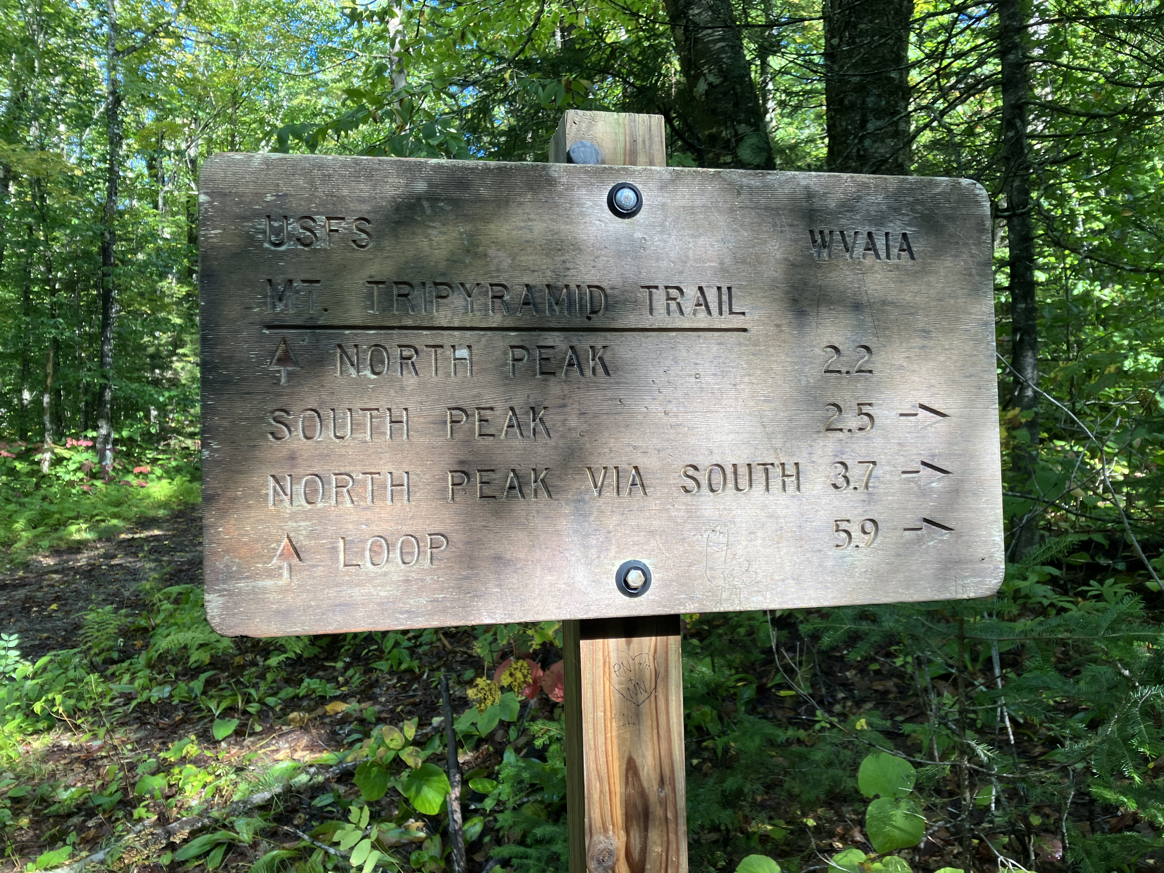
Weathered signs at the Scaur Ridge Trail junction.

Lushness at the head of "Scaur Ravine."

Gorgeous glades below.

A peek at the North Slide as the lowering sun illuminates North Tripyramid.

The Avalanche Camp clearing along Livermore Trail with dusk drawing on. Did the last two easy miles by headlamp to complete the 12-mile loop.

Do you have an idea if those huge 19th century slides were a result of clearcutting/massive logging?
ReplyDeleteGreat post as always, love the nature details.
-Lynn in Lebanon
Hi Lynn, Thanks for your comment. These slides predated the heavy logging on Tripyramid. They were the result of prolonged torrential rainfall.
ReplyDeleteGreat blog as always. I enjoyed ‘tagging’ along with you. Bonnie
ReplyDelete