On one of those rare perfect summer days - sunny, 70s, low humidity, refreshing breeze - Carol and I decided to take the long, generally easy walk into one of our favorite places: Flat Mountain Pond. This mile-long swath of water is secluded amidst the mountains of the Sandwich Range Wilderness, with two separate peaks named Flat Mountain overlooking it on the NW and SE sides.
We approached the pond from the western of the two trailheads for Flat Mountain Pond Trail, starting at the parking area on Bennett Street, off Route 113A in Sandwich. The last half-mile of Bennett Street is a narrow dirt road, but quite passable in a passenger car as long as you take it slow.

The first half-mile of the hike follows the continuation of the gravel road, through the privately-owned land of the Swift River Tree Farm, whose owners graciously provide access for hikers.

Then you turn R onto the Bennett Street Trail, well-maintained by the Wonalancet Out Door Club.

This path soon enters the National Forest and weaves through some deep, dark hemlock groves.

There's a long, attractive section that runs near Pond Brook, the outlet stream from Flat Mountain Pond.

A while after passing the junction with the Gleason Trail, you come to this inviting cascade and pool.
 Another 0.3 mile up a fairly rough section of trail along the streambank is Great Falls, dropping out of a small gorge into another golden pool.
 We followed Bennett Street Trail up along a tributary brook.
 At 2.1 miles from the trailhead we returned to the Flat Mountain Pond Trail, which follows the old grade of the World War I-vintage Beebe River Logging Railroad. Except for a couple of short washed-out sections, this narrow, gently graded route provided a fine, relaxing walk up along the side of the Pond Brook valley.
A mile farther we came to this picturesque brook crossing, with a beckoning midstream ledge.
 After two more crossings the trail leaned into the famous horseshoe curve by Camp 9, noted as the sharpest turn on any of the White Mountain logging lines. Scenic beaver meadows border the trail on both sides here.

The trail crosses an old overgrown beaver dam between the meadows.

I made a short bushwhack through the woods to the other side of the eastern meadow, where there was still a pool of water.
 To the SW rose the high ridge of Sandwich Dome.
Farther along the trail there was a 45-foot piece of exposed rail. Construction on the Beebe River line began in 1917. Starting from Campton (near today's Exit 27 off I-93), the line was eventually extended 22 miles up past Sandwich Notch and Flat Mountain Pond to the SW slope of Mt. Whiteface. Twelve logging camps were spaced along the route.
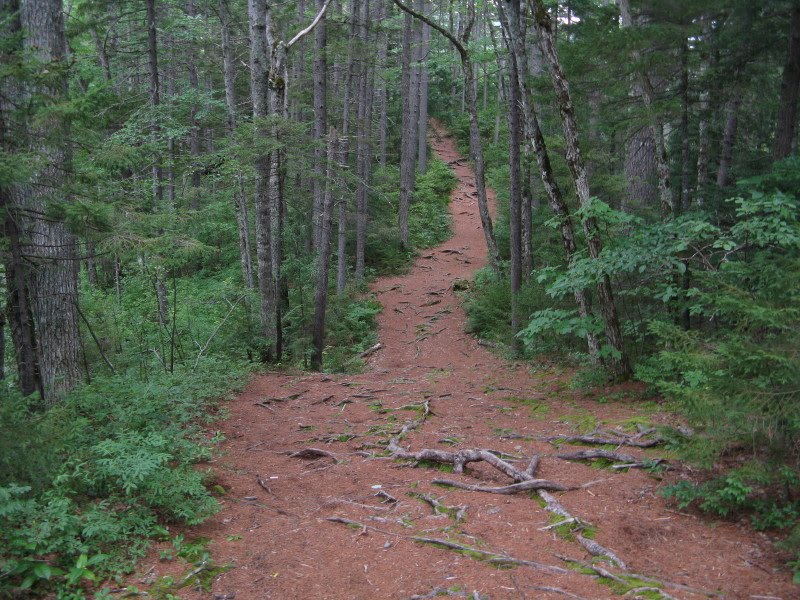
 White birches line the trail as you draw nearer to Flat Mountain Pond. They are the legacy of a catastrophic fire that hit the Beebe River Railroad in July, 1923. Fueled by slash left over from large-scale clearcutting, the blaze consumed 3,500 acres and cost the life of one firefighter. Sensing his fate, he scribbled a note on a piece of paper and pinned it to his coat: "John Gray died July 13." After the fire visitors described the Flat Mountain Pond area as a barren and desolate place. But before long, green growth returned, and a eventually a forest of paper birch - a "pioneer" tree that thrives after disturbance - cloaked the land.
The Forest Protection Area sign means we're only 1/4 mile from our objective, the shelter and clearing at the south end of the pond.

At the junction with the shelter side path, the Flat Mountain Pond Trail turns off the railroad grade to traverse along the slope above the west shore of the pond. Ahead, the railroad grade leads out into the swampy fringe of the pond; the water level is higher than it was in the 1920s.
 Near the shelter is a nice designated campsite.
The shelter is in good shape. We were surprised that there was no one around on this gorgeous day in late July. In fact, we saw no other hikers all day; only a group of summer camp kids down in the lower valley, tenting across Pond Brook from the trail.

This shelter is a room with a view. South Tripyramid pokes above the trees, with the upper part of its South Slide showing.

A path leads down from the shelter to Pond Brook just below the pond outlet.
 At the outlet itself there is an old, small wooden dam. Built in the 1950s to improve the trout fishery, it has deteriorated badly.
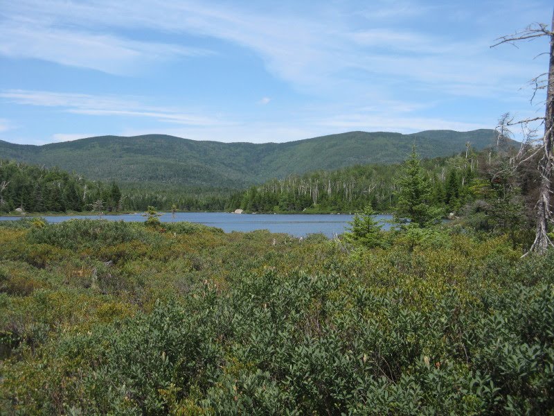
By the dam there's a fine view north up the pond to South Tripyramid.

In front of the peak is a spur of East Sleeper that guards the remote, mysterious gap known as Lost Pass.

Nearby to the NW is the broad mass of the northern Flat Mountain.
 A few yards west of the dam we found a shady spot with a wide watery vista to South Tripyramid, West Sleeper and East Sleeper.
 A closer look at the Sleepers. The southern slopes of East Sleeper may be the most remote area in the Sandwich Range.
After a long sojourn at our shady seat, I checked out the spot where the old railroad grade disappears into the pond. Here Mt. Whiteface (on the far R) is added to the view.
 While Carol read her mystery novel over by the dam, I made a foray north along the Flat Mountain Pond Trail, which enters the Wilderness soon after leaving the shelter area.
This section of trail is rough, primitive and often overgrown - quite a contrast to the railroad grade.
 Passing by one cove, there was a peek at Mt. Whiteface.
The trail goes through several short ups and downs above the shore, some of them rocky.
 My objective was a massive boulder positioned at the edge of the pond, about a half-mile north of the shelter. A fairly strenuous scramble is required to get atop this perch.
 From the top there's a long view down to the south end of the pond.
 Best of all is the fine view of Mt. Whiteface, with its little-known West Spur rising to its L.

If you don't want to scramble up onto the boulder, there are lower rocks just to the south that you can hop out to for a similar view.
On the way back I found this view of the southern Flat Mountain from a fern glade next to the trail.

Back to the shelter - still no one else around!
 The composting privy comes complete with instructions.
 A couple of final shots before heading out.
 With just the slightest downgrade, the railroad bed provided comfortable walking on the way out.
 We continued past the Bennett Street Trail junction for a loop variation descending on the Gleason Trail. A series of old railroad ties got us through a mucky section with dry boots.
I spent a few minutes poking around the site of Camp 8 on the railroad, located near the junction of the Gleason and Flat Mountain Pond Trails. Didn't find much for artifacts, save for this big old piece of metal - perhaps part of a boiler?

The Gleason Trail provided a nice moderately descending link through hardwoods back to the lower Bennett Street Trail. What a perfect summer day it was!
 The round trip hike to Flat Mountain Pond Shelter as described above is 9 miles with 1300 ft. of elevation gain. Add a rough mile round trip to visit the boulder with the Whiteface view.