
On a cool, sunny last day of summer I returned for a sixth bushwhack visit to Slide Ravine, the sharply cut basin on the SW side of Mount Moosilauke that is scarred by a number of landslides. Most of these fell in the big November 1927 rainstorm and the September 1938 hurricane. At least ten slide tracks can be seen in this 1955 U.S. Forest Service aerial photo. Several of these slides are now mostly or fully revegetated. Most prominent today is the large two-pronged slide seen on the south side of the ravine, which I've visited four times. The objective on this trip was the slide just to the SW of the big one. The lower part of this smaller slide is now revegetated, but there is still a large open patch in its upper part. I had looked at this spot many times from Mud Pond and various slides on Mount Clough, and I finally got around to going there.

I approached via the southern section of the Tunnel Brook Trail from Long Pond Road, an easy to moderate hike with good footing that passes through beautiful hardwood forest.

Many trail drainages had recently been cleaned. Kudos to the Steven Saffo family, the dedicated adopters of the Tunnel Brook Trail.

A lovely walk across the broad height-of-land at the south end of Tunnel Brook Notch.

I took a break at the shore of Mud Pond, the southernmost in the long chain of beaver ponds in Tunnel Brook Notch. This spot offers a fine view up to the South Peak of Moosilauke and Slide Ravine.

Though the slides were backlit in the morning sun, I had a good look at my lofty objective, seen in the upper center of the photo, with the big slide to its left.

I followed a moose path around the south end of Mud Pond, gaining a nice perspective looking north into Tunnel Brook Notch, the deep gap between Mount Moosilauke and Mount Clough.

Behind the pond I passed through this fern-filled hardwood glade.

Great hardwood whacking as I headed over towards Slide Brook.

As seen in the 1955 aerial photo, the open track of the slides extended far down the course of Slide Brook. Along the edge of the brook there are excellent examples of debris flow levees, lateral moraines of boulders deposited on the sides as the slides surged downstream.

One of many small cascades on Slide Brook.

Side view of a taller cascade.

Wild conifer woods.

Slide Brook sliding, and tumbling.

Glimpse of a high ridge enclosing the ravine.

When I first came upon this weedy opening years ago, I thought it might be the site of a logging camp. Upon further investigation, it appears to be the runout of an old slide off the north wall of the ravine.

It looks more "slide-y" above the opening. It apparently was the narrow, squiggly slide seen in the center of the 1955 aerial, on the north side of Slide Brook.

A nice open glade of birch.

Another debris flow levee alongside the brook.

Up near the 3000-foot level I crossed Slide Brook to reach the base of the slide I wanted to visit.

Yikes! I decided I wouldn't be climbing directly up the lower part of the slide track.

Instead, I opted to climb a steep mini-ridge just to the west of the track. This slope has a pitch on the order of about 34 degrees, but the spruce forest was wonderfully open with a minimum of rocks, holes and blowdown.

I made a short detour to the west to look at a shorter slide track parallel to the one I was aiming for. This narrow slide is clearly seen in the 1955 aerial photo.

Looking down this track.

Continuing up the little ridge between the two tracks.

Small deer postholes in the turf.

Looking back down the slope.

Higher up, I cut across eastward to the point where my target slide starts to open up. In here, where the rocks are shaded by the scrub, the footing was treacherously slick.

First views back to Mount Clough.
Opening up above.

Careful footing required on loose rock, but at least out in the open the rocks were dry.

Made it to the big open patch at 3400 ft.

A sweet view of Mount Clough, Mud Pond and distant (if hazy) horizons out to Vermont's Green Mountains.

Most of Mount Clough's steep, naked bedrock slides could be seen.

Mud Pond.

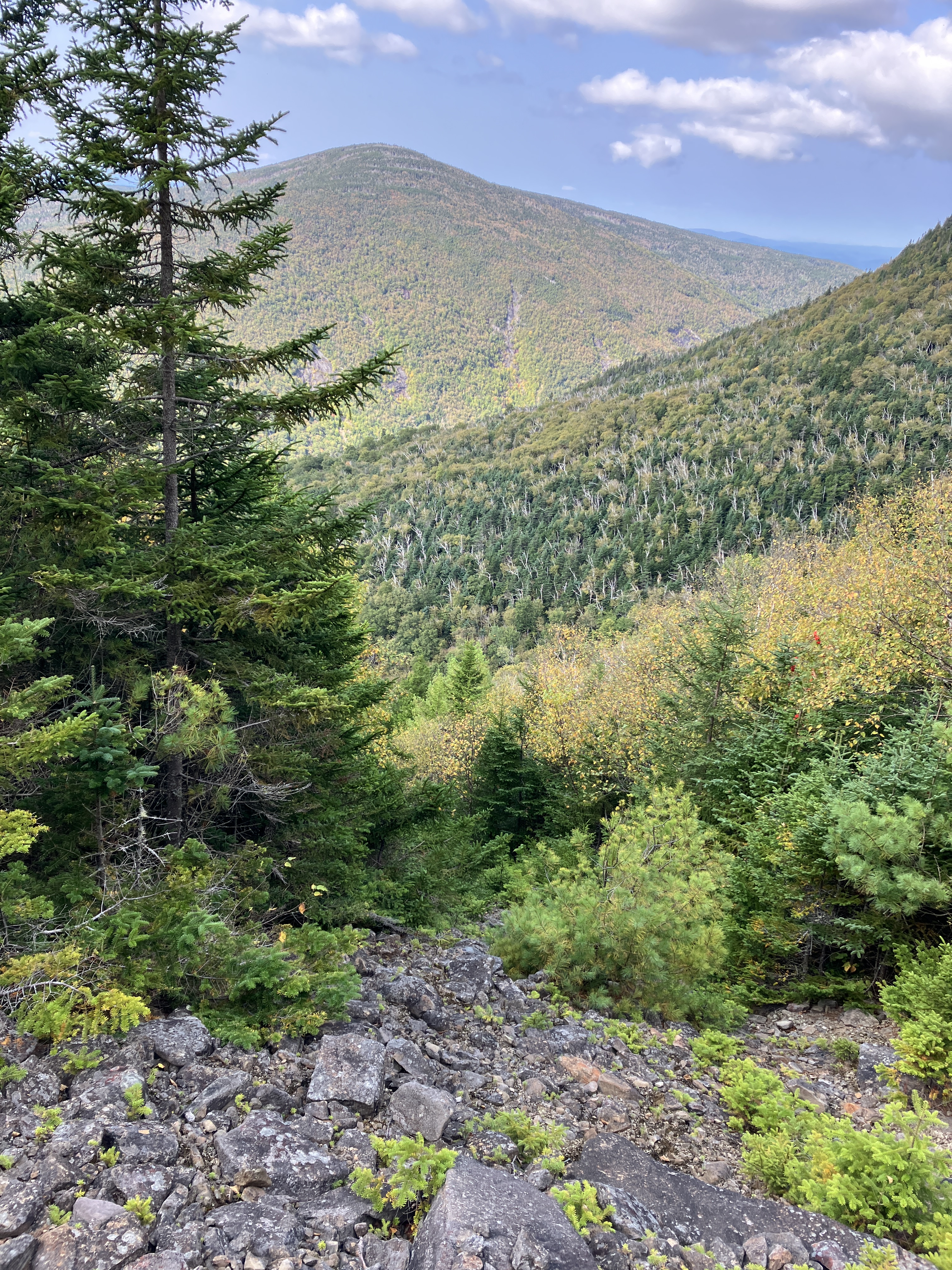
A massive Moosilauke ridge encloses Slide Ravine on the north side.

There is a large slide on the north wall of the ravine that probably fell in the late 1950s. John "1HappyHiker" Compton and I visited this one back in 2014. It's not easy to get to.

View out towards Vermont from the very top of the open section of today's slide. Distant views were hazy, but I could make out peaks such as Mt. Abraham, Mt. Ellen and Camel's Hump.

The uppermost part of the slide is a narrow finger that is largely revegetated with spruce.

For the 500-foot descent to the brook, I took to the woods from the bottom of the open slide patch, avoiding the slippery rocks on the scrubby section of the slide.

Back down through the steep, open spruce forest.

Interesting rock formation on a ledge band near the bottom.

A debris flow levee beside the base of the slide.

My favorite cascade on Slide Brook.

Hardwoods & hobblebush.

Evening at Mud Pond.

No comments:
Post a Comment