Wednesday, June 24, 2020

Waterville Flume: 6/23/20


One of the coolest spots in the mountains for a hot, humid day.

Peaceful scene on the Mad River, along Greeley Ponds Trail.


Big washout on Flume Brook from Tropical Storm Irene in 2011.


Logging artifacts revealed by the washout. Probably from Parker Young Company's Camp 5 across the stream.


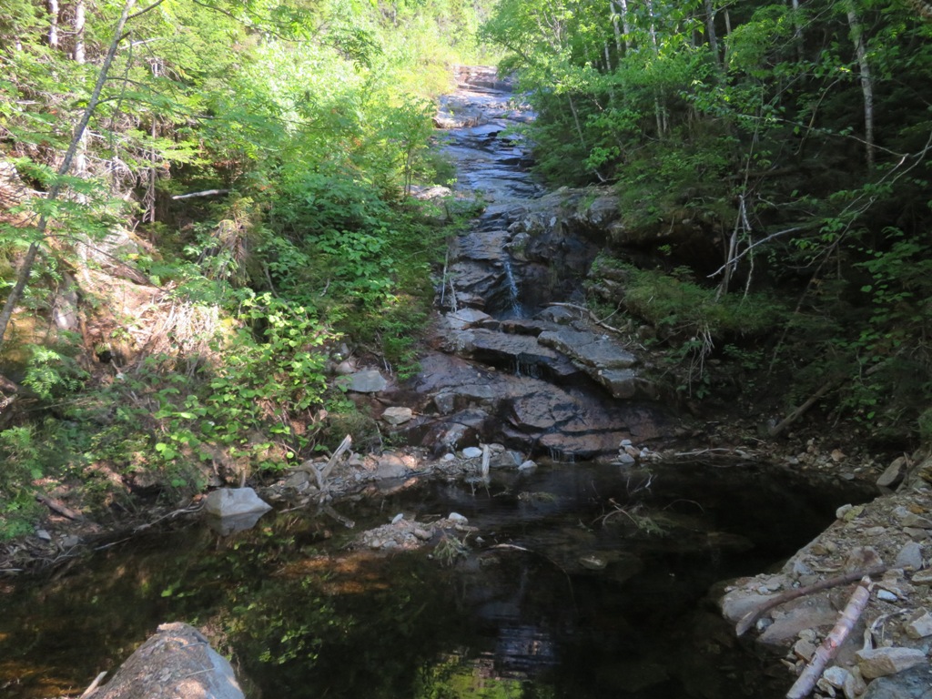
Towles Falls on Flume Brook, tiny but beautiful.


They were named for for the Hon. George Makepeace Towle of Brookline, MA, a summer visitor to Waterville Valley.


The Flume Brook Trail was abandoned after Irene due to a major washout, but much of the trail is still in good shape. This was one of the original Waterville trails built by innkeeper Nathaniel Greeley in the 1850s as part of the first trail network in the U.S.


 Remains of the dam on Flume Brook, used to build up and then release water for log drives down the Mad River in the early 1900s.


This gear wheel is suspended on timbers from the dam.


 A major meeting - where Flume Brook is joined by Kancamagus Brook.

  
The big washout on the Flume Brook Trail, where the trail was obliterated for maybe 0.1 mile.


Hobblebush has taken over parts of the abandoned trail


 Looking into the Waterville Flume.


 Flume Brook as it slides through the feature for which it was named.


 Cascade up around the corner, just above the Flume. The rough path that formerly led to this point was wiped out by Irene. Had to do a Dry River-style steep bank traverse to get here.


 Looking down through the Flume.


 Inside the Flume.


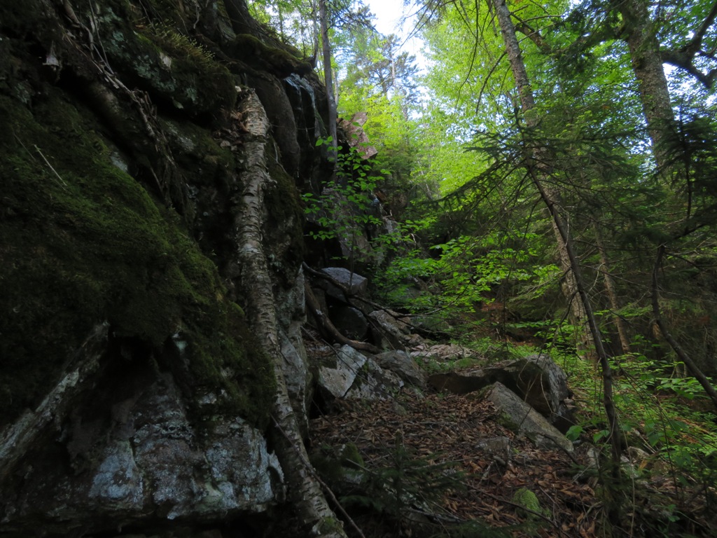
 Mother Nature took a bite out of this crag.


I returned via the wonderful Irene's Path, opened in 2014 to replace the Flume Brook Trail. As it climbs up onto the ridge to the south, you are treated to this unique view towards Mad River Notch.


 Hazy outline of the Osceolas.


 Owl's Head is seen in the distance through the Notch.


 Fine staircase built by OBP Trailworks.


 Ledge along Irene's Path.


 Fern glade.


 Waterville's Rock of Gibraltar.


Hazy view of Sandwich Dome from The Scaur.


 Clouds building over Tripyramid.


 White Admirals on the Livermore Trail.


Friday, June 19, 2020

Scenes from a Sunny Week


I was fortunate enough to get out for three hikes during a week of marvelous sunny and increasingly warm weather.

Carol and I took a late afternoon hike to The Scaur, the fine little rocky viewpoint that is our favorite destination in Waterville Valley. We saw no other hikers on the Kettles Path or at The Scaur.

WVAIA President Dan Newton recently painted and placed this new sign near the top of the Kettles Path.


Late afternoon sun on the south-facing Scaur. The name is apparently a Scottish variant of "scar."


Sandwich Dome, Noon Peak (below in front) and Jennings Peak.


The champion white ash of Waterville Valley, towering over the Kettles Path.


Taking advantage of the very dry conditions, on another day I climbed onto both forks of the Downes Brook (Passaconaway) Slide. The ledges of the slide are slippery and dangerous when wet, which is why the former trail that followed this route was closed by the USFS in the late 1950s.

Potash Mountain (R) and "South Potash" (L) overlook the wide lower slabs of the slide. This slide came crashing down around 1892 and vegetation has yet to gain more than a foothold on this bare rock.


A pool and wet slab at "the turn of the slide," where the west and east forks meet.


Looking back to Mt. Hancock in the distance.


The steep, wet upper slab of the west fork.


At the top of the west fork.


Relaxing in the sun, taking in the northerly vista.


The Presidentials sprawl beyond Mt. Tremont. Church Pond can be seen at the lower left.


Still a few lingering snow patches on Mt. Washington.


Potash Mountain, Mt. Carrigain, Green's Cliff and the Nancy Range, with Mts. Field and Willey peering over in back.


Dropping back to the "turn of the slide," I headed up the east fork, which begins at this peaceful spot.


 Sluice and pool.


This fork of the slide fell at a later date than the west fork and the lower slide, perhaps during the 1938 hurricane. Here it cuts through an interesting flume-like formation.


A "throat" that  I snowshoed up two winters ago. In summer the slick ledges necessitated a detour through the dense woods.


This brushy thicket was an open snowfield on that trip in the snowy late winter of 2019.


The biggest single drop on the east fork. In winter I snowshoed along the edge, skirting ice bulges. Today there was not enough time to navigate a route to the top of this pitch through the mean-looking woods beside the slippery ledges of the slide.


There's a good view from those ledges up there.


 The view in winter.


Ladyslippers seen on the careful return trip down the slide.


The high northern crags of Mt. Passaconaway.


The Ring of Power? This may have been used to lower logs via cable by lumberjacks working for the Swift River Railroad (1906-1916).


On a 90+ degree day I hiked to Fletchers Cascade on the flank of Flat Mountain North in Waterville Valley. Huge hemlocks thrive in the ravine of Bowlder Brook; this one toppled across the Fletchers Cascade Trail.


The lower cascades were just a dribble, but the stairstep ledge formations are picturesque in their own right.


The upper cascade, at trail's end, is a high rock wall.


I bushwhacked up through steep, gnarly terrain to the top of the long slide of open ledge that extends far up the mountainside above the cascades.


I emerged onto tiers of rock at the top.


Looking down the slide, which is visible from several points down in Waterville Valley.


I lounged for a long time in the hot sun, admiring the view of Mt. Tecumseh and Mt. Osceola.


The southern slides of Osceola were well-displayed.


Type 2 fun in the thick forest beside the slide.