On another steamy day I headed into the quiet Downes Brook valley for an ostensibly lazy day lounging on the gentle lower slabs of the Downes Brook (Passaconaway) Slide, a favorite spot where there would be shade and running water to be found. But that wasn't enough, so I ended up doing a bushwhack up a spruce-clad ridge on the east side of the slide, hoping to find some views. The views I found were limited, and I got pretty scratched up, but it was an interesting excursion nonetheless.
The waterbars on the lower Downes Brook Trail were in excellent shape, thanks to its new adopter, Ken MacGray, well known for his fine work on the 52 With a View guide and the AMC New Hampshire guidebooks.
Hadn't been to this happy place in a couple of months.
Other than the four brook crossings each way (on which many of the rocks were greasy and slick), the lower half of Downes Brook Trail provides generally smooth walking.
A short bushwhack, partly along traces of the historic, long-abandoned Downes Brook Slide Trail, brought me to the expansive lower slabs of the vintage early 1890s slide, which are prominent in the view of Mount Passaconaway from nearby Potash Mountain. The ledges of the slide are slippery and dangerous when wet, which is
why the former trail that followed this route was closed by the USFS in
the late 1950s. Caution was needed to avoid stepping on wet areas of ledge, which are slick as ice.
Climbing up the dry low-angle slabs is a joy on a sunny day.
My friend Dan Newton calls this the "Garden Slide" because of the great variety of vegetation that populates the crevices and edges of the slide. This is one of several species of goldenrod that blooms here.
Lance-leaved goldenrod is a regular bloomer on this part of the slide.
Looking across the valley at Potash Mountain. I took a long break here in the shade of a white pine.
Red maple and white pine.
On the next slab up the slide, trailless, spruce-clad South Potash enters the view.
A pool below a small cascade.
Moss and algae.
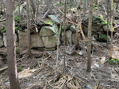
I always pay a visit to the "Ring of Power," a relic of the Swift River Railroad logging days in the early 1900s.
This may have been used to lower logs down the ledges with a cable.
I left the slide at the highest of the open ledges on the lower half of the slide. This one was a little too greasy to walk up.
The steep ridge on the east side of the slide is forested almost exclusively with red spruce. For the first part of the climb, the woods were open.
Looking back.
Farther up the ridge the young conifers were taller, making for thick and prickly going.
A ledge band running across the slope.
I circled around on the north side through some rugged terrain.
Moose have been wandering all over this ridge.
Moose track punched into the turf.
The top of my destination, a 2850-foot nubble, was in sight above.
The rocky nubble, which showed up faintly on Google Earth.
Tree growth limited the views, and despite some diligent searching for openings in the thick woods I didn't find much. There was this nice look at Mount Tripyramid.
I had hoped there would be a good look at the north side of Mount Passaconaway and the upper sections of the two forks of the Downes Brook Slide. But the trees were too tall and dense for that. I did get a look up at the northern spur of Passaconaway, the location of the mountain's great northern viewpoint, a thousand feet above where I was standing.
Another angle on the top of Passaconaway.
I found only one glimpse of the Downes Brook Slides - the top of the east fork, which fell many years later than the fork followed by the old Downes Brook Slide Trail. It was neat to see a prominent round boulder perched at the very top of that slide.
This boulder cave was an interesting feature of the nubble.
On the descent off the nubble, I got into some bad terrain for a bit.
I was plastered with spruce needles by the time I emerged from this.
I was happy to get back down to the slide.
Looking back at the mountain.
The lower slabs were beautiful in late afternoon sun.
Pretty scenes abound.
Time for another break, lounging on the slabs.
Streaky.
Side view. The angle on these slabs is only 18-20 degrees, for the most part.
Staircase at the bottom of the slide.


My favorite trail. I often go to the slabs too and make a coffee and read. Because this was such a popular trail in the early 1900’s, I always suspected the rings were part of a rope railing to help hotel-goers climb the slide.
ReplyDeleteA few years ago I asked a friend who is well versed in White Mountains history about the ring, and he wasn't sure what the ring was used for. I guess for now it will remain a mystery! Those slabs are a wonderful pace to hang out in the sun.
DeleteI’ve hiked this slide several times, both from the top down and bottom up. But it was at least twenty years ago. I went up again Sept 24th with my wife and two children in high school and middle-school. I enjoyed it as much as I remembered. It does seem much harder to follow the abandoned trail now. We only went part-way to a pool that has a slippery low angled slab right after it. It was a relatively open area where we could view Carrigain. Is that where the slide splits? It looks like one could cross there.
ReplyDelete