
With a late morning start, today's plan was to visit a number of waterfalls and viewpoints along the complex trail network out of Appalachia. The trek would incorporate a short side trip to the Valley Way tentsite, which I had never taken the time to check out. (Call it a bit of obsessive redlining.) I was fortunate to have another good weather day for wandering around the Northern Presidentials.

I wanted to walk on a variety of less-used trails, so I quickly turned off Valley Way onto the aptly-named Maple Walk.

 This stroll led to the Fallsway, where I descended a short distance to see Gordon Fall.

This lovely trail follows Snyder Brook up through a patch of old-growth forest with some large hemlocks. A strip of land here is protected as the Snyder Brook Scenic Area.

The trail rises past Lower Salroc Fall...

...Upper Salroc Fall...

...and the beautiful Tama Fall, seen here from above where the Brookbank crosses the stream.

Next it was time for some views. I turned L on the Brookside to cross Snyder Brook on large step stones where a bridge was washed away in 2005.

On to the short, steep and view-rich Inlook Trail.
 In recent years the RMC trail crew has built rock steps on the lower steep, wooded section of Inlook.
At just 2250 ft. you have your first of several vistas looking "in" up the Snyder Brook valley to Mt. Madison. I sat here for a few minutes in the sun, listening to birdsong and the roar of the brook below. This fine spot is just 1.3 miles from Appalachia.
 The trail climbs steeply, alternately in the woods and across open ledges, to the most spacious slabs at about 2500 ft. Here the vista also includes John Quincy Adams and Mt. Adams itself. Time for another break!
There are also views out to the west. The original name for this route, before it was obliterated by logging in the early 1900s, was the "Inlook and Outlook Trail." Some of these ledges were bared by a 1921 forest fire. The present trail was cut in 1932.
 Higher up, the trail emerges on the glacially eroded Dome Rock, where there are partly restricted views north to the Crescent and Mahoosuc Ranges.
 The Inlook Trail meets the Kelton Trail at another viewpoint known as the Upper Inlook.
 This ledge provides another perspective on the Adams summits and the Snyder Brook valley. The 1.6 mile hike to this point, using Fallsway and Inlook Trail, is among the best of its length anywhere in the White Mountains.
 The next segment of the hike was on the upper half of the Kelton Trail, one of the nicest woods walks in the region. Deep mid-elevation woods and good footing.

A rough sidehill section was vastly improved a few years ago by the RMC trail crew.

Next up was the upper portion of the Brookside. Typical of trails in the Northern Peaks, things get steeper and rougher above 2800 ft.or so.
 Not far above the junction is pretty Salmacis (sal-may-sis) Fall.
A short side path leads to some nice ledges (use caution) at the top of the falls. Nice place to hang out, and there's even a little distant view N to Jericho Mtn. near Berlin.

The Brookside ends at the Watson Path, then a short segment brings you to Duck Fall.
 Close by is the junction with the short trail known as Lower Bruin, next on the itinerary.
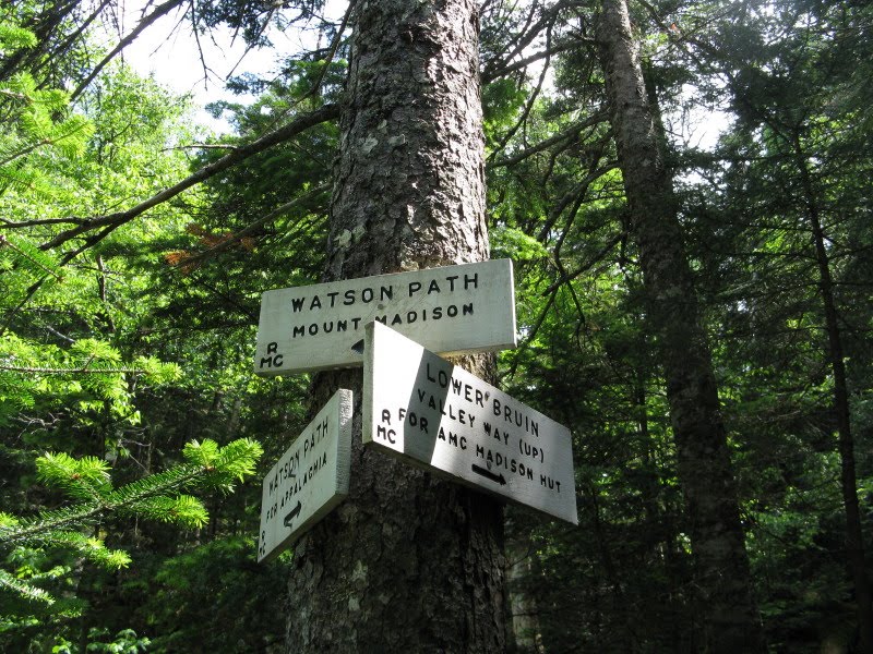 Lower Bruin starts out with a fairly challenging boulder scramble, then is moderately steep and rough as it ascends to Valley Way.
I turned L on the wide and rocky trade route of Valley Way and climbed about a half-mile to the Valley Way Tentsite spur path.

This leads about 150 yards to two tent platforms and an overflow camping area.

From the upper platform there's a clear view up to Mt. Madison: room with a view, no extra charge. A luxuriantly bearded AT section-hiker came by while I was taking a break here and was happy when I told him the platform was his, I was just there for a few minutes.

Just above the tenstite spur I turned R on Upper Bruin, a neat little trail that scoots by this wooded crag.
 Upper Bruin emerges above treeline just before it meets the Air Line on Durand Ridge, at the beginning of the scenic ledgy crest known as the Knife Edge. (This Knife Edge is actually quite mellow, nothing like the more notorious one on Katahdin.)
 A first look at the impressive headwall of King Ravine.
I climbed 0.1 mile up the Air Line and parked myself on a rough crag just before the junction with the trail called Chemin des Dames (elevation 4450 ft.). Mt. Madison looms nearby to the SE.

Looking up the Knife Edge to the Gateway of King Ravine, with John Quincy Adams behind.
 The summit of Mt. Adams rises well beyond the headwall.
In the shadowed SW corner of King Ravine is the "Great Gully," the location of the spectacular trail of that name.

The route of the Great Gully Trail can be seen climbing steeply to the R of waterfalls and crags in the center of this picture. The long, thin waterfalls were impressive this day, spilling down for hundreds and hundreds of feet.

This photo, taken in 2007, shows some of the wild terrain surrounding the Great Gully Trail.

From my perch next to the Air Line I could look down on the great boulder field on the floor of King Ravine...

...and out the mouth of the Cold Brook valley to the Pliny Range beyond.

Far below were the ledges on the Inlook Trail, from which I had peered up at the peaks earlier in the day.
 Late in the afternoon I headed down the Air Line, following two hikers who had summitted Mt. Adams.
The upper wooded part of Air Line is mellow ridge walking.
 Before the steep, rocky part of Air Line began, I turned right on the lightly-used Scar Trail. This route is 0.7 mile longer than direct via Air Line, but has mostly moderate grades and good footing.
Farther down I turned L on the optional Scar Loop, which leads over the steep little ledge viewpoint known as Durand Scar. Normally it's better to go up the Loop, due to some narrow, precarious footing with dropoffs just below the Scar. Of course it can be descended; just some caution required.

Looking down from the top of the Scar (3150 ft.).
 The view NE out to the Mahoosucs.
 The neatest vista from the Scar is up the valley to Madison and Adams. Wild and secluded here.
 Below the outlook the Scar Loop tightropes along a cliff face.
I followed the lower Scar Trail down to Valley Way, one of the easier descent trails in the Northern Peaks. Lower down, for variety, I diverged L onto Beechwood Way, which passes through a stately stand of tall sugar maples.
 The last 0.6 mile was down through airy hardwoods on the lower Air Line, completing a very rewarding 8-mile loop that passed by six waterfalls and six viewpoints and utilized all or part of 12 different trails, 10 of them part of the RMC system. There are more hike possibilities on the Appalachia trail system than at any other trailhead in the Whites.