Friday, April 27, 2012


RATTLESNAKE MOUNTAIN (RUMNEY): 4/26/12

The morning was sunny and beautiful, though showers were predicted for the afternoon.  The Rattlesnake Mountain Trail off Buffalo Rd. in Rumney provides a short hike with a stiff climb and fine views - fitting the bill for the day's weather pattern. I parked at an alternate spot by this historical marker just east of the regular trailhead, which has a small and rough parking area that can be hard to get in and out of.


 A connecting path leads up through a beautiful pine grove to the main trail.


The trail follows this tumbling, attractive brook for a little ways.


The middle section of the trail has some pretty relentless climbing. The woods below the trail were coming to life with freshly minted greens.


Higher up the grade eases. This is generally a very pleasant trail with good footing.


The loop junction is reached after a climb of 0.8 mi. and 850 ft.


I usually take the right hand fork of the loop, which gets you to the views more quickly. I like the section where it ascends over semi-open piney ledges.


My favorite view spot is on a side path to the R just before the trail turns L to scramble up to the summit ledges. This secluded perch has a good view north to the various trailless southern spurs of Carr Mountain, with the darkly wooded main crest peering over in back.


There's a long view west up the Baker River valley to the broad sweep of Smarts Mountain (L) and ledgy Mt. Cube (R). Black Hill is seen between these two Appalachian Trail peaks.


I spent an hour here relaxing in the sun. The distant view extends out to the Signal Mountain range in Vermont, with Piermont Mountain on the R.


As you clamber up open ledges to the summit, you pass this south-facing perch, with Mt. Cardigan in the distance.


Wavy metamorphic ledges along the summit crest.


View east over the Baker River valley with its fields and oxbows.


The summit ledge.


Stinson Mountain looms close by to the NE.


Identifying the spurs and neighbors of Carr Mountain. Of the named peaks shown here, only Carr itself has a trail, and all except Kineo have at least a partial view, though not necessarily at a summit. An interesting area to explore.


The NE view extends all the way to North Hancock.


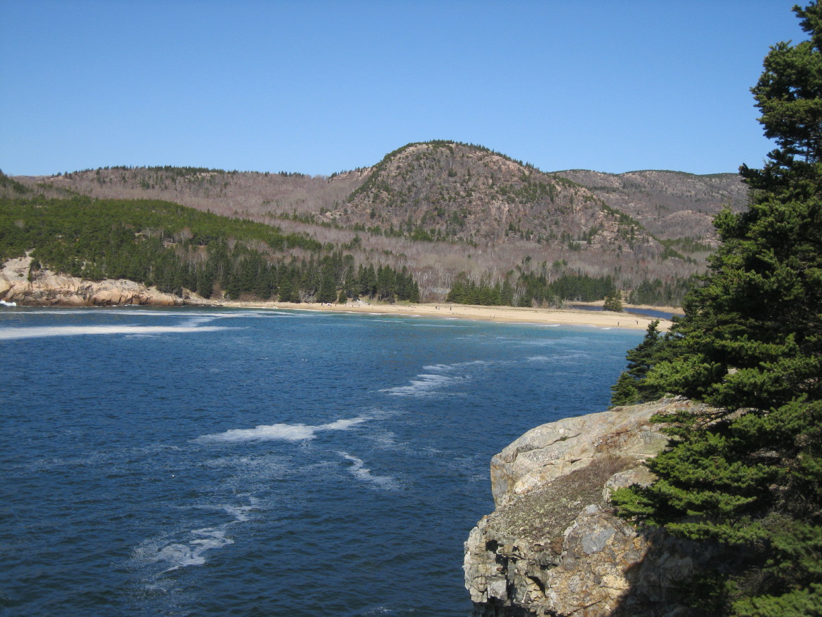
After descending from Rattlesnake, I did the short nearby 1.3 mi. loop at the Quincy Bog Natural Area as grey skies took over. A bridge at the east end of the trail offers this view of Stinson Mountain. Out in the pond/bog I saw a beautiful male Hooded Merganser, and flushed an American Bittern. Near the end of the loop I ran into a good friend out walking his dogs after a visit to the vet. All in all, a good day down in Rumney.


Monday, April 23, 2012


ACADIA NATIONAL PARK - GREAT HEAD TRAIL: 4/19/12

Another glorious sunny day in Acadia. Before making the long drive home to NH, we took a morning hike on the Great Head Trail, which makes a loop around a rocky headland and provides ocean and mountain views. We started from trailhead parking at the end of Schooner Head Rd. and soon veered left at a trail junction.


Within a few minutes a short side path provided our first ocean view, looking north.


The trail led through some birches that grew up after the big 1947 Mount Desert Island fire. I read somewhere that the blaze burned itself out in a big fireball out here on Great Head.


A sign marks the 145-ft. "peak" of Great Head.


A view across to the Schoodic Peninsula, part of which is included in the park.


Looking south to Otter Point.


Gazing out over the vast Atlantic.


Carol gets a shot from a rocky promontory.


Classic Maine coastline.


We spent some time on a ledge with a great view across Newport Cove to The Beehive. Down in the water we saw several Common Eiders and a Black Guillemot.


From the ledge, the trail climbed back up to the Great Head ridgecrest, passing this view of Gorham Mountain.


There were several fine views of Champlain Mountain, home of the famed Precipice Trail.


A view down to Sand Beach.


The return loop led across a unique ledgy plateau carpeted with gnarled pitch pines.


More ocean views on the way back down into the woods - a great way to end an Acadia vacation.


ACADIA NATIONAL PARK - CANADA/BEECH CLIFFS & BEECH MOUNTAIN: 4/18/12 

For the final full day of our Acadia visit, we decided to explore the western part of the park for the first time. We drove to the remote, high-elevation (500 ft.) trailhead at the end of Beech Hill Road, enjoying some good views along the way. Three trails leave from this parking area, providing options for shorter or longer loop hikes. An interesting boulder takes up one parking spot.


Our plan was to do the short, easy loop to Beech Cliff and the adjacent Canada Cliffs and then take it from there.


In an easy 0.2 mi., we reached the junction with the Canada Cliffs Trail and took a short side trip to viewpoints atop the Canada Cliffs. This vista looks SE to St. Sauveur Mountain and the Cranberry Islands beyond.


Another ledge provides a view to Beech Mountain and its firetower, close by to the SW.


A gorgeous view north over Echo Lake.


Then we headed over to Beech Cliff, just to the north of Canada Cliffs.


Looking NE to Acadia Mountain with Sargent Mountain beyond.


Peregrine Falcons often nest on Beech Cliff. The trail is open, but the area below the trail is closed to all entry so as not to disturb the falcons. We saw one of these magnificent raptors fly over while we were at the Canada Cliffs.


Relaxing atop Beech Cliff on a perfect spring day. This is one of the easiest hikes anywhere to a good clifftop viewpoint.


We decided that a second hike was in order, this one to Beech Mountain on the other side of the parking area. The Beech Mountain Loop makes a 1.2 mi. circuit over this 835-ft. firetower peak.


The longer, easier western part of the loop leads a half-mile to expansive ledges with a sweeping view over Long Pond and distant hills to the NW and north. This was one of the nicest spots we visited all week, quiet and lovely.


Darkly-wooded, ledge-spotted Mansell Mountain rises beyond the south end of Long Pond. This 949-ft. summit has several trails, including the rugged Perpendicular Trail.


It was only another 0.2 mi. to the summit of Beech Mountain, where ledges offer views south to the distant ocean.


This is the only fire tower in Acadia. The cab is locked, but you can go up to the first platform to expand the views.


A ledge just east of the tower looks NE to Acadia, Sargent and Cadillac Mountains and part of Somes Sound.


The eastern part of the Beech Mountain Loop starts out with a flat traverse through a neat area of ledges and pitch pines, then drops fairly steeply to the parking area, mostly over ledges. Another fun day in Acadia - one trailhead, two great little loops.


Sunday, April 22, 2012


ACADIA NATIONAL PARK - CONNERS NUBBLE: 4/17/12

Bar Harbor was shrouded in fog this morning, but things started to brighten around 10:00, and by the time we drove to Eagle Lake, not far out of town, skies were completely sunny and the temperature was soaring into the high seventies. Today's destination was Conners Nubble, a small (588 ft.), rocky peak that rises steeply at the SW end of Eagle Lake. I had visited this spot on an evening loop over North Bubble last year, but the hour was late and I could only enjoy the marvelous views for a few minutes before heading out. A repeat visit was in order.


The easiest way to approach Conners Nubble is a 1.4 mi. walk along the Eagle Lake carriage road on the west side of the lake. Last year the carriage roads were closed for mud season; this year's early spring enabled them to open early. The carriage road junctions are marked by these nifty signs.


The first part of the carriage road led through tall conifers.


Through the trees there were glimpses of Eagle Lake.


Most of the carriage road walk was through a fine oak forest. The sun was beating down relentlessly in these leafless woods.


We turned off onto the Eagle Lake Trail and quickly made another turn onto the Bubbles Trail.


This trail climbs gradually along the north slope of Conners Nubble through an area of scrubby hardwoods recovering from the great 1947 fire that burned thousands of acres on Mt. Desert Island. No shade here.


A steep pitch signified that we were approaching the main climb up the Nubble.


After a few easy ledge scrambles, we emerged on the open rocky summit, with the backside of The Bubbles visible ahead.


Conners Nubble is a small little peak, but its setting amidst several of the highest summits of Acadia provides outstanding vistas. Pemetic Mountain is seen over the south end of Eagle Lake.


Cadillac Mountain, Acadia's tallest, rises to the east.


The impressive ledgy mass of Sargent Mountain, second highest in the park, looms to the SW.


To the NW is a view over a remote, low-lying area of the park, including Aunt Betty Pond.


The Nubble commands an unparalleled vista over Eagle Lake.


The sun was brutally hot on the ledges, with virtually no breeze, so we cut our summit stay short after an hour.


We descended back to the north, then headed a little way south on the cool, shady Eagle Lake Trail.


Carol found us a nice spot on the shore with a view across to Cadillac Mountain. We lounged here for the better part of an hour before heading back along the shade-less carriage road.


Back at the parking area at the north end of Eagle Lake, we could look back at Conners Nubble, seen here to the left of center under the two humps of the North Bubble.


Since the day was so fine, if a tad warm, we drove the road up Cadillac Mountain and meandered along the summit loop trail. This view looks east over the south ridge of Dorr Mountain to Champlain Mountain, with fog lingering out over the ocean. 


The view SE down the valley between Cadillac and Dorr to The Beehive, Gorham Mountain, and Otter Cove. We capped off the day with fried clams at a Bar Harbor eatery.