Monday, April 30, 2018

CATSKILLS: PEEKAMOOSE ROAD GEOCACHING, 4/25/18


On a rainy day, Carol and I drove down to Peekamoose Road for some geocaching and waterfall viewing. This road is a narrow, winding route through a gorge carved out by Rondout Creek on the southern edge of the Catskills. There are a number of waterfalls spilling down the steep walls on either side of the road.


The best-known cascade is Buttermilk Falls, accessed by a short path.


A closer look at the main part of the falls.


This trailhead is the starting point for the climb to 3843-ft. Peekamoose Mountain.


One of the trickier caches was located 100 yards or so up picturesque Bear Hole Brook.


This wild stream drains a deep valley enclosed by Peekamoose, Table and Van Wyck Mountains.


Carol logs a neat cache hidden in a natural rock fort.


Sandstone ledges and mountain laurel.


An extremely popular swimming spot known as Blue Hole.


CATSKILLS: BEAVER KILL RANGE, 4/24/18


On another fine spring day, I joined bushwhacking buddy Mark Klim, who had come down to the Catskills from his Massachusetts home for a couple of days, for an off-trail adventure to the Beaver Kill Range, a remote ridge in the western part of the Big Indian Wilderness. Mark is pecking away at the Catskill 100 highest peaks, as described in Alan Via's excellent book, The Catskill 67. The day before he had bushwhacked up steep rocky slopes and through foot-deep snow on the ridge to Sleeping Lion Mountain, a little-visited peak on the west side of Rt. 42 and Deep Notch. That was his 60th peak on the list, and the summit of the Beaver Kill Range would be #61.

We made the long drive down to this very isolated southern trailhead in Mark's truck. The last few miles were on the gravel Black Bear Road, which was in excellent shape. We parked at the end of the maintained road, where there was a fine view from a large field, with Table and Peekamoose Mountains visible in the distance. 


We proceeded up the rough extension of the road on foot, designated as the Neversink-Hardenburgh Trail, and agreed that it would have been unwise to try driving any farther. 


After passing through a parcel of private land, we launched our bushwhack on state land, ascending through open hardwoods.


This rocky slope was one of the few rough spots we encountered on this generally mellow bushwhack.


Mark framed by an unusual tree.


Spring whacking at its best.


An old sugar maple.


This open glade was one of the finest spots of the day.


A meadow-like area in the woods.


After skirting an eastern summit of the ridge, we encountered some spring snow in a high, broad col. Time for a break.


Heading up towards the main summit.


As we neared the summit, we climbed over a deep, hard-packed snowdrift deposited by the winter's NW winds.


On the other side of the drift, we emerged in the fabulous fern and yellow birch glade beautifully described in Alan Via's book. To our surprise and delight, the glade was free of snow.


What a stunningly beautiful spot, in this remote nook of the Catskills.


The glade offers a good view north to Balsam Lake Mountain and the ridge leading across to Graham Mountain.


 Balsam Lake (on the left) and its namesake mountain.


A zoom on Balsam Lake in its hardwood bowl.


Graham Mountain to the NE.


We savored this spot for an hour and a half.


Mark taking it in.


Heading up towards the summit.


A rock with a view over the open high-elevation forest.


Park-like.


At the 3377-foot summit of the Beaver Kill Range.


Cool layered rock.


A Catskill Valentine.


Heading down a southern ridge to check out a large beaver meadow/pond.


At the base of the ridge was a pretty little stream flowing into the beaver pond.


Tall trees at the edge of the pond.


A serene scene at the north end of the pond.


Fresh beaver cuttings.


Beaver meadow creature.


Beaver dam near the south end.


Looking north to the main crest of the Beaver Kill Range.


A lovely spot in the wilderness.


We sat on a log for a while to take it in.


Parting shot before bushwhacking over a ridge to the Neversink-Hardenburgh Trail to return to the trailhead.


CATSKILLS: BURNT KNOB, 4/23/18


The mellow hike up to Burnt Knob (3180 ft.) on the northern part of the Escarpment Trail is one of the best moderate hikes in the Catskills, with three fine viewpoints, each with a unique perspective on the surrounding landscape. We had a beautiful warm, sunny spring day in store for us, and I could think of no better place to spend it.

We started from the trailhead at the end of Big Hollow Road and headed up the north side of the Black Dome Range Trail.


There was some ice and old snow in the hemlock forest on the lower slope.


Once into the open hardwoods, the snow mostly disappeared. There were a number of large black cherries in the hardwood mix.


Rugged terrain along the Escarpment Trail as we climbed towards Burnt Knob.


Typical Catskill sandstone ledges.


Carol works her way up through a ledge scramble. Above here, where the trail makes a steep switchback out to the north, we had to negotiate a steep sidehill of old firmly packed snow. This entailed some vigorous step-kicking.


At the top of the climb the trail levels, and soon a side path brought us down to one of our favorite Catskill spots, looking across Big Hollow to the three peaks of the Blackhead Range: Blackhead, Black Dome and Thomas Cole.


Blackhead Mountain, with the peak called Arizona peering over on the left.


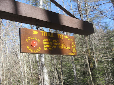
Looking east to Acra Point, another viewpoint along the Escarpment Trail.


Black Dome Mountain.


Thomas Cole Mountain, with its western spur, Camel's Hump, on the right.


We headed NW along the Escarpment Trail, enjoying the bare ground walking.


We encountered some spring snow in a broad col west of Burnt Knob.


The second view ledge offered a vast view to the NE. With 90+ mile visibility, we could see distant peaks such as Equinox and Glastenbury Mountains in southern Vermont and Crane and Puffer Mountains in the Adirondacks.


Windham High Peak loomed close by to the NW.


Carol takes it all in. While we were here, she downloaded the peakfinder.org app to her iPhone, which was a great help in distant peak ID.


After a ridge traverse and short climb, we arrived at the third and final vantage point for the day - a ledge perch with a wide SW view.


Another angle on Windham High Peak.


Thomas Cole, Camel's Hump, and The Caudal.


A long view to many Catskill peaks, including West Kill, Rusk, North Dome, Halcott, Vly and Bearpen.


Heading back along the Escarpment Trail.


The Blackheads in late afternoon.


Through the course of our 4 1/2 mile hike, I tossed perhaps a couple of hundred branches and limbs off the trail. Many appeared to have fallen during a recent ice storm. There were a few larger blowdowns as well.


Along the trail was a small cascade on a tributary of the Batavia Kill, a nice scene at the close of a fine spring day in the Catskills.