Tuesday, December 17, 2019

Snows Mountain Bushwhack: 12/16/19


Taking advantage of the current combination of bare ground/thin cover down low and hard-frozen snow above 2000 ft. - excellent conditions for bushwhacking - I returned to the Snows Brook valley and did a bushwhack-and-trail loop over Snows Mountain. Highlights of the day were limited but interesting views, a wonderful high-elevation hardwood glade, and a number of remarkable old trees.

I reprised the approach up the Snows Brook valley from the previous week's Lost Pass journey, taking Waterville X-C ski trails and the abandoned and partly overgrown Snows Brook Trail. Not far from the XC trails I found this partly buried old wheel.


A small cascade on Snows Brook.


The 1920s logging camp site well up in the valley, which I had first visited the previous week.


I spent some time poking around and found some more (protected) artifacts. Perhaps this was part of a stovepipe.


Not sure what this item was.


Might be part of an old bed frame.


Snows Brook.


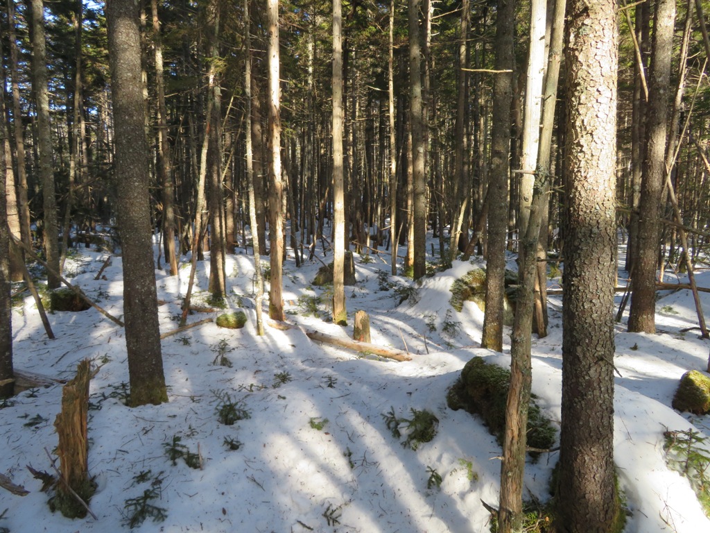
I  bushwhacked across a broad part of the valley to begin the steep ascent to the Snows Mountain ridge.


A towering white ash.


A wide-spreading shelf fungus.


Starting the climb through mixed woods.


The slope became very steep, rocky and rough. Time to traverse westward to find better going.


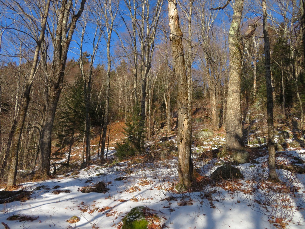
Ah, here's the hardwood slope I was looking for.


A gorgeous stand of high-elevation sugar maples.


The first of two old logging roads that cut across this slope. Flat Mountain North is in the background.


Could be spring in the Catskills.


Suspended.


The monarch of Snows Mountain.


Shelf fungus art.


Vivid moss.


Great whacking.


Fern glade.


I reached the broad ridgecrest about a half-mile west of the true summit of Snows, and a half-mile east of the upper end of the Snows Mountain Trail.


The snow was rock-solid, making for superb bushwhacking conditions. Today I wore Stabilicers trailhead to trailhead. Here I crossed tracks with what I thought was a coyote.


I spent some time wandering along the ridgecrest. I went a little ways to the east before turning around.


Not enough daylight to go to the true summit of Snows (3060 ft.), which Keith D'Alessandro and I traversed back in December 2006.


I wondered what made these old tracks, distorted by melting.


 "Snows Mountain Park."


There is a healthy growth of hobblebush on this ridge.


What's a bushwhack without seeing some bear tracks.


Many magnificent old yellow birches grace this ridgecrest.


The viewpoint on the spur at the top of the Snows Mountain Trail was bathed in sunshine, but the views are limited. Seen here are the SW peak of Flat Mountain North on the left and Sandwich Dome on the right.


The spur path to the outlook. No recent hiker traffic.


Another stalwart of Snows Mountain.


I poked around the north side of the ridge and eventually found this view of Middle and South Tripyramid through a break in the forest.


It's not an "official" 4000-footer, but South Tripyramid is a favorite peak of mine.


Signs at the top of the Snows Mountain Trail. Starting around 1899 there was intermittently a rough, little-used path up Snows Mountain, but this was abandoned in the early 1900s. After a new link to the Woodbury Trail (a long route from Waterville Valley to Mt. Whiteface) was opened along the northern base of Snows in 1907, a side trail was cut to "Snows Mountain Outlook", a viewpoint farther west and lower down on the ridge. For a time this was a popular short hike for guests at the Waterville Inn, but it has long since been overgrown. The present loop trail over the west half of Snows Mountain was opened in 1960-1961 by the WVAIA.


Old-style WVAIA sign a short way down the southern side of the loop trail.


 There's a nice vista over the town of Waterville Valley to the Mad River valley and Mt. Tecumseh.


I carefully wormed my way down to a precarious clifftop with a view across the Snows Brook valley to Sandwich Dome and Jennings Peak beyond spur ridges of Flat Mountain North.


Late afternoon sun along the southern half of the Snows Mountain Trail.


 Nearing sunset.


Saturday, December 14, 2019

Lost Pass, 12/12/19


Lost Pass, the remote and mysterious gap between Snows Mountain, Sleeper Ridge and the northern Flat Mountain, in the western Sandwich Range Wilderness, is one of those places that draws me back again and again. In the 1860s there was a trail through the pass, connecting Waterville Valley on the north with Whiteface Intervale in Sandwich on the south, and then it was lost. Four decades later the trail was reborn on a different route, and then it was lost again. More than a century later the area remains essentially trailless, aside from a sporadically cleared winter-use path. There is nothing spectacular here, no sweeping vistas or tumbling waterfalls. The main attractions of Lost Pass are its quiet beauty, its aura of mystery, and its palpable sense of isolation.

 Lost Pass area from USGS Mt. Tripyramid 7 1/2' quad


This would be my fifth visit to the heart of Lost Pass:  a large beaver meadow at the head of Pond Brook. These trips have all been in winter conditions, as there is much wet terrain in that area. For this bushwhack, I chose the approach via the valley of Snows Brook, which was the route taken by the original trail through the pass. This was opened by Waterville innkepper Nathaniel Greeley around 1860 with help from the residents of Sandwich. It was essentially abandoned by the 1870s. In 1905-06 a different route from Waterville Valley to Lost Pass - up the Cascade Brook valley via the Woodbury Trail (a path to Mt. Whiteface) and then a newly cut path - was opened by Nathaniel Goodrich and other Watervilleans. The Sandwich end was reopened by Arthur Walden and others from the Wonalancet Out Door Club. But within a decade this route, in turn, fell into disuse.

Back in 1998 I had snowshoe-whacked up the south side of the Snows Brook valley. This time I approached along the north side, hoping to find and follow a 1920s logging road that was maintained by the WMNF in the 1940s as the Snows Brook Trail. After a rain and hard freeze, the snow conditions would likely be firm, making for excellent bushwhacking.

I set out with a heavy heart that morning as I had just learned of the passing of friend and legendary hiker Gene Daniell, with whom I had many mountain connections: hiking several 4000-footers in winter on trips led by Gene; co-editing AMC guidebooks; and serving on the AMC Four Thousand Footer Committee and the Appalachia Committee. I don't know if Gene ever went to Lost Pass, but I know he did climb to the summit of Flat Mountain North, a 3000-footer that forms the west side of the Pass. This bushwhack was dedicated to him.

I approached via trails of the Waterville Valley XC network, which were mostly bare ground with spotty ice and crunchy snow.


Frozen bear tracks on a bridge.


I missed the point where the old trail diverged from the XC trail, and bushwhacked up the valley through fine hardwood forest, quickly entering the Sandwich Range Wilderness.


Tuning fork tree.


After a while I stumbled upon the former trail corridor.


It soon became an obvious old logging road. This showed as Trail #341 on the official 1941 WMNF map. It was still shown on the 1963 WMNF map, but did not appear on the 1967 map. It was also shown on AMC trail maps of that era, but a description never made it into the AMC White Mountain Guide.


Well up into the valley it passed through this open area, the site of a logging camp, probably dating to the early 1920s and used for operations by the International Paper Co. and then the Parker-Young Co.


Several artifacts were visible above the snow. As always, please remember that these are protected by law and should be left in place for others to enjoy.


Sled runner.


Part of a wood stove.


Part of a foundation or cellar hole.


Snows Brook.


At this left turn high in the valley, the old trail has become a streambed.


Some years ago this route was intermittently cleared by unknown parties for backcountry skiing.This saw cut now has moss growing on it.


A wonderful stretch of the old road/trail, high on the slope above the brook.


At 2600 ft. the old road abruptly narrows into a rough trail...


...and soon disappears into a maze of blowdown, dense conifers and meandering little brooks.


It took an hour to navigate the next half-mile in the bewildering terrain typical of Lost Pass. There are numerous minor knobs, dips, and drainages. It's very easy to become "misdirected" out here. At one point I had to squeeze around this towering boulder.


I've always found this to be one of the wilder areas in the Whites.


Yikes! Not going that way.


Or this way.


Time to push through some thick stuff that was at least blowdown-free.


Thin ice!


Finally, some of the open conifer forest I remembered from previous trips.


The hard-frozen snowpack made this an ideal time to visit this wetland on the NW side of the Pass. At such times you can wander at will and not damage any fragile vegetation.


From a corner of the wetland I enjoyed this view of South Tripyramid and West Sleeper.


South Tripyramid and the tops of the two South Slides.


Bushwhacking dream woods heading over a rise to the big beaver meadow.


From the west edge of the meadow, looking across to the remote SW spur ridge of East Sleeper.


I skirted through open conifers along the west side and emerged at the outlet at the south end of the meadow, where Pond Brook begins.


Here is the heart of Lost Pass.


South Tripyramid presides.


 I wandered through the open woods to the SE of the meadow.


Had I two extra hours of daylight, it would have been tempting to climb to the crest of the East Sleeper spur. The snow conditions were ideal and the woods looked open, at least at the start. But with darkness falling by 4:30, it was not to be. I had to leave enough time to get back through the nasty half-mile west of the Pass.


I headed back around the west side of the meadow and popped out at the north end for a long view back.


Critter tracks on the inlet brook.


Back across the other wetland.


I tried a different route back to the old logging road/trail. Same result.


I used my ski pole handles to whack a foot-high, hard-frozen spine of snow off this blowdown, enabling me to clamber over it with snowshoes on.


Glad to get out of that maelstrom.


Back down the valley in the hardwoods, I paused to admire alpenglow on the ridge of Snows Mountain. It seems that the Snows Brook route into Lost Pass has once again been lost.