On one of the few really fine days we've had this summer - sunshine with puffy clouds and low humidity, plus a refreshing breeze - I enjoyed a leisurely tour over North and South Hancock, with a side bushwhack to the top of the Arrow Slide for an extended break. These mountains were very quiet on this midweek day - I saw only three other hikers in nearly ten miles on the trails.
The 1890s J.E. Henry logging railroad grade always provides a nice easy warmup on the Hancock Notch Trail.
Morning sun on a spur of Mt. Hitchcock rising above the North Fork of Hancock Branch.
Ledges on the North Fork, adjacent to the Cedar Brook Trail.
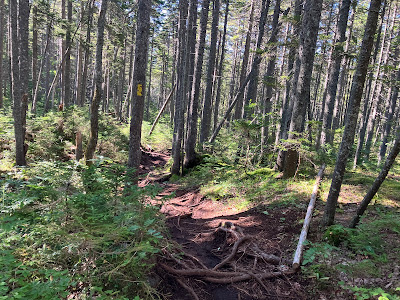
Beautiful spruce forest along a rooty section of Cedar Brook Trail.
The North Fork, high in the valley.
Heads or tails? I almost always go up North Hancock first. I prefer doing the shorter descent off South Hancock. This also avoids the 100-foot climb after the descent off North.
The usually dry brook at the bottom of the drop towards North Hancock was running thanks to the wet summer.
The relentless climb up North Hancock: 1100-foot ascent in 0.6 mile.
View back to South Hancock from an open swath on the trail. Gravel and loose rock make for unstable footing here.
A little higher up I bushwhacked across the slope to the upper part of the Arrow Slide. The woods started out OK, but then I had to wrestle through the dense scrub for which Hancock has been noted for many years. It took 20+ minutes to travel about 120 yards.
I emerged at the upper east edge of the slide, a bit below the top of its eastern prong. This slide is more than a century old, for it was noted as a route to North Hancock in the early 1900s. A crude path from the south to this remote and then-trailless peak was cut by the AMC in 1908, using the Arrow Slide as part of the route. The slide was recommended for the ascent in 1916 in the 2nd edition of the AMC White Mountain Guide. The guide described a route that led “to the foot of the slide so prominent from the S and W. The slide is easily climbed and a blazed and partly cleared trail leads from the top of the slide to the summit.” The slide was a recommended means of ascent in the guidebook for many editions thereafter, though for a time after the 1938 hurricane and subsequent lumbering the editors refrained from suggesting any route to Hancock.
Though the slide was used as a climbing route for many years, and is still occasionally ascended today, it is by no means easy and is potentially dangerous, with a mix of smooth slabs, both dry and wet, and loose, unstable rock. A detailed description of the route via the Arrow Slide (also called the “Y-slide”) was provided in the June 1958 issue of Appalachia, shortly after the formation of the AMC Four Thousand Footer Club, by chairman Albert S. Robertson. It included this caveat: “The climb up the slide is long and steep, and is not recommended for wet weather. Especial care must be used not to dislodge rocks upon persons below, and in any case parties should keep close together." The average slope of the main part of the slide is 33 degrees. I climbed the slide with a friend in 1988 and will confess to taking to the woods to bypass the steepest slabs.
The Hancock Loop Trail was opened in 1966 by the Worcester Chapter of AMC, after a route was cut parallel to and east of the slide. Since then the slide has seen only occasional ascents. For an interesting story about the trail, see "The Hancock Loop Trail, Then and Now: Reflections from One Who Helped Build the Trail," by Douglass P. Teschner, in the Winter/Spring 2021 issue of Appalachia.(available to download at digitalcommons.dartmouth.edu)
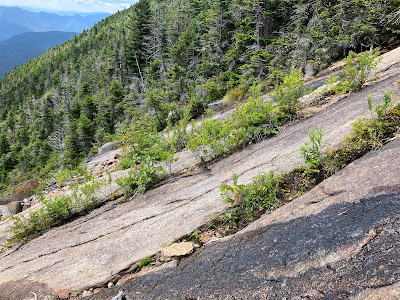
This wet season has likely made the slide more difficult and dangerous than usual for late summer. These slabs on the upper eastern prong looked particularly uninviting. The wet streaks are slick as ice.
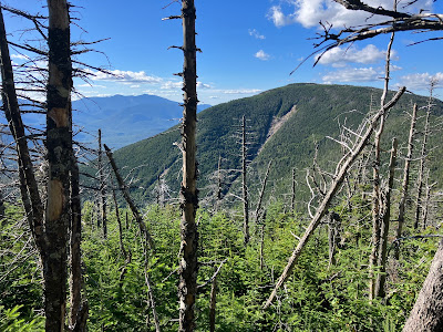
The upper slide provides an excellent view down the North Fork valley and out to Mt. Huntington and the Osceolas, with Sandwich Dome in the distance.
I worked my way carefully down and across to a seat at the edge of the slabs for an extended lunch break.
Looking across to Middle and South Hancock.
Looking up to the top of the eastern prong.
Pioneering plant life has taken hold in cracks in the ledges.
Backlit view of the Osceola slides, with the Dogleg Slide on the left.
A white pine struggles for survival.
Meadowsweet (Spiraea latifolia) was found on 12 of 22 White Mountain slides visited by researcher Edward Flaccus in the late 1950s.


I did these last summer and on our way out, we accidentally took a wrong turn!! Luckily we were ok and made our reservation at the dinner train! Greata pictures and a great hike!
ReplyDelete