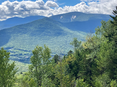
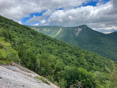
A close-to-home, half-day bushwhack to a familiar slide on the east side of Big Coolidge Mountain, the southernmost major peak of the Franconia Range. On this, perhaps my sixth visit, I continued higher than before for a unique view of the slides on Whaleback Mountain and at the head of the Clear Brook ravine.
After an approach along the old Osseo Trail, I whacked up through open hardwoods, soon passing this mossy boulder paired with a large white ash.
The terrain on this steep slope features a number of small drainages and little hogback ridges.
A monolith in the forest.
In his 1958 dissertation, Landslides and Their Revegetation in the White Mountains of New Hampshire, Edward Flaccus visited and studied this slide. He determined that it was triggered by the September 1938 hurricane. The main part of the slide was 491 yards long, with an average slope of 34 degrees. Its long runout extended another 1365 yards down to the floor of the valley. The 1946 edition of the AMC White Mountain Guide noted that the southern part of the Franconia Ridge Trail (later known as the Osseo Trail, now the Old Osseo Trail) “comes out on the base of a large slide which came down from Big Coolidge.” The crossing of the slide was noted through the 1983 edition; in that year the trail was relocated to its current location.
Three distinct swaths of gravel and loose rock remain open nearly 85 years after the fall. The lowest of these provides a sweeping eastward view, taking in North Hancock, Mt. Hitchcock, Potash Knob, Mt. Huntington, Mt. Kancamagus, the Osceolas, and the Hancock Branch valley leading up to Kancamagus Pass.
Partial revegetation with ferns and scrubby birch, spruce and fir.
The Osceolas and Scar Ridge from the middle swath, with the sun glinting off Scar's upper Northwest Slides.
Gullying from this spring and summer's heavy rains.
The third and uppermost open swath.
There were deer tracks on all three swaths.
From the top of the upper swath I continued up the steep slope through the woods to visit a large ledge slab above and to the SW. This was inspired by a photo on a 2011 post on Joe Richardson's blog (Just Joe Hiking) that revealed an unusual view of the Whaleback and Clear Brook slides.
It didn't take long to reach a beautiful flat, ferny spot at the base of the slab. As Joe had noted, it's too steep and wet to ascend for a non-technical climber.
I climbed steeply up through the woods to the left, skirting this cliff near the start.
Very steep terrain, but doable with care.
Made it up to a small perch atop the widest part of the slab, at 2700 ft. This may not be part of the 1938 slide, though it could be a remnant of an older slide.
From here, all five of the Whaleback/Clear Brook slides could be seen. In his dissertation, Flaccus noted that these reportedly came down during the June 1883 storm, which also unleashed the big Flume Slides and the South Slide on Mt. Liberty. The latter swept away the famous suspended boulder in the Flume.
A closer look. In August 1883, AMC explorer W.L. Hooper encountered the outflow of the Clear Brook slides while traveling along the East Branch of the Pemigewasset River out of Lincoln. “Two and a quarter miles brought me to the Clear Brook slide,” wrote Hooper in Appalachia. “This slide is said to have originated in five different places two or three miles back from the East Branch, presumably on Big Coolidge. [They were actually on Whaleback and the headwall.] It occurred on the same day with that which devastated the Flume.”
The Hancocks could be seen off to the east, with the tip of Mt. Carrigain visible above the 1927 Cedar Brook Slide.
Back down on the lower gravel swath, the sun highlighted Whaleback Mountain and its spurs, South Whaleback and Potash Knob.
From this angle, Whaleback is an impressive peak.
Last look at the wider view before heading down.


No comments:
Post a Comment