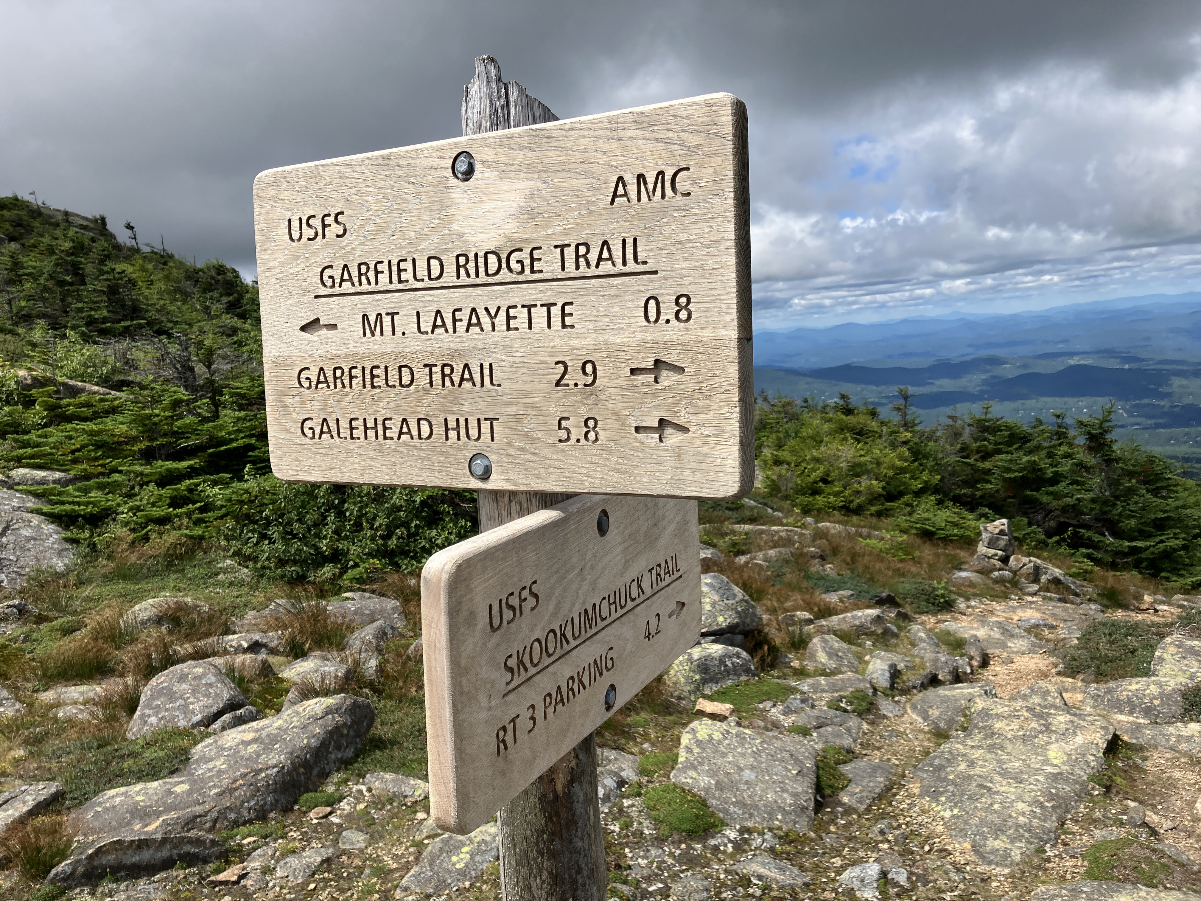
This 15-mile trek was two hikes in one. First a climb of Mount Lafayette via the quiet, wooded Skookumchuck Trail and the spectacular alpine section of Garfield Ridge Trail that runs over the North Peak. Then a bushwhack down the massive Lincoln Slide and through the woods down to Lincoln Brook Trail, followed by a long walk out to Lincoln Woods.
Fine hardwood forest along the lower traversing section of Skookumchuck Trail.

For some distance the trail follows alongside mossy Skooumchuck Brook.
Rock steps aid the stiff climb out of the valley.
Recent waterbar work has been done here - thank you!
Partway up this part of the climb Joe Richardson, a fellow bushwhacking enthusiast, came up behind me.
Joe and I hiked together for a bit and caught up, then he took off ahead of me as he can keep a faster pace than me.
Gorgeous open woods along the middle section of Skookumchuck Trail.
One of my favorite stretches is this gentle shoulder at ~4200 ft.
While most of Skookumchuck Trail has decent to good footing, the last section up to the ridge is rough and rocky....
...with one tricky ledge that can be bypassed by a scramble over rocks to the right.
Views were glorious on Garfield Ridge Trail near the Skookumchuck junction. Always a nice place for a break. Visibility was excellent, a rarity in a summer frequented by Canadian wildfire smoke. With binoculars I could pick out the dim bulk of Macomb Mountain in the Adirondacks, sighted through Lincoln Gap in the Green Mountains.
Great view into the Pemi Wilderness from a northwestern perspective.

Nice angle on Mount Garfield and its south cliff.

This way to the summit.
Ran into Joe again as he was on his way down, having climbed his first 4K peak after the age of 70. Congrats!
North Peak and the main summit loom ahead.
Looking back down the ridge along the climb to the North Peak.
Cannon, Kinsmans and Moosilauke from North Peak. Eagle Lake and Greenleaf Hut seen below.
A series of rocky bumps leads up to the main summit.
Great ridge walking here, much less busy than the section south of Lafayette.
The Twins seen through a sedgy col.
Large-leaved goldenrod was blooming along the trail, along with many patches of the hardy mountain sandwort.
Looking back at the North Peak.
Owl's Head lurking out in the Pemi.
Zoom on Owl's Head, with the slide followed by Owl's Head Path seen at lower right.
Final approach to the summit, with a trail runner silhouetted against the sky.
Summit signs.
Waves of mountains in a southeastern view from the summit.
Looking south down the ridge.
Twin-Bond Range across the expansive valleys of the western Pemi.
A trio of A-10 Warthogs put on quite a show over the ridge. Many hikers had their phones and cameras out.
Heading south down the ridge.
Peering down into Walker Ravine's north branch. The outlook ledges along Old Bridle Path are seen far below.
Important message from the West End Trail Tenders, volunteers who provide stewardship and education on the Franconia Ridge Trail.
Part of a parade of hikers descends along string fencing recently installed by the West End Trail Tenders to better define the trail.
Looking back at Mount Lafayette.
Along this section is where I launched part two of the day's hike - a bushwhack down
the big Lincoln Slide and the woods below to the Lincoln Brook Trail.
This slide enthusiast had never been to what is likely the largest slide
in the Whites, covering eight acres of gravel and loose rock on the
eastern flank of the ridge.
Starting in 1936, shortly before the Lincoln
Brook Trail was opened, the AMC White Mountain Guide suggested
the Lincoln Slide as an approach from Franconia Ridge to the Lincoln
Brook valley at the western base of Owl’s Head, from which one could
bushwhack to the summit. This approach route was briefly described in
the guidebook through the 1972 edition: “From the col N of Mt. Lincoln
head E, dropping about 200 yds. to a visible big slide. From the foot of
the slide go out through a deep cut and continue E, reaching Lincoln
Brook about ½ m. from the slide…From a big washout on the brook climb
due E to the summit.” Today the Lincoln Slide is occasionally used by
4000-footer FKT (Fastest Known Time) aspirants and a few other experienced bushwhackers as a route (not an easy one) to connect
Franconia Ridge with Owl's Head in the western interior of the Pemigewasset
Wilderness. Obviously great
care is needed to avoid trampling alpine vegetation when descending to the head of
the slide. I chose a location where krummholz (dense fir scrub) and not alpine vegetation lines the trail on the east side. I waited for a break in the hiker traffic, then made a discreet entry into the scrub. No alpine vegetation was trampled. It was quite a tussle, with some crawling involved, to get down to the northern tip of the slide.
I emerged just below the trigger point for the north fork of the slide.
Looking down from the northern tip.
The slope falls away, and the view opens dramatically. This excellent perspective on Owl's Head almost figured in the determination of the location of the true summit in 1960. Albert S. Robertson, one of the founders of the AMC Four Thousand Footer Club in 1957, proposed to locate the true summit "with the aid of mirrors - one mirror on the Lincoln slide and another in the bush on the ridge of Owl's Head - and then erect a cairn to last for all time." The hazy, showery weather on the chosen day (July 23, 1960) ruled out the mirror idea, so the group of 24 (!) climbed Owl's Head via its slide and spent a long time attempting to locate the highest point. After this trip it was eventually determined that the second bump they had traversed was the highest point, and on Labor Day weekend hiker Herbert Preble placed a sign at this spot. It's interesting that the location of the high point was changed again in 2005 - or was this a re-discovery of the bump located back in 1960?
An unusual angle on Mount Lincoln, seen beyond the huge multi-pronged central part of the slide.
The slide opened wide as I slowly and carefully descended the loose rock and gravel, making many little switchbacks. It would be very easy to turn an ankle on the unstable rocks.
Spotlight on Mount Guyot and the largest slide in Redrock Ravine, which covers about five acres.
The Bonds.
Down-look.
A daunting sight looking back up.
Looking across to the central part of the slide and the narrower southern fork beyond. In the foreground is one of a relatively few bedrock exposures on this slide.
Side view. This part of the slide averages a relatively moderate slope of 28 degrees.
Looking back up from a spot below the confluence of the north and middle forks. A huge slide kingdom. I have not been able to determine the date(s) on which this slide fell. In his seminal 1958 dissertation, Landslides and Their Revegetation in the White Mountains of New Hampshire, Edward Flaccus did not list this as one of the 135 slides that could be dated to the year in which they fell. We know it at least predates the mid-1930s AMC guidebook description.
Some serious gullying. The southern fork seen beyond.
Looks like treacherous travel down there.
Revegetation is proceeding very slowly on the barren expanse of this slide, which is likely more than a century old. Here some stunted balsam firs eke out a living, along with a few hardy sedges and grasses.
Approaching the narrowing of the slide at 4100 ft.
Below here the slide becomes more of a wide, open cut of a brookbed with a good flow of water running down it.
Looking back up. I had to do a good amount of careful weaving to get down through the boulders and ledges.
Looking down from the top of a small cascade.
The cascade from below.
Continuing down in the open, but slow going.
The brookbed descent got to a point where I felt it would be faster and safer to go through the woods. I exited the slide track at ~3900 ft. via a climb up this sketchy bank.
As expected, the woods at this elevation were thick, and the terrain was rough.
Farther down the woods opened up, and remained so much of the way down to Lincoln Brook, save for one stretch where I was lured close to the brook, then got walled in and had to climb back up a steep slope. It was a long way down, more than a mile, from the foot of the slide to Lincoln Brook.
A nice cascade on the brook that drains from the slide.
I eventually came to Lincoln Brook, and worked a short way upstream to see Lincoln Brook Falls.
It would be an understatement to say I was happy to reach the Lincoln Brook Trail, about 0.8 mile north of the Owl's Head Path. After 6:00 pm, and only eight miles to go!
It was good to see that the two cairns still mark the start of the Owl's Head Path.
The entrance to the Brutus "Bushwhack" has been blocked with limbs, perhaps to prevent hikers from accidentally following it thinking it was the Owl's Head Path.
I had carried Crocs all day just in case, but the Lincoln Brook crossing was rock-hoppable, as were the two tributary streams farther down the trail.
A lovely section of Lincoln Brook Trail in a yellow birch forest.
A trailside cascade, with dusk drawing on. I navigated the roly-poly Black Pond "Bushwhack," the Black Pond Trail and the Lincoln Woods Trail by headlamp, making for a very late exit. Along the way I took a rest stop at Black Pond, a serene spot by starlight, gazing at the silhouette of Bondcliff in the distance. Thanks to Carol for meeting me at the Lincoln Woods trailhead for a ride home!


Epic..and awesome!:)
ReplyDeleteI am certain Guy Waterman was smiling down on this wonderful day. Skoo is such a wonderful trail up Lafayette and I truly wish all who hike Lafayette understood and acknowledge the legendary explorer Guy was. Forest and Crag should be a mandatory read for anyone hiking in the Whites and am thankful you share your explorations online. Thanks for being such a steward to the Whites and happy trails!
ReplyDeleteThank you - Guy was an amazing hiker and steward and he and Laura left a remarkable legacy on the ridge and in their writings.
DeleteWow, that is quite the adventure, Steve. Congrats on completing it. "It would be an understatement to say I was happy to reach the Lincoln Brook Trail". I know that feeling!
ReplyDeleteThanks, BC - it was quite a day!
DeleteGreat picturama Steve. I know you've been primarily Bushwacking of late so you see the awesome display of the Pemi Wilderness from this northern angle makes it all more appreciated. Hoping to stop by and see you in October. Looking forward, JimmyO
ReplyDeleteThanks, JimmyO - the views of the Pemi were oustanding!
DeleteNow try it in reverse!-Paul Ferguson
ReplyDelete