
I returned to the Northern Presidentials for a loop hike over Durand Ridge on Mt. Adams. The upper "Knife Edge" section of that ridge is one of the more spectacular walks in the Whites, with dramatic views into King Ravine. I took the direct route up Air Line, having not been on its steep and rough middle section in quite a while. It hasn't changed.

The lower mile and a half of Air Line is a generally pleasant, moderate climb through a fine hardwood forest.

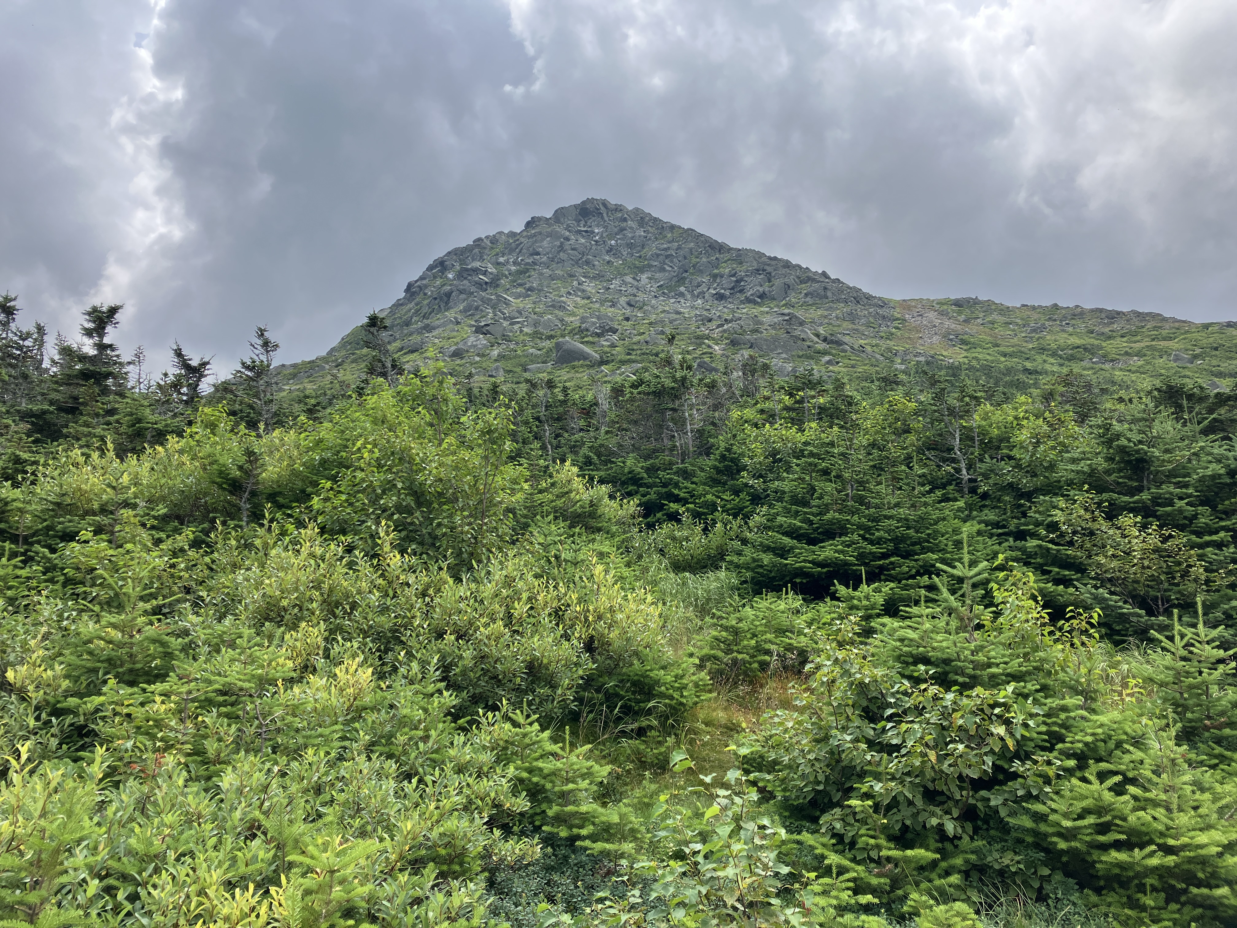
At ~2700 ft. the trail turns very Northern Presidential-ish.

Steep, rough and rocky for a half mile or so.

A welcome easing of the grade as the junction with the Scar Trail is approached. I usually use the moderate, lightly-used Scar Trail when coming up this way, thus avoiding the gnarly part of Air Line.

From here, Air Line climbs moderately up the crest of Durand Ridge, passing through this blowdown patch.

First peek at Mt. Adams and the headwall of King Ravine.

Mossy fir forest at 4000+ ft.

The obligatory warning sign photo.


The headwall of King Ravine, creased with numerous gullies.

Looking across at the west wall of the ravine, and down to the remarkable assemblage of boulders on the floor.

Hazy view north to the Pliny and Pilot Ranges.

One of the things I wanted to look for was any remaining evidence of the huge slide that fell during Hurricane Carol in 1954 on the lower west wall, below the RMC's Crag Camp. A swath of lighter colored trees can barely be discerned. The blue outline gives a rough approximation of the slide's location. Edward Flaccus visited this slide during his research in the late 1950s. He gave it a length of 594 yards with an average width of 60 yards. It was one of the steepest slides that he measured, with an average slope of 35 degrees and a maximum slope of 49 degrees. As noted by Brian Underhill in the June 1958 Appalachia, the slide provided “a quick route up the wall of King Ravine,” with the top of the slide ending just a few hundred feet from Crag Camp. Underhill described two routes from Crag Camp down to the top of the slide: the “Scenic Route,” which led through caves and thick scrub, and the “Truck Route,” used by hikers wearing packs. Added Underhill, ”It does get pretty steep near the top of the slide, steep gravel and dirt that you almost have to cut steps in.”As seen here. this slide is now fully revegetated save for a handful of small ledge patches.

This zoomed photo highlights the route of the steep and wild Great Gully Trail, which climbs from bottom center, to the right of the cliffs, to the upper left, where it exits above treeline.

I spent a leisurely couple of hours ambling up the open ridge, stopping a couple of times to hang out in the sun. The summit of Mt. Adams presides over the scene at upper left.

The jutting rock in the foreground may be what the RMC guidebook, Randolph Paths, refers to as Needle Rock.

Peering down a gully.

One of the three wild, scrambly trails that exit the ravine.

A rugged stretch along the Knife Edge. While dramatic, it is not nearly as sharp as the Knife Edge on Katahdin.

Mt. Madison rises close by to the east.

Looking back down the ridge.

A hiker on the skyline.

Cloud theater over Adams.

Looking down the valley of Snyder Brook, whose stream-carved V-shape contrasts with the U-shape of glacier-carved King Ravine.

Dark clouds rolling in, time to get moving.

The Knife Edge section ends at the junction with Air Line Cutoff.

View back down the Knife Edge.

Madison Spring Hut nestled at the base of the mountain.

Along the narrow Air Line Cutoff.

Ominous sky over John Quincy Adams.
With darkening skies, predicted showers, and hazy distant views, I opted not to head up to Mt. Madison. I'm not a fan of the boulder-hopping, anyway.

I hadn't been on the upper part of Valley Way in quite some time. J. Rayner Edmands would probably be appalled by the steep, rough route it has become over the years.

A graded trail no more.

Junction with the short trail known as Upper Bruin. The footing improves somewhat below here, but is still generally rocky and wet.

About halfway down, I made a steep bushwhack down to the trail known as Brookside, for a more interesting lower half of the descent. I came out not far above Salamcis Fall.

Salmacis Fall. This section of Brookside is rough.

The section of Brookside below the Kelton Trail junction is one of my favorite walks in Randolph. Narrow, lightly used, excellent footing, passing through attractive woods of white and yellow birch.

Can this really be the Northern Presidentials?

A glimpse of the cliffs lining the lower part of Gordon Ridge. The ledgy Inlook Trail rides the crest above these cliffs.

Brookside living up to its name. The two crossings of Snyder Brook were pretty easy this day.

Giant of a boulder along the brook.

Down the Fallsway, the scenic alternative to lower Valley Way.

Trailside view of Tama Fall.

Tama Fall from below.

Gordon Fall. I made it out just before a heavy shower unloaded on the Northern Peaks.

No comments:
Post a Comment