Continuing a series of wanderings in the Northern Presidentials, I aimed to explore the location of a huge slide that fell during Hurricane Carol in 1954 on the west wall of King Ravine. This slide looks massive on a 1955 aerial photo, but today it is fully revegetated except for some very steep ledge outcroppings. I hoped to find evidence of the slide in the form of tracks and debris flow levees, and if feasible, I would try to access one of the ledges for a view into King Ravine from an unusual angle. A close-in view would be the best bet on this very hot, humid and hazy day.
The parking at Appalachia was overflowing, but as soon as I turned off onto The Link I left the crowds behind. In fact, I encountered only two other hikers all day.
At its eastern end, The Link shows its softer side.
Land of many uses.
Sap lines in the woods.
Important notice.
Memorial Bridge over Cold Brook, dedicated to the early Randolph pathmakers.
The Amphibrach is a quiet and pleasant route up the lower slopes of Mt. Adams.
Cold Brook Fall, one of the finest cascades in Randolph.
One of several nameless off-trail cascades found farther up the brook.
The lower half of Amphibrach has exceptionally good footing for a Northern Presidentials trail.
At the junction with Monaway, a spur path leads left to cascades known as Coldspur Ledges.
A cascade on Spur Brook, just upstream from the trail crossing.
The RMC's Randolph Paths guidebook notes that "Pentadoi" is the "Greek name given to the five-way intersection of the Randolph Path, King Ravine Trail and Amphibrach, 2.5 mi. from Appalachia."
Turning onto a lightly-used section of the King Ravine Trail.
Nice walking here.
Rougher footing as the trail curves into the lower part of King Ravine.
The track of the slide can be discerned in this photo (taken years ago from Chemin des Dames) by the cluster of exposed whitish ledges to the left of center. I targeted the lower large ledge as a potential viewspot, if it turned out to be accessible.
Studying the vegetation pattern on satellite photos, I could tell where the track of the 1954 slide came down to the trail. It is cloaked in a somewhat scruffy growth of birch and fir.
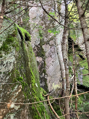
Not far up I came to a train of boulders that appeared to be a "debris flow levee" deposited by the slide.
Looks like there is a passage along the base - what's at the end?
I scrambled up to a ledge with a dropoff to a densely revegetated portion of the slide track below. In researching for his 1958 dissertation on revegetation of White Mountain landslides, Edward Flaccus visited this slide. He gave it a length of 594 yards with an average width of 60 yards. It was one of the steepest slides that he measured, with an average slope of 35 degrees and a maximum slope of 49 degrees. There are two photos of the slide in his dissertation. Though they are muddy in the pdf I have, I can clearly see the outline of the ledge I was standing at the base of here.
From here I could look up along this wild exposed outcrop. Just a few feet above was a scrubby white pine that seeded in on the slide, miles from its nearest relatives.
Too steep to scramble any higher.
But from the base I had a view across the valley to Durand Ridge.
Satisfied that I had found a ravine view, I dropped back down off my perch and started descending carefully back to the trail. A short way down another huge ledge loomed through the trees, I had noted this on satellite imagery and the Lidar contour map as a secondary objective.
Peering up, I saw a possible route that might bring me up to the left of it.
To my surprise and delight, it was accessible and flat on top.
Plus, it was in the shade with a slight breeze.


What a view of King Ravine!
ReplyDelete