On a dry, partly sunny day I returned to the Stark area for a real North Country adventure. A few days earlier I had scouted a potential route into the remote Roberts Brook valley between the main mass of Long Mountain and its lofty southern arm. My objectives were a small open wetland on the floor of the upper valley and one of a pair of slides on the steep SW face of Long's eastern summit (one of New Hampshire's Hundred Highest peaks). The logging road I had pegged as a possible approach route turned out to be gated and posted, so I climbed North Percy Peak instead.
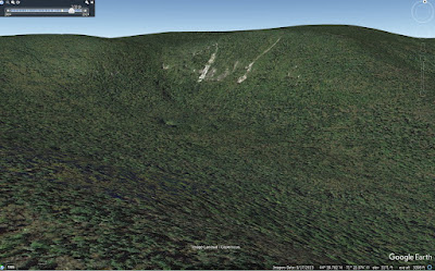
Google Earth image of Long Mountain and upper Roberts Brook valley.
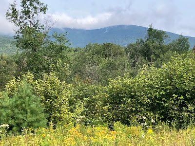
Over the next several days I spent some time studying various maps of the area and reviewing trip reports from peakbaggers who had climbed "East Long," a lower spur of the mountain. An approach from Paris Road, a gravel logging road that runs many miles north up the valley of Phillips Brook, seemed feasible, if long. Lingering questions were the condition of Paris Road; the state of a bridge over Phillips Brook 6.7 miles from Rt. 110, which in recent years had been reported as sketchy; and the status of a spur road running back to the south from said bridge. Satellite photos suggested that there had been very recent logging off that spur road, which meant that the bridge was likely repaired. The long drive up Paris Road was fine in Carol's Forester, keeping an eye out for the occasional protruding rock or pothole. Along the way I paused to take in a partial view of Long Mountain.
Thanks go to the landowner and forest management company for allowing public access to these lands.
The bridge was solid and the spur road heading south was in good shape, so I was able to drive 1.2 miles to a point near the first of many logging road junctions I had mapped out. Here I parked at a log landing, where sunflowers were in bloom.
On foot, I soon reached the first junction and followed a fairly recently used logging road 0.7 mile to the west. Some folks might drive this side road, but I figured why chance it. It's easy walking, anyway.
The wide-open walking ended at a logging yard clearing.
From here on I followed a succession of older logging roads in various stages of regrowth. This section was pretty good.
Other sections were crammed with saplings and shrubs. I was thankful that whatever dew had condensed overnight was mostly dried by mid-morning. No matter how densely the vegetation closed in, there seemed to be a treadway beneath, thanks to the local moose population.
One of several meadow-like logging yards crossed along the way.
The blooms of Pearly Everlasting were abundant.
At another road junction I veered left and downhill on a badly overgrown stretch.
At the bottom of the descent the old road's crossing of Roberts Brook was impassable due to thick growth and a steep bank. As luck would have it, I stumbled upon a footbridge close by. I wondered if this might be a remnant of the long-defunct Phillips Brook Backcountry Recreation Area. They maintained a yurt high on the east ridge of Long Mountain and had a Roberts Brook Trail that accessed it from the south. Their property map showed a crossing of Roberts Brook at approximately this location.
Without the bridge, I probably would have had to use my Crocs to make the crossing.
In the next meadow I came across one of several moose beds seen along the way.
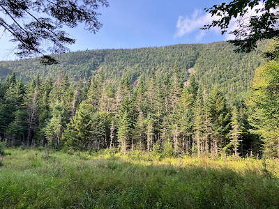
A bit farther along, I crossed the biggest clearing of the day, with part of Long Mountain visible in the distance.
The next road segment was the worst of the day, thoroughly overgrown, with mud underfoot, chopped up by many moose hooves.
I missed a turn at the next fork, but was glad I did, as this road segment led down to a lovely spot along Roberts Brook. This would be the launching spot for a whack to the two small eastern slides on Long Mountain. Today I was going to see the two larger and more remote western slides.
The last old logging road I followed, which I spotted on Lidar hillshade mapping, led into the Nash Stream State Forest amidst gorgeous woods.
Thanks to the moose traffic, this was almost like a maintained trail, providing the most delightful walking of the day.
Worth the price of admission.
There was plenty of moose sign all along my route, but thankfully I had no encounters.
Approaching the end of the last logging road segment.
Fern riot in the Roberts Brook valley. Pure bushwhacking from here on.
The generally good going was interrupted by a nasty swath of blowdown, perhaps caused by a microburst. Had to make a detour around it.
On the broad upper floor of the valley - the inner sanctum of Long Mountain. A real sense of remoteness out here.
Approaching the open wetland meadow I was seeking.
I was hoping the meadow would have a partial view up to the western slides on Long Mountain, and I was not disappointed. I planned to climb to the base of the slide on the left, glimpsed under the overhanging branches.
Looking up to the col between the two main peaks of Long Mountain. Picturesque Long Mountain Pond is nestled on a plateau up there.
A closer look at the right-hand (eastern) of the two western slides. These slides are ledgy and savagely steep.
Heading north across the floor of the valley.
The only moose shed I saw all day.
Going up. And here I made a navigational miscue, straying to the left to avoid a rough bouldery area when I should have veered more to the right.
I ended up in very steep, rough terrain well to the west of the base of the slide. As a result, I had to contour eastward on difficult terrain, crossing a couple of branches of Roberts Brook en route.
It was slow going in thick scrub peppered with boulders, holes and blowdown. What a dummy!
I eventually struggled my way to the base of this cliff. Almost to the slide, but not quite.
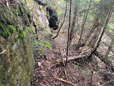
A handy shelf along the base of the cliff.
I wormed my way across to a ferny shelf partway up the slide.
There was no way I was going to get up the ledge step above the shelf and climb up the slide. This one is very steep, with a slope of about 40 degrees.
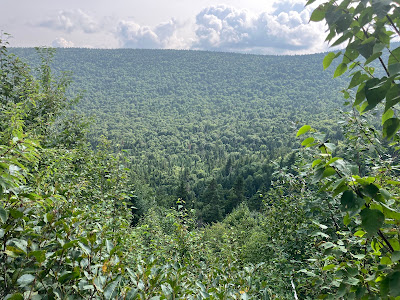
From here I had a view across the upper Roberts Brook valley to the great southern arm of Long Mountain.
Looking across to a nearby knob of Long Mountain.
It's steep on the east side of the slide, as well.
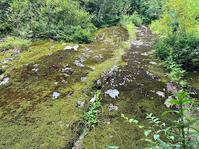
The bedrock on the slide is named, appropriately enough, Long Mountain Granite. A review of satellite photos suggests that this slide fell between 1994 and 2003, possibly in the October 1995 storm. The slide just to the east is older, as it is present in a 1955 aerial photo.
Side view from the west edge.
I descended directly south towards the floor of the valley, making a side trip to look up from the very bottom of the slide.
Slow and careful wins the day.
Back to the meadow.
The little white streak at the center of the photo is a lovely cascade on Roberts Brook, high on the valley headwall.
Evening sun on the slides.
A zoom on the slide I visited, left of center.
Heading back down the valley.
The best of the logging roads.
Gotta take the bad with the good.
Last look at Long Mountain. I was happy to make it back to my car before dark, as this area is "out there."











No comments:
Post a Comment