After a potential bushwhack into the Roberts Brook valley on the south side of Long Mountain (Nash Stream Forest) was foiled by a gated and posted logging road, I went with Plan B, a climb of nearby North Percy Peak. That's a pretty good Plan B, since North Percy, with its expansive bare granite ledges, is one of the finest climbs in New Hampshire. And I hadn't been there in eight years.
I drove 3.8 miles up Nash Stream Road to the Percy Loop Trail, my favorite route up the mountain.

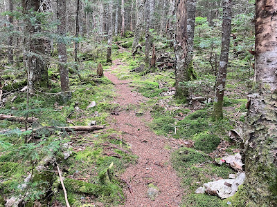
The first 1.5 miles of the red-blazed Percy Loop Trail is a delightful climb up an old logging road with good footing, leading though nice hardwood forest. As Cohos Trail founder Kim Nilsen writes in the trail's guidebook, "The trail here is as pleasant a woods walk as can be had in the whole North Country."
The trail offers a nice sense of remoteness as it heads up the Bowman Valley between North Percy and Long Mountain. It was opened in the early 2000s by the Cohos Trail Association, a dedicated group that oversees its 170-mile trail from Crawford Notch to the Canadian border.
Just beyond the end of the logging road section, the Percy Loop Camp tentsite is a short distance to the left along the Trio Trail, the northern continuation of the Cohos Trail.
In addition to a tent platform, it has a bear box and a composting privy.
Cohos Trail signage.
Beyond the tentsite the trail ascends through a wild conifer forest on the NE flank of North Percy. Here it is blazed in both red and yellow, the latter marking the through route of the Cohos Trail.
There is one rough and rocky section.
Followed by some smoother going.
Plenty of moose sign up here.
The Percy Loop Trail meets the older Percy Peaks Trail at the base of the steep summit cone.
A scramble up a small eroded gully.
Halfway up the cone, the trail emerges on the bare granite ledges for which North Percy is famous. The steepest slabs are at the bottom, but the rock is super-grippy when dry. Not sure how the traction is when the ledges are wet.
The view rewards are immediate as you ascend the ledges. The view back to the SE takes in Christine Lake, the nearby bumps of Victor Head and Bald Mountain, the Mahoosucs, the Carter-Moriah Range, the Kilkenny peaks and the Presidentials.
Views west to distant peaks in Vermont.
A fun scamper up the ledges.
South Percy dominates the view in that direction. Just to its right are Garfield, Lafayette, Cannon, the Kinsmans and Moosilauke.
Close by to the east is the huge rolling mass of Long Mountain, which hosts two peaks on the NH 100 Highest list. Between the peaks lies Long Mountain Pond, one of the highest water bodies in the state. The prominent white spot on the far right, set on a high southern arm of Long Mountain, is a slab known as Diamond Ledge. My friend John "1HappyHiker" Compton bushwhacked to that ledge in 2013. I climbed the two peaks of Long with friends back in 1990. I have yet to visit Diamond Ledge. I had considered climbing over that ridge and dropping into the valley of Roberts Brook, but one look at that massive wall as I was driving along Rt. 110 convinced me to reconnoiter the easier logging road approach from the east, which as noted above did not pan out. (My interest in that valley is that it provides access to four slides on the south slope of Long.)
Just below the summit I went over to the west side of the summit to peer down the extremely steep (approaching 40 degrees) slabs at the upper end of the long-abandoned West Side Trail. This "sporty" route was laid out by the famed climbers Miriam and Robert Underhill.
An excellent view to the west here, and quite a down-look to the forest below.
Traversing the broad flat top of North Percy.
One of the best of the 52 With a View peaks.
My favorite spot on the mountain is a ledgy patch on the north side with a unique view up the Nash Stream valley and out over much of the 39,000 acre Nash Stream Forest, owned and managed by the state of New Hampshire. On the left are several 3500-ft. peaks, including West Peak, Castle Mountain, Sugarloaf, Bunnell Mountain and Gore Mountain. Mt. Muise stands alone on the right.
To the west, in the center of this photo, is the Savage-Goback mountain group.
The Mahoosucs on the eastern horizon.
Another angle on Long Mountain.
The Pilot Range ridges behind South Percy.
Walking down into the views. Amazingly, I had this wonderful summit to myself for more than two hours.
Hard to beat this for a descent route.
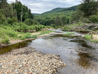
Before heading home, I drove a half-mile north on Nash Stream Road to make what I thought would be a quick little bushwhack to a gravelly, meadowy expanse of Nash Stream that I had spotted from North Percy. Little did I know that it would require twenty minutes of pushing through a bushy swamp to get there.
But it was a beautiful, peaceful spot.....
...with a view back to North Percy.
The Nash Stream Forest is a special place, and I hope to return before too long.


No comments:
Post a Comment