In recent years the NW side of Mount Tripyramid has been a favorite haunt for this hiker in May. The Tripyramid foothills are an excellent place for viewing spring wildflowers, and there are several options for interesting bushwhacks. On this warm, almost hot sunny day, I repeated a favorite bushwhack up Avalanche Ravine (aka the Ravine of Avalanches) to the Pine Bend Brook Trail, and continued up to the summit of North Tripyramid late in the afternoon. I descended via the Pine Bend Brook/Scaur Ridge/Livermore Trail route. It was a grand day with wildflowers aplenty, brook and slide scenery, and several interesting views.
There were many flowers along the lower part of Livermore Trail, including Painted Trilliums and Wood Anemones (pictured here).

Bluets were in bloom along an open section of the trail.
Vivid violets.
White Cascade on Slide Brook always seems to be in good flow.
Artifact at the site of the first of two Avalanche Camps (1910s/1920s) along Avalanche Brook.
Foamflower was just starting to bloom.
Though hobblebush is often the bane of bushwhackers, it is pretty at this time of year.
The clearing at the site of the second Avalanche Camp (1930s/1940s).
Livermore Trail was bursting with the fullness of spring.
The trail entrance into Avalanche Ravine.
A small but pretty cascade on Avalanche Brook.
Spring wildflowers, such as these Spring Beauties, were still flourishing on this north-facing slope, where the snow had only recently melted.
There were dozens of Red Trilliums along this section of trail.
And several patches of Dutchman's Breeches!
A favorite spot along the trail.
I went up to the very bottom of the North Slide for a quick look before launching the bushwhack.
Here I had the pleasure of meeting Laura and Jonathan Soule, aka WanderingSoules, who recently completed the Grid. They had come in from the Kanc via soggy Livermore Pass, were doing the slides loop over the Tripyramids, and then heading back up and over the pass. A full day!
A lovely glade on the floor of the ravine.
Mossy rocks on Avalanche Brook.
The East Fork of the North Slide.
I brook-whacked slowly up the ravine, stepping carefully to protect both me and the streambed moss and plants. Much of the monzonite bedrock was carpeted in green.
In the Catskills they refer to following a stream as "blue-lining."
A different scene around every bend.
Farther up, the drainage closed in tight. Time to take to the woods.
During the same August storm in 1885 that triggered
the huge and famous North Slide of Tripyramid, eight smaller slides fell in the
ravine, and it became known as Avalanche Ravine, or the Ravine of
Avalanches. Most of the 1885 slides are
largely revegetated, but the remaining open patches still offer good
views. This photo, taken by Edward Lorenz in 1910, shows the North Slide on the
right and the additional slides in the Ravine of Avalanches on the
left. My first objective in the ravine was the lowest open patch on the left side. (Photo courtesy Town of Waterville Valley)
As I climbed up a steep slope, I encountered some "slidey" rocks.
There's the open patch.
I was pleased to find a single white pine here, at 3150 ft., far removed from its normal haunts.
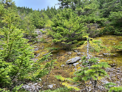
Warm and dry on this south-facing slope.
One of the best views of Mount Tecumseh, with spring greens painting the lower slopes of Scaur Ridge.
The summit of North Tripyramid looms 1000 ft. above.
Sidehilling on the steep slopes of the upper ravine.
Two headwaters of Avalanche Brook.
A revegetated slide patch on the headwall of the ravine.
Emerging on a remaining open area of the major 1885 headwall slide seen in the 1910 photo.
Exposures of broken monzonite, surrounded by a dense growth of red spruce.
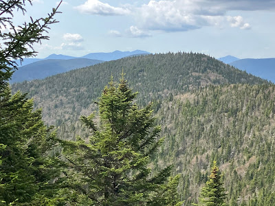
A nice remote spot to hang out in the sun for a while, and take in the view of the Osceolas and Mount Moosilauke seen beyond the slope of Scaur Ridge.
A fascinating article, "The Tripyramid
Slides of 1885," was written by Alford A. Butler for the March 1886
issue of "Appalachia." Butler paid four visits to the Ravine of
Avalanches and wrote about the North Slide and the eight smaller slides
in great detail. This article can be read on Google Books.
Continuing up the slide, stepping on rock to avoid trampling moss.
Zoomed view from the top of this open swath, with the Kinsmans on the right.
Climbing through boreal forest to the uppermost open swath of the old slide.
The narrow, gravelly upper swath.
High peaks view from the top: Garfield, West Bond, South Twin, Hancocks and Carrigain.
Franconia Range to the left of Scaur Peak.
Ascending to Pine Bend Brook Trail.
I reached the trail at 3680 ft., near this rock wall, where the terrain gets very steep and rugged.
Snow lingers under a cave.
Good old Pine Bend Brook Trail, rough as ever, and always damp.
The upper trail was mostly bare, with intermittent patches of ice. Used the spikes in a couple of spots.
Someone corrected the sign!
Summit rocks.
A peek at Mount Washington from the restricted NE viewpoint (which is spectacular with deep snowpack).
Middle and South Tripyramid and Sandwich Dome from the western outlook, reached via an obscure path.
Descending the rough and slippery upper Pine Bend Brook Trail is a slow and tedious affair for this tramper, especially late in the day.
Ah, but the gentle section along the narrow ridge is one of my favorite walks.
View of Green's Cliff, Carter Dome and Mount Tremont from a semi-open glade on the north side of the ridge.
Turning onto one of my favorite trails.
Wildflower garden partway down Scaur Ridge Trail.
Late-blooming Trout Lilies at 3100 ft.
Dancing yellow birches.
Great footing along an old logging road.
Classic view of the North Slide.
Farewell to the Wilderness. I walked the last mile on Livermore Trail by moonlight, serenaded by a chorus of Spring Peepers in the hidden Swazeytown beaver pond, and a Barred Owl, hooting from deep within the darkened forest.


No comments:
Post a Comment