
Never thought I'd be
doing the North Slide in winter, and hadn't really planned on it today, but once I
started up I kept going. Wind-scoured crust made the exposed areas
sketchy, so I stayed mostly on the scrubby parts of the slide or in the
woods alongside. Descended via the Scaur Ridge route.
Got a bit of a late start, and by 10:00 the sun was already balmy on Livermore Trail, though it was breezy.

Beyond the groomed section, Livermore Trail had a pretty firm old track. There were tracks from one Microspiker ahead of me.

My
original plan was to go up to the South Slide and bask in the sun, but
there was barely a trace of a track on that fork of the Mt. Tripyramid
Trail. Though the snow was firm in the AM, I figured with temperatures
rising into the 40s I would be punching through with every step for two
miles on the way down. Nope.

The north fork of Mt. Tripyramid Trail had a nice smooth, firm styrofoam track from snowshoers and backcountry skiers.

Of course...

Impressive burl.

Magnificent old yellow birches in the Avalanche Brook valley.

Where the trail starts up the slide. Depending on conditions, I figured I'd go high enough up to get a view and come back the same way. Thanks to WVAIA for maintaining this classic route!

The slide track started out nice and easy, with a hard crust that gave good bite for my MSRs. But at the first really steep pitch, there was a couple inches of powder atop the crust that caused slippage.

Time to take to the woods. This is actually a part of the trail, with some faded old blazes.

Getting steeper.

Another detour into the woods.

First view of Osceola.

This part of the slide - which fell during a tremendous rainstorm in August 1885 - is revegetating with scrubby spruce.

Some ski tracks from a few days prior. On this day I suspect it would have been survival skiing on the crust, which wasn't softening on this northwest-facing slope.

Views expanding.

I think I was more or less on the route of the trail here, with the open trough of the slide track to the right.

Halfway up the slide I stomped out a seat in some scrub with softer snow to have lunch and admire the view. Here I decided that going the rest of the way up was a better option than a slow and tedious trip down my ascent route.

Yup, it's steep. In his dissertation, "Landslides and Their Revegetation in the White Mountains of New Hampshire" (Duke University, 1958), Edward Flaccus measured the maximum slope at 35 degrees.

Getting up to the wider part of the slide. More old ski tracks.

Wow.

The upper part of the slide is a vast snowfield in winter.

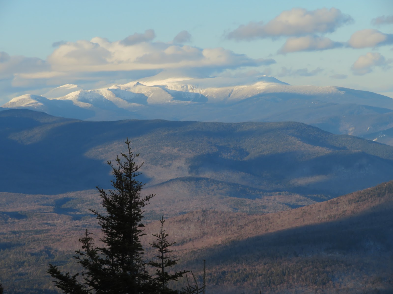
Northern views open to Mt. Carrigain, the Presidentials and the Carters.

A few scrubby little trees gave some (probably false) sense of security in the exposed areas. At this point the trail route was on a wide open slope off to the right. Going directly uphill was the safest direction of travel. No way was I going to traverse across the slope on hard crust with that kind of exposure. As that day's forecast from the Mount Washington Avalanche Center noted: "A long sliding fall hazard exists on steep terrain scoured to icy or firm surfaces."

Where the snow wasn't hard crust, it was deep.

The vista expands all the way out to Vermont.

Some of the best views in the Whites.

Snowy Franconias.


After 135 years, this is the reigning monarch of White Mountain slides. Of the slides he measured in his 1958 study, Flaccus found that this was the second longest at 1100 yards and had the largest area at 20.5 acres.

Approaching the top of the slide. As the AMC White Mountain Guide notes, the trip up the North Slide ascends 1200 ft. in about 0.5 mile.

Breaking through a drift in the scrub.

A few spruce traps awaited.

The sudden appearance of open fir woods indicated that the trail above the slide was a short distance ahead.

I dropped a short distance down the trail to where it exits the slide at the very top. Even going a few yards down on the crust felt precarious.

Above the slide there's still 200 ft. of fairly steep ascent to the summit of North Tripyramid.

A welcome sight!

The northeastern viewpoint at the summit is quite restricted in summer, but is impressive with a deep snow platform.

Mts. Carrigain, Willey and Lowell.

Mt. Chocorua.

Mt. Passaconaway, with its hidden NW Slide partly revealed. I looked up at Tripyramid from the top of that big slab last month.

Presys looking wintry, despite the thaw.

The steep descent off the cone of North Tripyramid on Pine Bend Brook Trail featured a very crusty hardpacked track.

The wonderful stretch along the narrow ridge between North Tripyramid and Scaur Peak.

View from the open glade below the Pine Bend Brook/Scaur Ridge junction.

Late afternoon shadows on the Presys.
Almost buried.

Golden sun on Scaur Ridge Trail.

The solo hiker who Micropsiked the Tripyramids must have regretted not bringing snowshoes as there was a parade of postholes on the lower mile of Scaur Ridge Trail, where the snow had really softened in the sun.

Shadows on the snow.

Guardians of Scaur Ridge.

Did I really go up there?

Alpenglow.

Ski tracks encountered on a bushwhack shortcut through the open hardwoods along Livermore Trail. Snowshoed the last two miles by moonlight, exchanging greetings with a pair of fat bikers out for an evening ride.

Awesome hike, Steve, and congrats on climbing the North Slide in winter!
ReplyDeleteThanks, BC - it was an amazing experience, and one I hadn't really planned on. I'm happy to have done it!
DeleteWow, what a great report Steve! When I first saw the title I thought that maybe you had ascended part of the slide. To climb the entire slide in winter is quite an accomplishment. Heck, even in summer it is scary in places. The amount of snow up there is impressive. By way of comparison, here in central VA we have had a total of 1 inch this winter, and that came in November. Go figure! Many thanks for the great photos, and of course your (always) expert commentary.
ReplyDeleteBest regards from Virginia,
Paul Gaitanis.
Thanks, Paul - my initial thought after abandoning the South Slide option was to just go partway up the North Slide and get a view. But after going partway up it seemed better to keep on to the top, as descending, even in the scrub, would have been tricky with the crust and occasional spruce trap. Today it's going into the 50s and we're losing snow at a rapid pace. Hope all is well with you.
DeleteBest,
Steve