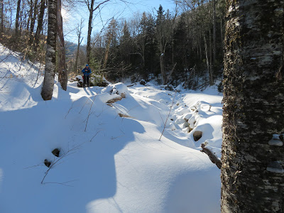
A bushwhack/trail/bushwhack trek into a remote corner of the Sabbaday Brook valley with Ray "Jazzbo" Caron. Our objective was the huge slide on the NE flank of West Sleeper unleashed by Tropical Storm Irene in 2011. It was a scene of desolate winter beauty.
Due to the recent thaw and a NETC report from 1/25 of breaking through into knee deep water, we opted to bushwhack to avoid the lower three large crossings on Sabbaday Brook. Ray, a skilled reader of maps and terrain, spotted the line of an old logging road on a LIDAR hillshade image,curving into the valley along the east side of the brook. After a 0.2 mile bushwhack from the Kanc Highway we found it.
For a mile southward we followed this historic tote road, which we believe dates back at least to the days of the Swift River Railroad (1906-1916). The breaking was fairly strenuous with a foot or more of mealy snow beneath a thin crust.
One area showed much sign of moose activity.
Frozen moose bed and outhouse.
This section of the old road, contouring across a steep slope high above the brook, fit the description of the "old Sabba Day Brook tote road" from the 1916 AMC White Mountain Guide: "The old road slabs the side of Mt. Potash, high above the stream."
On gentler terrain, Ray scouts the route of the road ahead.
The old road brought us to the Sabbaday Brook Trail at the point where it turns right onto its continuation up the east side of the valley. A short distance beyond we reached the Wilderness boundary.
This delicate bird's nest had fallen onto the trail.
Easy cruising up the valley, with 2-3" of crunchy newer snow atop a solid snowshoe track. There was one set of boot tracks ahead of us, perhaps from the previous day.
A bent sled runner at the site of the Swift River Railroad's Monahan Camp, just before the trail's fourth crossing of Sabbaday Brook.
We began our bushwhack to the slide along an old sled road that led away from the camp location, but soon petered out.
Snow-frosted Middle Tripyramid looms at the head of the valley.
For a generally light snow winter, there was a respectable snowpack out here.
Contouring around into the side valley that leads up to the slide, and eventually to the col between the Sleepers.
Open yellow birch glade.
Ray comes up through the glade.
Inviting.
Looking across the valley.
The first sign of the slide is a tangle of tree trunks deposited well downstream.
Beyond the tree carnage, we dropped down to the open rubbly runout of the slide.
A nifty open route up the track.
Snowshoeing into the sun.
A bank gouged out by the slide.
Ray climbs onto the open bank across from the base of the slide.
There it is!
Looking north to the Fool Killer.
View from the shelf at the base of the slide.
Ray coming up.
Side view along the shelf.
We climbed a short way up the south edge of the slide, where the widest distant view is obtained. Had we more time, we might have ascended farther up; the thin, grippy snow cover was favorable for snowshoeing.
Good views on this fine sunny day.
In the distance (L to R): Mt. Tremont, Carter Dome and Rainbow Ridge, Bartlett Haystack and the Baldfaces.
Carter Dome was nicely frosted.
Ledgy Potash Mountain, which has a good view of the slide, and its trailless neighbor, "South Potash."
Looking across the slide.
Ray takes in the view while enjoying a late lunch.
Time to head out.
Looking back at the broad crest of East Sleeper.
Following our tracks back to the trail.


No comments:
Post a Comment