
Didn't have time for the summit of the Dome after climbing Jennings Peak
two weeks ago, so I returned to Drakes Brook Trail for some unfinished
business. Excellent snowshoeing despite some "bareboot blues" on the
ridge, and the 100-mile views were phenomenal.
Obligatory sign shot.


Someone had skied high into the valley a day or two before. The lower two miles of Drakes Brook Trail was actually a designated ski trail in the 1930s.

Wonderful 'shoeing. Thanks to those who packed this out after the previous week's snowstorms.

Snowshoe hare.

High in the valley I made a short bushwhack to find a small opening I'd spotted on Google Earth.

I had faint hope it might be a logging camp site I've been looking for, but as I suspected it was a tiny wetland along a small meandering stream.

Making tracks in the Wilderness.

Drakes Brook at the turn in the trail, where steeper climbing begins.

The gentle wooded ridge walk between the Jennings Peak and Smarts Brook junctions is one of the nicest in the Whites.

Snowy tunnel.

Unfortunately what must have been a nice softly-packed snowshoe track had been badly chewed up by barebooters, making for tedious travel. I don't like doing it, but when I encountered the trio of young men descending near the summit, I asked the one who was carrying snowshoes if he would put them on, pointing out the difference between the churned up track above them and the smoothed out track behind me. I discovered on the way down that he did put his 'shoes on - thank you! - and the descent was much more enjoyable than it would have been otherwise.

It doesn't look like much here, but because this massive mountain rises in lofty isolation, it is a commanding viewpoint. It was once much more open; now you have to stand to see the sweeping northward view.

In
the 1870s, geologist Joshua H. Huntington - for whon Huntington Ravine
and Mt. Huntington were named - listed Sandwich Dome as one of his top
six viewpoints in the Whites, along with Mt. Prospect in Holderness,
Washington, Lafayette, Moosilauke, and Kearsarge North. Guidebook
editor Moses Sweetser, who climbed the Dome with Huntington around
1875, called the view "one of the grandest and most fascinating
panoramas in New England."

Here
are a few snippets of the view. South Twin, the Bonds, and Zealand
through Mad River Notch, with the Hancocks to the R above the K1 Cliff
on Mt. Kancamagus. All told, 35 of the White Mountain 48 can be seen
from here.

The Osceolas and Franconia Range beyond Waterville Valley.

The four Franconias.

Sandwich Range neighbors Passaconaway & Whiteface behind the NE summit of the Dome.

Tripyramids, with Carter Dome peeking over the North/Middle col.

Mt. Carrigain and the Presidentials beyond Mt. Kancamagus, Livermore Pass and Scaur Peak.

Zoom on the Presys.

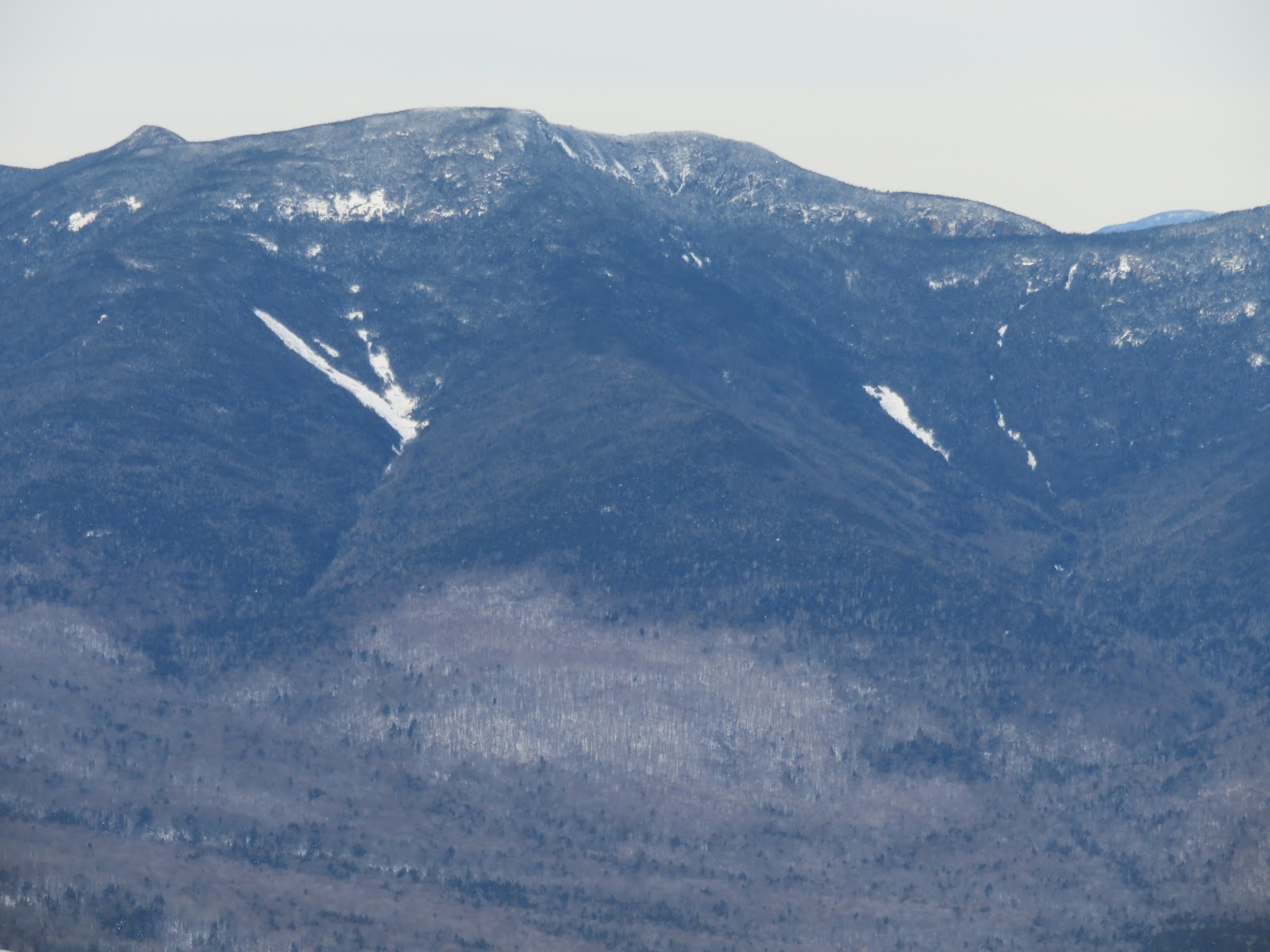
Mt. Moosilauke, showing the slides in Gorge Brook ravine and the ice cliffs on the Jobildunc Ravine headwall.

Close-up of the South Slides on Tripyramid.

The southern slides on Osceola, which fell during Hurricane Carol in 1954.
The vast blowdown on East Sleeper, from Hurricane Sandy in 2012, shows as a large patch of gray.

Hancocks and the Arrow Slide.

Before heading home, I made a short side trip down the Algonquin Trail for the southern part of the view.

The Algonquin Trail is rarely used in winter.

About 0.1 mile and 100 ft. in elevation down from the junction, the scrub parts for a Lakes Region view.

Squam Lake behind the north end of the Squam Range and the eastern Sandwich Notch area.

Mt. Israel, Red Hill, Lake Winnipesaukee and the Belknaps.

Looking down at Black Mountain, the SW shoulder of Sandwich Dome, over which the Algonquin Trail passes.

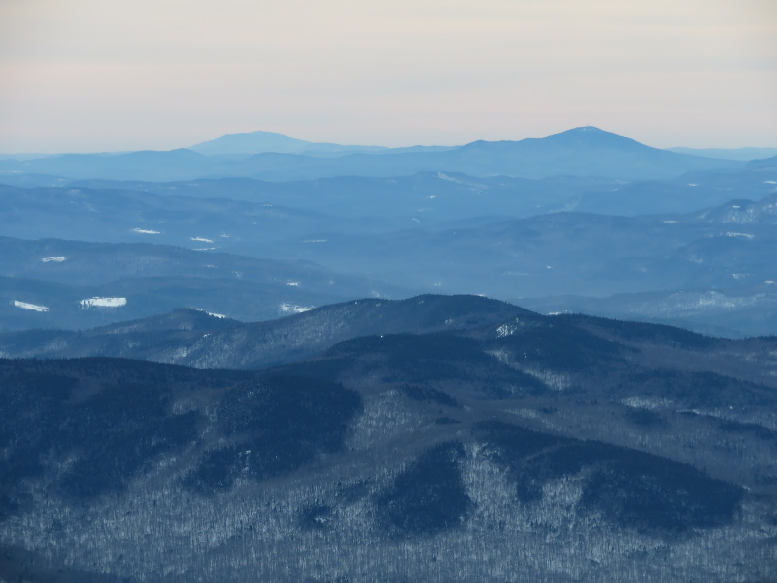
Crystal clear viewing revealed Mt. Monadnock (L) and Mt. Kearsarge (R) beyond the southern half of the Squam Range. It was clear enough to see (with binoculars) the ski trails on Mt. Wachusett in Massachusetts, 99 miles away.
With the track smoothed out, sweet snowshoeing along the ridge on Sandwich Mountain Trail.

No comments:
Post a Comment