
My brother Drew was up at AMC's Three Mile Island Camp on Lake Winnipesaukee, and we hadn't hiked together for almost a year, so we rendezvoused in Holderness and headed up to Sandwich Notch for a hike up 2630-ft. Mount Israel via the Guinea Pond and Mead Trails. Joining us was Stacie Funt, an AMC member from Long Island, who was also staying at Three Mile. It was an interesting hike with great views and a bit of added excitement.
Drew drove us up the Sandwich Notch Road from Center Sandwich to the Guinea Pond trailhead parking on Beebe River Road. Beyond the Sandwich Town Park the road was very rough, especially the short paved sections, as bad as I've seen it. Not recommended for low-clearance vehicles!
Early on, the Guinea Pond Trail crosses a powerline built in the late 1950s. We crossed it again on the Mead Trail.

Heading into the extensive wetlands along the Guinea Pond Trail, following the grade of the old Beebe River Logging Railroad (1917-1942).

Sprawling Sandwich Dome seen across a beaver swamp. The new bypass created last year around a sometimes-flooded spot on the trail was not needed today, as this stretch was bone dry.

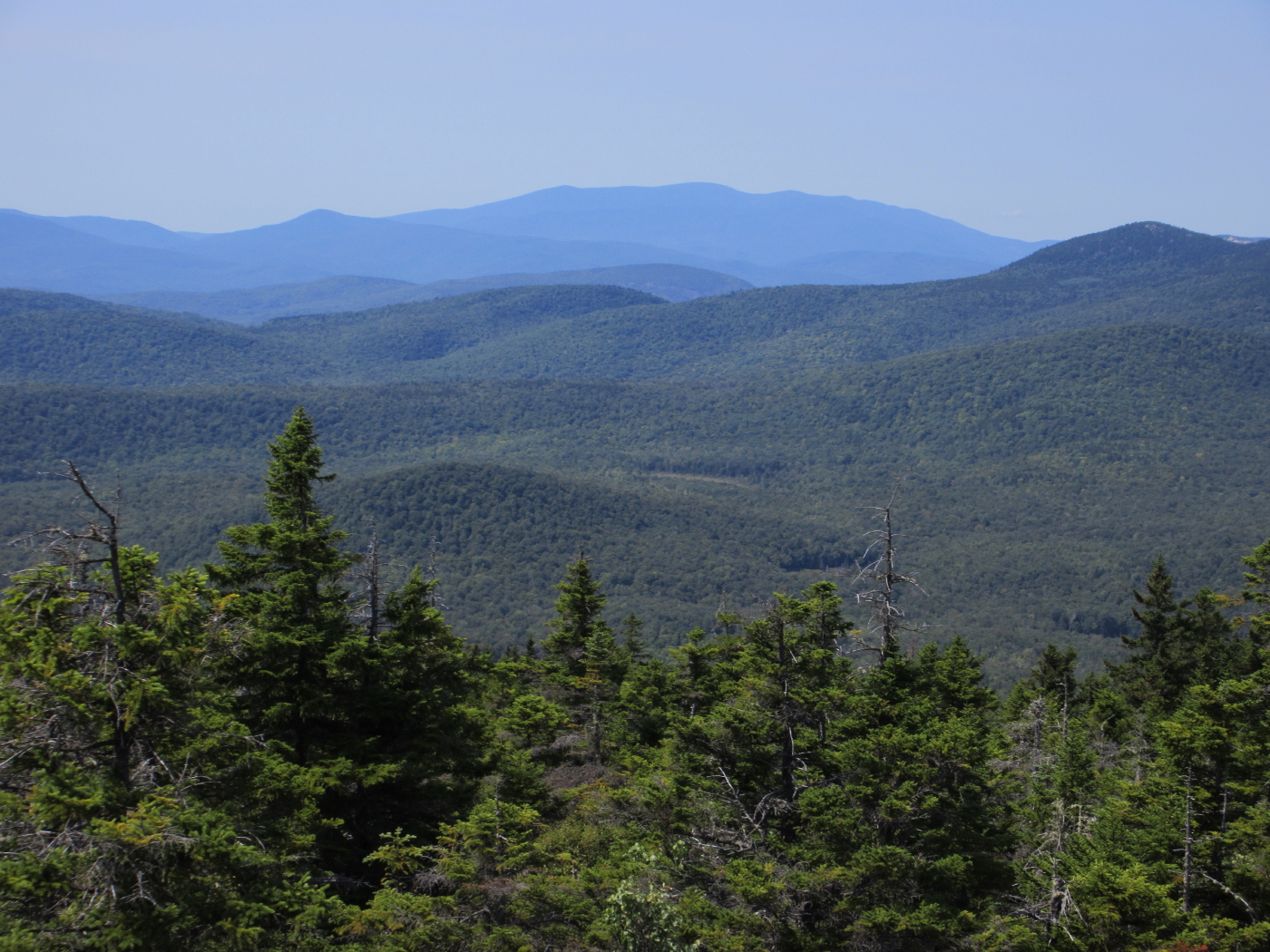
The looming SE spur of Sandwich Dome.

Stacie and Drew getting ready to head up the Mead Trail. Five minutes earlier, we heard a rustling in the woods and then saw a bear cub scampering up a tree trunk. We hustled out of the area before momma made an appearance.

The Mead Trail passes between these twin white ash trees.

Snack break at a brook crossing halfway up the pleasant Mead Trail. A quiet spot deep in the forest.

Pileateds at work.

Lush greenery.

The uppermost section of the Mead Trail climbs through spruce forest. Right above here I took a bee sting in the arm.

Trail junction just below the summit.

Summit smiles!

Israel's ledges are a premier lunch spot.

One of the best views of the Sandwich Range high peaks.

Paugus and Chocorua off to the northeast.

Massive Sandwich Dome, front and center.

Mount Moosilauke to the northwest, beyond the upper Beebe River drainage.
A peaceful scene along the Beebe River, a short way in on the Black Mountain Pond Trail.

On the way home I took a short walk in on the Col Trail below the Rattlesnakes to visit this beaver pond with a peek at the Squam Range. Here I saw a Great Blue Heron, a group of young mergansers, Cedar Waxwings, and a pair of fly-catching Eastern Phoebes.

Thanks for a wonderful hike, Steve!!
ReplyDeleteThanks for your good company, Stacey! It was a great hike. Yesterday at the end of another hike a saw a mother bear with two cubs out in a field, at a safe distance!
ReplyDeleteSteve