WANDERING UP WHITEWALL BROOK: 8/19/15
On a hot, humid day I headed into the Zealand Valley to do some off-trail exploring along Whitewall Brook above Zealand Falls Hut. It was a trek filled with interesting pond, forest and stream scenery, with some geocaching and a mid-day thunderstorm thrown in for some extra excitement.
Morning errands necessitated a late morning start on the always-scenic Zealand Trail. After an initial miserable rocky and rooty bypass, this trail along the grade of the 1880s vintage Zealand Valley Railroad (J.E. Henry's first logging railroad) provides some of the easiest walking and best footing in the mountains. At the 0.8 mile mark I always make the short side trip to see these ledge slabs in the Zealand River.
The first of several beaver meadows, swamps and ponds is reached at 1.7 miles, where Zealand Ridge comes into view. The serene vista of this high, gentle crest welcomes you to one of the most beautiful remote valleys in the Whites.
An early-turning red maple. Say it ain't so!
The recently rebuilt boardwalk that replaced the old "Z-bridge."
A refurbished beaver dam.
I could see that a thunderstorm was brewing over Zealand Notch. This did not bode well for the day's bushwhacking plans.
Zeacliff Pond Peak above the north end of Zealand Pond.
Rain was speckling Zealand Pond as I neared the junction with the Twinway.
Thunder was rumbling while I made the steep, rocky climb to Zealand Falls Hut. I waited out the t-storm for an hour here, chatting with some folks who were heading to Zealand Mountain and enjoying some tasty lentil soup. An AT thru-hiker came by, as well as two guys doing a one day hut traverse. Though there was quite a bit of thunder and a couple of lightning flashes, it didn't rain for long.
After things settled down I went up to the wide, ledgy bed of Whitewall Brook above the hut. A wonderful ledgy playground! But one does need to be careful here, as some of the ledges are slippery. Mount Tom is seen to the left of the big pine tree, and the West Peak of Mount Field is visible to the right.
A lone fallen leaf on the brookbed.
I went about a half-mile up the Lend-a-Hand Trail, the more interesting of the two maintained trails up Mount Hale.
It traverses beautiful birch and fir woods in high country on the west side of the Zealand Valley.
From the trail I bushwhacked back to Whitewall Brook at this lovely ledgy cascade. I visited this spot in 2013 and the mountain ash was draped across the cascade then. That hardy tree is still green two years later.
An inviting expanse of granite.
Looking down the parallel waterslides.
A wonderful spot to relax on a hot summer day.
After a nice break I continued up the ledgy brookbed.
Looking downstream.
An amber pool.
More ledgy meanderings.
A mini-island in the stream.
It was great fun picking my way up the ledgy brookbed. The best in stream-whacking!
Yet another expansive slab.
An artfully sculpted channel.
Cascade and pool.
Looking back for a different perspective.
Wild country out here!
Though some more dark clouds drifted by, the sun eventually won out for the rest of the day.
A section choked with blowdown.
Taking to the woods beside the brook, I came upon this well-worn moose path. Unfortunately it wasn't going my way.
Some nice open woods here, but above 3150 ft. the forest closed in and soon I was pushing through a tangle of scrubby conifers laced with blowdown.
I slowly worked my way around to this confluence of the main (left, coming from the south) and NW forks of the brook, at 3220 ft.
I was hoping to find some cascades higher up the now north-flowing brook, on one of the ultimate headwaters of the East Branch of the Pemi. It was too dense to make much progress streamside, so I pushed upslope and emerged in these wonderfully open "salt and pepper" woods.
I climbed up this broad slope, then dropped steeply back down to the brook farther upstream, and carefully rock-hopped upward along the brookbed.
This area had a real "out-there" feeling.
The cascades failed to materialize, and it was late in the afternoon, so I turned around here at 3340 ft.
After a trying tussle up a steep scrubby slope, I again emerged in those wonderfully open woods...
...which led me back down to a lower crossing of the brook.
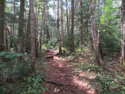
From here the whack back to the Lend-a-Hand Trail was delightful, with lots of birch forest. Some glades were carpeted with patches of tall bracken ferns.
These gorgeous glades are the legacy of the great Zealand forest fire of 1903.
On the way back to the hut I followed the brookbed down from the crossing on the Twinway. This cascade is just below that crossing.
Mount Tom and Zealand Pond.
Whitewall Mountain and the shadow of Zeacliff.
The pink granite of Zealand Falls.
Evening at Zealand Pond, where I shared the serenity with a swimming beaver and a rattling Belted Kingfisher.
The beaver meadow just north of the A-Z Trail junction, with Mount Tom in the distance. Thumbs-up for the Zealand Valley!


No comments:
Post a Comment