THE NANCYS: 8/6/15
On a cool, mostly cloudy day I hiked the Nancy Pond Trail to Nancy Cascades and Nancy and Norcross Ponds, then followed the steep herd path to the summit of Mount Nancy. Few hikes offer as much variety as this trek through the Nancy Brook Research Natural Area and on into the eastern fringe of the Pemigewasset Wilderness.
The trailhead is located on a pulloff at the edge of Route 302.
After 1.6 miles of hiking on various old logging roads, the trail crosses Nancy Brook, where destruction from Tropical Storm Irene is on display.
About 0.2 mile above the crossing the trail passes a crumbling brick furnace at the site of a mill that was part of a logging salvage project after the 1938 hurricane. That storm closed the newly built Nancy Pond Trail and it was not reopened until 1960 by crews from Camp Pasquaney on Newfound lake. The Pasquaney boys still help maintain this trail.
Just above here the WMNF Saco Ranger District trail crew built an awesome relocation for about 0.3 mile above major Irene-caused washouts and slides on the old trail route. This new section has moderate grades with many switchbacks and good footing.
At 2.4 miles the trail passes by the pool and rock seats at the foot of the towering Nancy Cascades. Only the lower drop of this 400-foot series of waterfalls can be seen here.
Another angle on the cascades.
The trail makes a very steep and rough climb parallel to the cascades, passing this peek at a higher drop.
An opening presents a view of the Giant Stairs and Mount Resolution.
Above the cascades Nancy Brook becomes much more gentle, with some nice ledgy spots.
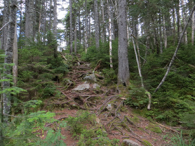
On this high plateau, the trail passes through an old-growth spruce forest, never logged. This is one of the rootiest sections of trail in the Whites.
At 3.4 miles the trail slips by quiet, somber, spruce-rimmed Nancy Pond.
Hikers traversing the many plank walkways near Nancy Pond.
A view towards Mount Anderson, one of the trailless peaks of the Nancy Range.
Pitcher plants at the west end of Nancy Pond.
Heading into "the Pemi."
Little Norcross Pond, well on its way to bog-hood.
Wide-open, exhilarating Norcross Pond, with the distant Twin-Bond Range partly in the clouds.
Looking across the water to Mounts Bond and Guyot.
Nice view of Mount Anderson along the shore.
A clearing shower over the eastern Pemi, seen from the terrific view ledges at the west end of Norcross Pond.
A beaver's-eye view of Norcross Pond.
The Twin-Bond Range under sunnier skies.
Bondcliff, Mount Bond and the southern Shoal Pond peaks.
The western view to North & Northwest Hancock, Flume and Liberty from a slide next to the Mount Nancy herd path, where it turns right to climb steeply to the summit..
The wild northern ridges of Hancock.
A shadowed band of cliffs on Mount Anderson.
Looking down the slide.
Mount Carrigain, peak "4266" and North Hancock from the top of the slide.
Mount Passaconaway peeks over the shoulder of Mount Anderson.
On the herd path to Mount Nancy.
It is a steep climb. Sort of like the climbs to the Hancocks with less erosion.
The human-enhanced northeastern view from the clearing at the summit of Mount Nancy (3926 ft.). This is the tallest peak in the Nancy Range and one of New England's "Hundred Highest."
Shadows on the Carter Range.
Mounts Field and Willey.
Lower Montalban Ridge and the Baldface Range and Doubleheads beyond Mount Bemis.
I bushwhacked down to a small ledge area on the south side of the summit, with a precipitous drop below.
This spot's unusual perspectives include a long vista down the East Branch valley to Northwest Hancock, Mount Moosilauke, and Mounts Flume and Liberty.
Norcross Pond and Mount Carrigain.
Sun-enhanced ripples on Carrigain.
Sweeping views to the SE.
Bird's eye of Nancy Pond.
The three ponds on their sun-washed plateau, with the Sandwich Range in the distance.
Passaconaway, Whiteface, the Sleepers and the Tripyramids.
From the trail near Nancy Pond, a peek up at Mount Nancy before heading down for a late exit.


Excellent photos...so much to see from there. Thanks.
ReplyDeleteHi Sandy! Thanks for reading. Keep up the great work on the Accidents. (Tough week up here.)
DeleteSteve
This area has been on my list for a long time, but I have not made it up there yet. Your great report and pictures are moving it higher up the list!
ReplyDeleteThanks, BC - it's nearly unmatched for its variety of scenery. Hope you can check it out.
DeleteSteve