
Wednesday, August 22, 2012


LOON MOUNTAIN EXPLORATION: 8/21/12

With a half-day off under partly sunny skies, I decided on an exploration close to home: Loon Mountain. I had wandered around this interesting mountain, best known for its major ski area, several times before, but it had been a number of years since I paid a visit. I rode the gondola up to a sub-summit, with plans to seek out an old hiking trail to the North Peak, then descend via ski trails with off-trail side trips to Loon Pond and Little Loon Pond.

From the top of the gondola, I walked down a path to the outdoor amphitheater with its spectacular view, where Carol and I were married in 2000. Where else can you tie the knot with the Bonds as a backdrop? 


I took a quick walk down and up through Loon's glacial caves, sort of like a little mountaintop King Ravine Subway, if you go off the main route.


I dropped off the back side of the gondola summit on a ski trail, then climbed up another ski trail a ways and bushwhacked across to pick up the abandoned hiking trail that climbs steeply to the ledgy true summit (3065 ft.) of Loon Mountain. Most of the trail was pretty clear and easy to follow, and there were still some old orange blazes.


The old trail is pretty steep in places, including this ledgy slot.


The upper 0.1 mile was in rough shape, overgrown with lots of blowdown.


I hadn't been up here in a few years, and the view from the summit ledges has grown up considerably, though it's still pretty decent. This vista looks over nearby Black Mountain and across the Pemigewasset Wilderness to the Willey Range and Mts. Hitchcock and Hancock; the distant Presidentials were socked in.


By standing, I could see over the trees to the Twin-Bond Range. I could spot two new slides from Tropical Storm Irene - a good-sized one on the side of Mt. Bond, and a small one in the Redrock Brook basin.


Scar Ridge looms ominously to the east, beyond the North Peak ski trails.


I followed the old hiking trail back down to its beginning on a ski trail, then descended along another ski trail towards Loon Pond. I made a short bushwhack to the top of an open cliff that drops into the water of this beautiful glacial pond, which was at one time far better known than it is today. The original name for Loon Mountain was Loon Pond Mountain, and a hundred years ago the pond was famous as a natural beauty spot. A crude trail led to the pond, and visitors then sometimes bushwhacked to the South Peak or North Peak of Loon for views. In 1881 intrepid AMC explorer Lucia Pychowska wrote an interesting article for Appalachia about an exploration of Loon Pond Mountain and its two ponds. In this photo, taken from the clifftop, Loon's South Peak rises beyond the pond.


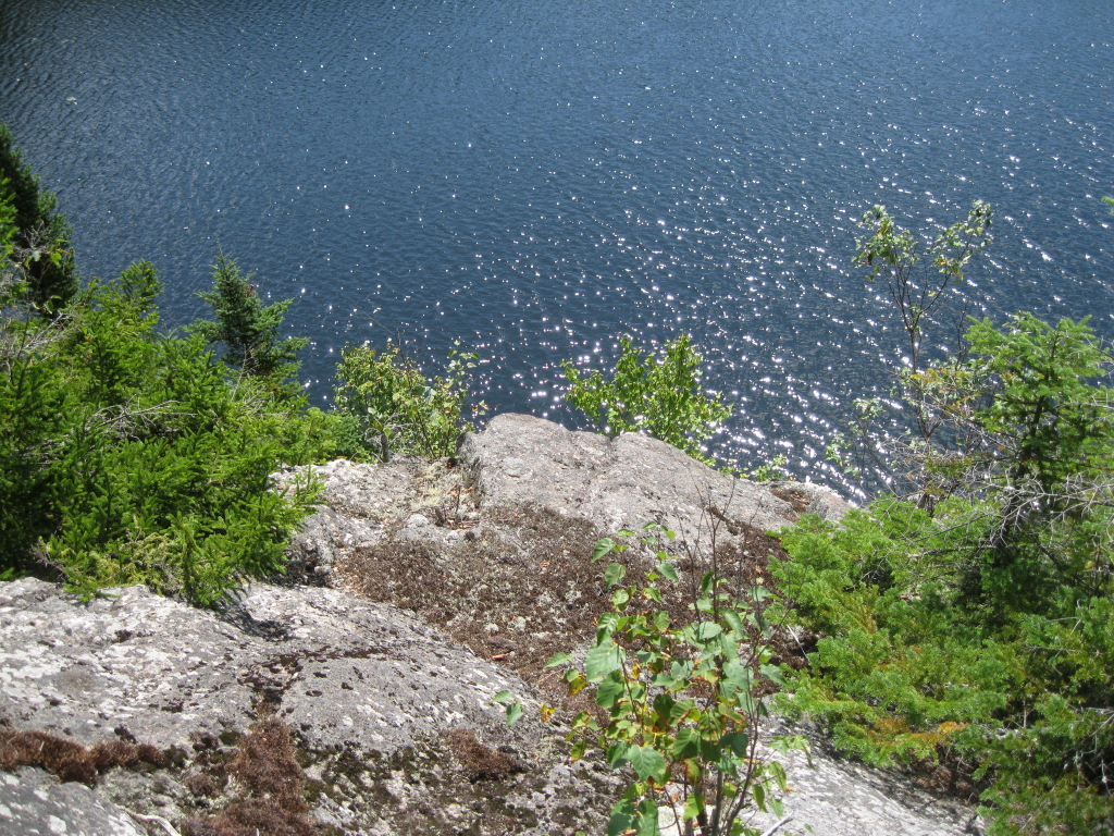
Looking down at a corner of the pond. In recent years Loon Pond has been better known as a source of snowmaking water for the ski area (it's no longer used for this purpose) and as one source of drinking water for the town of Lincoln (no camping, and visitors should take care to protect the purity of the pond).


The cliffs drop right down into the water.

Someone had set up a convenient bench for viewing the pond. What a peaceful and relaxing spot,  close to the ski area but feeling far removed.


I returned to the ski trail and descended some more, then made another short bushwhack to the cliffs that overlook Little Loon Pond, which Lucia Pychwoska referred to as "a rock-set gem."


Looking across at the South Peak of Loon.


Relaxin' on the ledges.


Little Loon, small and secluded. Until the 1960s both Little Loon Pond and Loon Pond could be accessed by the WMNF Loon Pond Trail, which ascended along the west side of both ponds.


A ledgy spot near the Little Loon Pond cliffs opens a view NW to the Kinsman-Cannon ridgeline.


A peek from the ledge at Big Coolidge, Liberty and Flume.


I found an old herd path leading back to the ski trail.


Walking down the ski trails through carpets of late summer wildflowers, with a great view ahead of the peaks surrounding the slide-scarred Clear Brook basin.


A zoom on Clear Brook, with Mt. Flume in back and Whaleback Mtn. on the R.


Mt. Bond in the distance, with the new Irene slide visible. East Whaleback (once called Elephant Mtn.) and Potash Knob in front on the L.


Around a bend, a view of Moosilauke. I took a variety of ski trails back to the base of the mountain, concluding an interesting half-day on Loon.


Tuesday, August 14, 2012


CHURCH POND: 8/7/12


On a beautiful cool, sunny morning, my brother Drew and I took the short, easy and very scenic walk into Church Pond on the north side of the Kancamagus Highway. For several reasons, this trail is lightly traveled: the trailhead is hidden away in the Passaconaway Campground; the Swift River must be forded at the start of the trail; and the footing approaching the pond is very muddy.

We parked at the trailhead (room for two cars), put on our water shoes, and waded the river and a second, smaller branch stream a little farther along. Then we reached the former loop junction, where the signs were still in place. The eastern loop of the Church Pond Trail is no longer maintained by the Forest Service due to extremely boggy terrain. The west part of the loop remains open.


The next section of trail is a needle-carpeted stroll under tall pines.


The last few tenths of a mile approaching the pond leads through an extensive swampy area. The bog bridges that were placed here some years ago are largely rotted away, with numerous protruding metal spikes waiting  to trip the unwary. Because of the dry summer, the footing wasn't too wet through here on this day.


Green's Cliff looms to the northwest. In his 1916 regional classic, Passaconaway in the White Mountains, Charles Edward Beals, Jr. admired Green's Cliff as "a truly magnificent and imposing rampart." Beals devoted an entire chapter to Church Pond and its trailless neighbor, Little Church Pond, which were then known as the Deer Ponds. 


Drew making his way through the swamp on the final approach to the pond. This is a great birding area in early summer, but the mosquitoes are a force to be reckoned with.


The official trail now ends atop a gravelly hillock covered with red pines, known simply as "The Knoll," overlooking Church Pond.


A couple of side paths lead steeply down to shoreline openings with beautiful mountain vistas. This view looks SW to the Fool Killer, North Tripyramid and Scaur Peak.


Looking south towards the Sabbaday Brook valley with the Sleepers at its head and Potash Mountain on the left.


A closer look at the Sleepers.


Next we followed the abandoned eastern loop along high ground to the east, and dropped down on a faint path to  a premier sitting rock on the eastern finger of the pond. This view looks west towards the main part of the pond with Sugar Hill beyond.


Good view from the rock north towards Mt. Tremont and Owl's Cliff.


Owl's Cliff has some impressive rock faces. For an account of an exploration of these, click here.


Watching some Belted Kingfishers patrolling this end of the pond.


Summertime, and the livin' is easy...


Back at the shore below The Knoll, a vista of Passaconaway and Potash.


Church Pond has some of the best mountain views of any water body in the Whites.


In the gravelly clearing atop The Knoll.


Lots of nice easy walking on the Church Pond Trail.


Looking east along the Swift River.


Wading the river to return to the trailhead after a great morning walk.
(This post is a little late in coming because our main computer, which has our photo files, was unavailable for a few days due to a construction project.)  


Wednesday, August 8, 2012


ZEALAND NOTCH: 8/6/12

On a cool, cloudy day my brother Drew and I spent an afternoon walking through the Zealand Valley and out into Zealand Notch. This is one of the most rewarding lowland walks in the Whites, with wetlands galore and excellent views of the surrounding mountains. (The Zealand Valley was originally called the New Zealand Valley in the late 1800s, supposedly a humorous reference to its remoteness.) We set off on the Zealand Trail, which largely follows the grade of the late 1800s Zealand Valley logging railroad, at the crack o' noon.


The first open wetlands are reached at 1.7 mi., with views up to Zealand Ridge, with "Zeacliff Pond Peak" on the R.


There is a very active beaver colony in the Zealand Valley.


The "Z-bridge" over a beaver-flooded wetland.


Looking south towards Zealand Notch.


One of the largest beaver ponds is near the A-Z Trail junction. It's said that this flat was a staging area or log yard during J.E. Henry's Zealand logging operation. Mt. Tom is seen in the distance.


Zealand Pond, with spurs of Mt. Hale in the distance. This pond is unique for having outlets into both the Connecticut River watershed (via Zealand River and Ammonoosuc River) and the Merrimack River watershed (via Whitewall Brook, North Fork, East Branch and Pemigewasset River).


Drew hanging out at Zealand Pond.


New signs at the Zealand Trail/Twinway/Ethan Pond Trail junction.


En route to Zealand Notch along the Ethan Pond Trail, we dropped down through the woods to Whitewall Brook, following faint paths at times, and made our way to a pretty cascade.


A beautiful stretch of the stream.


 More cascades, just a bit downstream.

 
Looking south down the brook from the base of the lower cascade.


We bushwhacked up the slope to the Ethan Pond Trail and continued south along the old railroad grade to the open talus area in Zealand Notch. The first view looks across the Pemigewasset Wilderness to the North and NW Peaks of Mt. Hancock.


Hard to believe a railroad was built along the side of Whitewall Mountain, with its ragged cliffs and massive talus slopes. The top of Whitewall - in particular the far-viewing ledges at its south end - is an alluring bushwhack objective. Some folks go right up the talus and through a slot in the cliffs, but I don't recommend it; the rocks are big and unstable and could pose a threat both to the bushwhacking party and unsuspecting hikers on the trail below. Far better to ascend Whitewall from the south or north, largely through birch forest.

A big flat-topped rock in the trail is a great spot to take a break and soak in the scenery of Zealand Notch.


Looking south to Mt. Carrigain, Shoal Pond Peak, and NW Hancock.


The rounded knob of the Zeacliffs looms high above the notch.


Plenty of talus below the trail, too.


Looking north up the notch to Mt. Hale. The roof of Zealand Falls Hut is visible in the center of the photo. Interestingly, on this midsummer day we saw not one other hiker during a fifty-minute sojourn here in the heart of Zealand Notch.


On the way back Drew spotted this interesting lichen pattern on a trailside rock.


Cruising along the Ethan Pond Trail, heading north out of the notch.


Still water in a Zealand beaver pond.


A parting view revealing the full length of Zealand Ridge.


On the way out on the Zealand Trail, we made a short side trip to some ledges in the Zealand River. Zealand is a place to return to again and again.