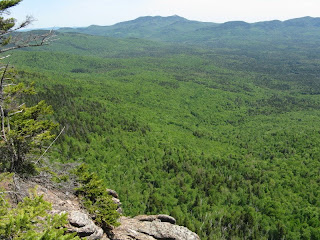
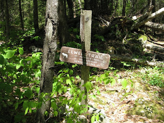
A couple of recent reports on Views from the Top reminded me of how much I like the journey to Owl's Cliff. Set way back from the Kanc Highway on the north side of the Albany Intervale, this 2940-ft. peak offers a feeling of remoteness and a fine view of the Sandwich Range from a ledge at the end of a spur path off the Brunel Trail.
Though usually thought of as a spur of Mt. Tremont, Owl's Cliff is a worthy peak in its own right, with impressive cliffs on both its south and west sides. In addition to the trailed view, on this spectacular cool, sunny day I wanted to see if I could find a perch on the main south cliff. If time permitted, I would seek out the top of the west cliff as well, which I had visited back in the 90s as part of a rather miserable bushwhack up from Sawyer Pond.
The usual approach to Owl's Cliff starts on Bear Notch Road and follows the gravel Rob Brook Road for 2.6 miles. I was going to mountain bike the road portion, but a broken tire valve deflated that plan. So I opted for the less-used south approach from the Kanc via the start of the Sawyer Pond Trail, to lessen the road-walk distance.

The reason this isn't often used is because you must ford the Swift River right at the start - bring the crocs. Invariably you must wade this, at anywhere from knee to thigh deep. There are some underwater rocks to help you along. In high water, forget it - too dangerous. Today was a knee-deep day.

The flat lower mile of Sawyer Pond Trail leads through some tall white pines, with a dense understory.

At 1.1 mile I turned right on the seldom-traveled lower part of the Brunel Trail.

In another 0.3 mile you turn onto Rob Brook Road for a pleasant mile-long stroll. At one spot there was a peek at the day's objective.

At the junction with the Rob Brook Trail, I turned right for a quarter-mile side trip to the northernmost of several beaver swamps and ponds that line this trail. The route follows the bed of the old Bartlett & Albany logging railroad.

As it reached the edge of the open swamp, the trail went AWOL, disappearing under a beaver overflow. For years now this fascinating trail has been impassable without significant wading - one recent report spoke of hiking in crocs for 2 miles. You can get the flavor of this area with this short side trip from the Rob Brook Road. The swamp was alive with birdlife, inlcuding an olive-sided flycatacher belting out its "whip-three-beers" song. It was a chilly morning, so the mosquitoes were mild at this point.

A winding channel of Rob Brook leads into the swamp.

From the edge of the swamp there was a nice view of Owl's Cliff, with Mt. Tremont peering over in back.

I returned to Rob Brook Road and in another 0.3 mile turned left into the woods with the Brunel Trail. In the next mile there was some nice hardwood forest.

And some good-sized hemlocks too.

As the AMC Guide notes, some large boulders "announce the approach to the east end of Owl's Cliff."

Just above here was the champion tree of the day, a towering sugar maple.

For a quarter mile the climbing was steep and fairly rough.

At the top of the steep pitch I veered left into the dense brush and started whacking along the edge of the ridge. This may have been similar to an older route of the Brunel Trail, which was described as passing several rocky openings en route to the west outlook. First I came to an isolated granite slab that I had spotted from the beaver swamp. Here I enjoyed the first of several fine views of the Sandwich Range seen across the broad Albany Intervale.

A zoom on Passaconaway and Whiteface, with Hedgehog and Birch Hill below.

A great look at the Sleepers and Tripyramids beyond the Sabbaday Brook valley. Church Pond is on the flats.

I decided to continue up the ridge. According to various sources, this peak was blasted by the 1938 hurricane and then scorched in a 1963 fire. As a result there is a tangle of dense vegetation and old blowdown. You pay a price in blood to get to the cliffs!

Partway along I got a side view of the main south cliff ahead.

Eventually I made my way to a perch atop the south cliff, where it was a long way down in front.

I weaseled my way down through some spruce scrub to get a side view of the sheer face.

The view from the perch was commanding....

...and extended all the way across to Chocorua.

From here I made a thick whack up to the spur path, where a sign talks about the 1963 fire.

The path drops steeply to a great granite shelf - a fine lunch spot, and quite snoozeable.

From the right side of the ledge you can admire the high peaks of the Sandwich Range.

Green's Cliff can be seen to the west.

It was late afternoon, but there was plenty of daylight left, so after a nap I decided to whack down to the top of the west cliff. It was just as thick as I remembered, and involved a discouraging amount of descent. After some toil I found a first viewpoint with a partial look at Sawyer Pond.

Farther down I emerged on a ledge with a serious dropoff.

There was a beautiful vista across a high plateau to Green's Cliff.

On this upland is a small open bog I visited a few winters ago.

The return view from the bog up to Owl's Cliff, looking at the west cliff.

A look back at part of the west cliff face.

The lowest perch took some doing to get to, but had the best views of all, looking across the Sawyer Pond Scenic Area to Hancock and Carrigain. Very wild, especially with ravens circling and croaking out over the valley.

Closeup of Sawyer Pond and Hancock. Didn't see anyone down at the shelter.

Carrigain and Carrigain Notch are seen from an interesting angle.

Zoom on Carrigain Notch. Zealand Ridge is in the distance.

And the lesser-known Hancock Notch, with Mt. Hitchcock beyond.

It was 5:00 and time to go. A parting shot of the Sandwich Range in evening glow.

The whack up to the summit of Owl's Cliff was nasty for a ways, giving me a four-inch gash on my leg - even though I was wearing long pants. I was glad to get back to the trail. Once I got back down to Rob Brook Road, a swarming cloud of mosquitoes moved in for the attack. A hasty application of Ben's held them somewhat at bay for the 2-mile walk out, though I could feel them hitting my arms with every stride. On the drive home I stopped at the Sugar Hill Overlook to study Owl's Cliff and try to trace the day's route.
The bird tally for the day was 40 species. Highlights included a belted kingfisher and spotted sandpiper on the Swift River, alder and olive-sided flycatchers, tree swallow, and swamp sparrow in the swamp on the Rob Brook Trail, and the regular assortment of woodland warblers.
A round trip hike to the Owl's Cliff outlook from the Kanc via Sawyer Pond Trail, Brunel Trail and Owl's Cliff Spur is 8.8 miles with 1700 feet of elevation gain. Using the Rob Brook Road approach from Bear Notch Road, thus avoiding the Swift River crossing, it's 9.4 miles with 1850-foot elevation gain. Watch your footing on the steep, gravelly section of Brunel Trail and on the descent to the outlook ledge. The whacking to the cliffs is best left to those who enjoy (?) swimming in dense spruce and straddling spiky blowdowns. Be safe and tread lightly.


