I had a sunny, crisp late October day for the fall maintenance trip on the Kettles Path, a one-mile-long trail I adopted through a cooperative program of the Waterville Valley Athletic & Improvement Association and White Mountain National Forest.
The first of just two blowdowns along the trail was sticking up onto the trail from the steep slope below.
Cut and removed.
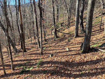
With the leaves down, the three Kettles along the trail are more visible. These bowl-shaped hollows were formed when chunks of glacial ice were
stranded as the glacier receded. Sediments built up around the ice
chunks, and when they eventually melted these hollows were formed.
The trail brushes by one of the largest white pines in Waterville Valley.
This interesting fungal sculpture has changed a bit over the last couple of years.
Each season I am happy to see this battered white ash still standing tall.
A nice hardwood corridor.
Cleaning drainages is an important task for adopters.
This small obstruction was easily dispatched.
Cleared.
The reward at the top of Kettles Path is the ledgy nubble called The Scaur, with a wide view across the valley to Sandwich Dome and Jennings Peak. The sun was beaming down on this south-facing perch, making a stay here quite comfortable even with the temperature in the high 30s.
Snow guns were firing on the upper slopes of Waterville Valley Ski Area on Mt. Tecumseh.
Middle and South Tripyramid rising darkly to the east.
From an opening on the west side of The Scaur, a view of East Osceola and the Painted Cliff.
A long ridge sweeps up to the main summit of Mount Osceola.
The "Rock of Gibraltar," found a short distance east along Irene's Path.
As I often do, I bushwhacked through hardwoods down the slope below the cliffs of The Scaur, returning to the Kettles Path below.


Hello Steve! Thanks for posting the pic pf the Kettle when the leaves were down. I didn't get to see that detail when I hiked that section in late August. Your report brought back many good memories of that hike. Best wishes!
ReplyDeleteHi Paul - Yes, you can see the Kettles much better when the leaves are down. Thanks again for the tasty peanuts - I finished them off a few days ago. Happy trails!
ReplyDelete