On a sunny, balmy October day with temperatures rising into the 70s, I returned to one of my favorite slides - the impressive Southwest Slide on Mount Osceola. The slide, which fell during Hurricane Carol in 1954, is prominent in the view of Osceola from the town of Waterville Valley, as seen in this photo taken from the edge of the golf course.
The first half of the approach to the slide was a mellow walk along the northern trails of Waterville's excellent cross-country ski network.
A new shelter for skiers.
The powerful surge of this slide scoured out its streambed (a western fork of Osceola Brook) for a mile and a half downstream. It also gouged out this parallel gully just to the east of the brook.
The lower end of a boulder train deposited by the runout of the slide.
Farther upstream, a ledgy spot along the brook. I could imagine the water and debris from the slide slamming through here.
A beautiful glade of sugar maples and boulders on the ridge west of the brook.
There was still a bit of maple color overhead, but it was falling fast.
There are several old logging roads leading up the valleys on the south side of Osceola.
Approaching the base of the slide, with the summit of Osceola high above.
Squeezing through along the steep footwall of the slide.
According to my pocket clinomteter, parts of the footwall have a slope of 40 degrees.
The right side of the footwall checks in at 45 degrees. Yikes!
Side view of the footwall.
After skirting the footwall to the right, I emerged to this view up the slide. The fork seen on the right is a much older, smaller slide, perhaps dating back to the 1880s.
Scrambling up the next set of granite slabs.
A short side trip led to the base of the older slide's footwall. This is extremely steep. approaching 50 degrees.
I cut over to the top of a gravel swath to bypass some wet slabs above.
On each of my several trips to this slide, I've avoided going out on this big exposed slab. I do not want to get partway up it and discover that the rock is slippery.
Which is what would happen at the top of the slab, with a ledge step to negotiate as well.
Down-look from the next level.
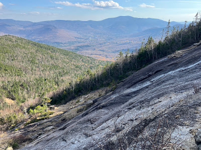
Expanding view out towards Sandwich Dome.
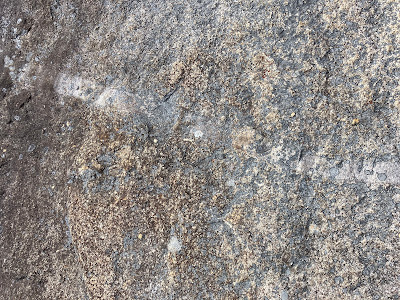
A small dike of intrusive rock cuts across the Mount Osceola Granite that makes up the ledges of the slide.
Continuing up. These slabs measured 30-31 degrees, about the average pitch for the slide as a whole.
These ledges on the upper part of the slide are steeper at ~35 degrees. Luckily they were dry and grippy.
Side view with Mount Osceola above.
Peering down.
Time for a long break in the sun near the top of the slide. The view takes in Mount Tripyramid, the Sleepers, Mount Whiteface and the northern Flat Mountain with the town of Waterville Valley below.
Looking across to Sandwich Dome. Some treacherous loose footing over there.
Looking up to the top of the slide. Doing the bushwhack up to the Mount Osceola Trail once was enough for me.
Zoom on Tripyramid (with the North Slide prominent), Sleepers and Whiteface.
After an hour's sojourn, time to head down, carefully. The crab walk was used to descend the 35 degree ledges.
Can't get enough of this scenery.
The sun drops behind the trees.
I was able to mostly walk upright down the 30 degree ledges.
A number of white pines have taken root on this 70 year old slide.
Looking back up after crossing to the other side of the slide.
An interesting rock formation.
Pothole pool above the footwall.
I'm glad I didn't try to scale the footwall.
Late day sun in the hardwoods.
A balloon, of course.
Homeward bound on the ski trails.


No comments:
Post a Comment