After a day spent wandering in the Great Gulf, for my next hike I decided to return to my favorite of the Presidential Range cirques: Castle Ravine, or Ravine of the Castles as it was once called, the great north-facing scoop between Mt. Jefferson and Mt. Adams. Tucked in between Jefferson's Castellated Ridge and Israel Ridge on Mt. Adams, this ravine has beautiful forests, outstanding brook scenery, wild crags, and no nearby road, railway, or hut.
My plan was to visit two of my favorite places in the ravine: an old slide on the west wall, and the open rocks on the lower part of the headwall. Both spots provide fine views.
The approach to the ravine is made via the Castle Trail from the trailhead known as Bowman. After a flat start, the trail crosses the Israel River - the first of 13 (!) stream crossings on the way into the ravine. This is a hike best done in low water conditions; even then some of the crossings are not easy.
Not far beyond the first crossing I made a short bushwhack down for a close look at cascades known as Israel Rapids.
For nearly a mile the Castle Trail rises at easy grades through a fine hardwood forest.
At 1.3 miles I veered left onto Israel Ridge Path, which soon crosses the river and then follows alongside it.
The Castle Ravine Trail branches off at 1.7 miles. Admirably maintained by the Randolph Mountain Club, it was opened in stages from 1915 to 1919.
The next two crossings - first of the Israel River, then of Castle Brook - have especially awkward footing, with pointy, slippery rocks.
The next crossing, much easier, passes by this pretty cascade.
Not far beyond, the trail crosses over a bouldery pile that is a debris flow levee deposited by one of two adjacent slides that are seen in a 1955 aerial photo. These slides are now completely revegetated.
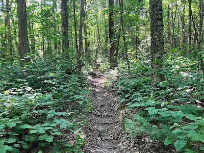
One of the prettiest stretches of trail in the Northern Presidentials.
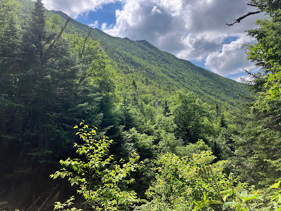
After another crossing, the trail ascends along an old logging road on the flank of Israel Ridge, passing this window view of the lower Castellated Ridge.
Nice walking here through open mixed forest.
About three miles in I dropped steeply off-trail, heading down to Castle Brook.
I crossed the brook and climbed up to the slide I was seeking.
This slide is prominent in a 1972 aerial photo, so it likely fell in the late 1960s or early 1970s. Dense spruce growth has claimed much of the slide, but open areas remain, offering interesting views, here looking up at the Castellated Ridge.
Looking down from the top of the most open strip.
Looking up at Israel Ridge and a bit of the Castle Ravine headwall.
I love the distant view to the NW, towards Mt. Waumbek, the Weeks peaks with Mt. Cabot peering over, Unknown Pond Ridge, Rogers Ledge, Deer Ridge and distant Long Mountain.
Several white pines have seeded in on the slide, miles from their nearest relatives.
A couple of tamaracks are here also, eking out a living amidst phalanxes of spruce.
Returning to the trail, I continued up the ravine.
At one point, the trail runs right up the brookbed for a few yards. There is an RMC "Path" sign on the straight tree in the middle, but it is obscured by branches.
I was amazed at how much water was flowing in Castle Brook, high in the valley during a dry season.
Approaching the headwall, the trail crosses the brush-grown track of a snow avalanche that ripped down through the forest in 2010.
This opening provides a neat look up at The Castles.
Just beyond, water can be heard gurgling under these massive boulders.
The steep, rough climbing up onto the headwall begins here.
Right after squeezing through this crevice...
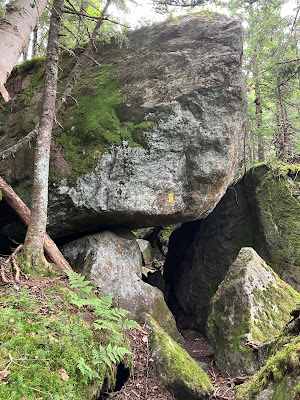
...you arrive at Roof Rock, one of the cool features of Castle Ravine.
Weaving through boulders on the final approach to the headwall.
Faded warning sign.
Some strenuous and in places challenging boulder scrambling lifts you to open rocks and views. A full-body workout here.
An RMC arrow points the way for descending hikers. Castellated Ridge looms above.
Looking back down the trail. It's wild out here!
A wonderful view down the long, curving valley to Mt. Bowman, with mountains in northern Vermont on the horizon.
Looking up to the craggy headwall.
I climbed up through the first boulder field and followed a rough traverse to where the trail crosses the track of a slide that came crashing down in 1991, disrupting the footway. The lower two-thirds of this slide is crammed with scrubby birch growth, as seen here. The upper part, high above, is still open. From a distance the long track of the slide can be seen as a thin light green strip on the headwall.
I went back down to the boulder field, found a flat rock, and enjoyed an hour's sojourn in late afternoon sun.
An amazing place to be, with the plaintive whistle of a White-throated Sparrow drifting on the breeze.
A great perspective on the Castellated Ridge.
The Castles.
Mts. Starr King and Waumbek out to the north.
These craggy gullies are known as the Three Sisters to backcountry skiers.
Descend carefully!
Twilight view of Mt. Jefferson and Castle Ravine from the trailhead.


No comments:
Post a Comment