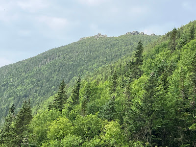
Took the afternoon off on a partly sunny day and headed over to Jefferson Notch Road to visit a slide I hadn't been to before. This one fell during Tropical Storm Irene in 2011 and spilled down across one of the more notorious trail sections in the Whites: The Link, between the Caps Ridge Trail and the Castle Trail. I prepared myself mentally for the 2+ mile round trip on this rough and tedious sidehill trail to gain access to the slide.
As expected, the Caps Ridge Trail, by far the shortest route to Mt. Jefferson, was busy on this Friday afternoon. Several descending hikers noted that the summit was socked in when they were up there, but it had since cleared out.

The Caps and Mt. Jefferson were in the clear when I arrived at the pothole ledge viewpoint, one mile up the trail.

Mt. Clay, with several small slides visible on its flanks.
Last summer I bushwhacked down to this slide from the Jewell Trail. It offered an excellent view of Caps Ridge.
The Southern Presidentials.
Long view out to the Willey Range and the Twin Range. A little hazy, but not bad.
The Link starts out innocuously for the first ~0.2 mile. Quite pleasant, in fact!
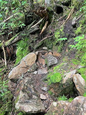
Soon enough, it becomes Link-like.
There is a certain rugged beauty to this trail, which clings precariously to the steep flank of Mt. Jefferson.
Verdant.
And rough.
Many a hiker has been fooled by the loop between the Caps and the Castles made possible by The Link. It looks inviting on the map, with little change in elevation. But the rough footing and countless little ups and downs have discouraged many a Caps/Castles looper. I met two who were regretting their choice about halfway along this 1.6 mile section.
The hits just keep coming. This trail can actually be (somewhat) enjoyable if you approach it with the knowledge that you are not going to breeze through in good time.
To be fair, there are some decent stretches mixed in with the rough stuff.
A mile or so from the Caps Ridge Trail, I came to the Irene slide. The section of the slide below the trail crossing is a crazy-steep brookbed that was scoured and widened.
Luckily there is a little shelf on which to cross the slide, though there is a steep scramble on either side.
Looking up the slide from the trail, I could see that the angled ledges would be too steep and slippery to safely climb.
Ledge perches along the trail's slide crossing.
A nice view here down a nameless valley, with Cherry Mountain on the horizon. Unfortunately, smoke haze from western wildfires had moved in, blotting out the distant views to Vermont.
I wanted to check out the wider, more open upper part of the slide, not too far above. The bushwhacking up through the steep woods beside the slide was slow going, with treacherous footing. Many hidden holes awaited.
I slowly made my way to the base of the upper section, and was greeted by an impressive, savage-looking swath. I wasn't sure I'd be able to get up on it.
First I climbed up along the gully on the left, under the steep half-footwall.
If this footwall extended all the way across the slide, it would be a formidable barrier.
The gully was loose and sketchy at the top, so I went back down partway to try another route.
Looking down the gully.
Side view of the footwall.
Using a different approach I was able to scramble up onto the spine of the slide.
Partway up, I found a good rock seat. By now the smoke haze had nearly obliterated the view.
From the south edge of the slide I found a view up to the Castellated Ridge.

A different angle on The Castles.
Down-look.
It was tempting to go higher, but the footing would have been tricky coming back down, and it was getting late.
Redrock.
Parting shot in hazy evening sun.
Careful descent.
I came back to the trail just north of the slide and followed it up this rather exposed scramble.
I felt like I was in the Great Smoky Mountains.
Steep slide and steep ridge.
Cascades of moss.
More of The Link's greatest hits.
With two plus miles round trip on the trail, I had my fill.
Evening on the pothole ledge.
Jefferson illuminated.
Apocalyptic sunset.


No comments:
Post a Comment