I last visited Owl's Head five years ago, and with a new edition of the AMC White Mountain Guide in the works, I wanted to check on the condition of the Owl's Head Path to the summit and visit a new viewpoint that has recently been opened by a blowdown, noted in several trip reports. I also wanted to see how much the Black Pond and Brutus "bushwhacks" had developed over the past five years.
Morning view of Bondcliff and the East Branch along the Lincoln Woods Trail.
The USFS has closed the footbridge over Birch Island Brook due to structural damage, and has placed large step stones as an alternative.
Onto the Black Pond Trail.
Scene along the Black Pond Trail.
The sharp south spur of Owl's Head from the Black Pond outlet.
Owl's Head cliffs.
Quiet morning at Black Pond, with Bondcliff in the distance.
The Black Pond "bushwhack" is now a full-blown trail, and erosion is eating at its steeper pitches. This route follows a much higher course, up on a side slope, than routes I have followed in the past.
The north section of the path has easier grades and is in better condition.
The Lincoln Brook Trail is a highlight of the long journey to Owl's Head, shaded by yellow birches as it rises gently through a remote wilderness valley. Kudos to trail adopter Adam Mooshian, the "Teal Goat."
There are many views of Lincoln Brook, including this sliding cascade.
The water was up from recent rains, but the crossing of Liberty Brook was manageable.
I used Crocs at the Lincoln Brook crossing as some of the rocks were at awkward angles. On the way back I was able to rock-hop.
This stony outwash on the trail leads up to the start of the Owl's Head Path.
Cairns mark the start of the unofficial but heavily used path. From here you climb 1400 ft. in about 0.7 mile.
Bottom of the slide.
Looking down the first open part of the slide.
There are occasional cairns on the slide, though the placement of some seems random.
This little scramble has a bit of exposure on the left.
These ledges at 2960 ft. are the best spot on the slide. I always take a break here to admire the views (and catch some breath). Mts. Flume and Liberty are seen to the SW.
There's a unique view up to the higher Franconia Range peaks, though Mt. Lafayette was socked in at this point. Here is a zoom on the Lincoln Slide, which was used as an approach to climb Owl's Head from Greenleaf Hut in the 1930s, before the Lincoln Brook Trail was opened.
Looking down from the ledge perch.
On my last trip I followed the most-used route, which bypasses the upper open part of the slide on the right. Today I used the alternate route that continues up the open slide, starting at this somewhat overgrown spot.
This route has a fairly difficult double ledge step. I had to remove my pack to get up it.
Looking down from the top of the scramble.
There was water running down the upper part of the slide.
By now Lafayette had cleared, providing a full view of the upper Franconia Range.
Looking down from the very top of the slide, at 3200 ft. According to late 1950s slide researcher Edward Flaccus, this slide fell in 1936. Above here the two routes rejoin.
Steep and rough on the old track above the open slide.
This boulder has become known as Brutus Rock, as it marks the upper end of the Brutus "bushwhack." This route was named after Brutus, the famous winter peakbagging Newfoundland, whose owner, Kevin Rooney, devised this as an alternate winter route in the 2000s after Brutus refused to ascend the slide
If descending the Owl's Head Path, the Brutus "bushwhack" goes to the left here, while the regular path makes a hard right around the rock. More than one hiker has gone down the Brutus route by mistake. More on that route later.
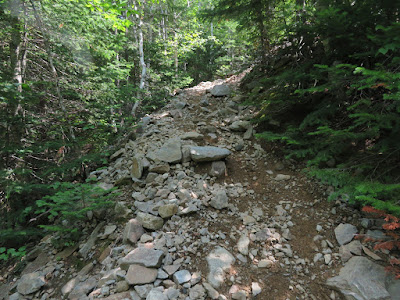
Above Brutus Rock, the Owl's Head Path is steep, nasty and rocky for a while. It improves as it nears the ridgecrest.
This blowdown-strewn knob was thought to be the summit for a number of years, until in 2005 a higher bump was found 0.2 mile to the north.
The path is well-beaten and clear between the "old" summit and the "new" summit.
Small clearing and cairn at the "new" summit.
Another angle.
A head-on peek at the Lincoln Slide from a fir wave.
Just north of the "old" summit is the view from a recent blowdown opening, less than 15 yards from the path. Bondcliff on the left and Mt. Carrigain on the right.
Mt. Bond and Bondcliff, with a great view into the Hellgate Brook valley.
Zoom on Bondcliff.
A junco was singing from a nearby perch.
I descended via the Brutus "bushwhack." The change from five years ago was shocking, if not unexpected. It is now heavily trampled, and the long steep section is a disaster of erosion with slippery mud and roots.
This route was developed for winter use and is unsustainable for summer use. It will only get worse with continued summer usage. I don't recommend it.
The obvious bottom of the Brutus "bushwhack." Here, too, hikers could be led astray thinking this is the cairn marking the start of the Owl's Head Path.
On the way out a fine ledgy spot on Lincoln Brook beckoned for a break.
Looking downstream.
Evening at Black Pond.


No comments:
Post a Comment