The east side of Mt. Clough, Mt. Moosilauke's near neighbor to the west, has one of the greatest concentrations of slides in the White Mountains. By my count, there are eight separate slide tracks, all in various stages of revegetation, that plunge down the slope into Tunnel Brook Notch. It's like a smaller version of the great slide-striped Mt. Colden in the Adirondacks.
The first two slides, towards the north end of the notch, fell in the November 1927 storm and closed the rough road that ran through this pass between Benton and Glencliff. It's believed that the rest of the slides crashed down during a storm in 1942, though there may also have been activity from the 1938 hurricane.
In 1933,
while mapping the bedrock of the Mt. Moosilauke quadrangle, the eminent
geologist Marland P. Billings and three companions made a startling
discovery on the northern of the two 1927 Clough slides: a fossilized
brachiopod encased in the highly metamorphosed schist. Geologists
note that such an occurrence is very rare. The next year another
brachiopod was discovered a short distance away on the same slide by
Billings and Arthur B. Cleaves. (A brachiopod is defined as a marine invertebrate with a hinged shell, resembling a bivalve mollusk. Brachiopods were abundant during the Devonian Period, from 417 to 354 million years ago, but are relatively rare today.)
Billings and Cleaves discussed their findings in an article in the December 1935 issue of the American Journal of Science: "Brachiopods from mica schist, Mt. Clough, New Hampshire." The discovery of these fossils was a key to confirming the age of the rock as Devonian. Having become an enthusiast of slides in the southern White Mountains, of late I have been fascinated by the possibility of locating the exact site where Billings and Cleaves found and collected the fossils. Both specimens reside in the Museum of Comparative Zoology at Harvard.
There are several clues in the article written by Billings and Cleaves. The fossils were found at elevations of 2650-2670 ft. on the northern of the two slides that were then present on Mt. Clough. The distance was 1.6 miles from the summit of Mt. Moosilauke, at a bearing of N 66 degrees W (a true north bearing of 294 degrees.) They found pegmatite dikes below and above the fossil site, and 120 feet above the site was "the east border of a large mass of the Bethlehem
granodiorite gneiss," a lighter-colored igneous rock.
The question is, which is the correct slide? The issue is confused by the six additional slides that fell during the following decade. I have been unable to find any photos taken between 1927 and 1942 (the two major slide occurrence dates) that would show only the two 1927 slides. Unfortunately revegetation has covered some of the possible clues.
A lengthy article by Billings in the April 1937 issue of the Bulletin of the Geological Society of America includes a striking photo of the slide on which the fossils were found, taken that year. From this photo it's hard to tell where exactly on the mountain the slide is located. I have spent much time (ask my wife) comparing the ledge and till deposit patterns in the 1930s photo, taken when the slide was fresh and completely open, with the remaining rock patches on the more northern slides as they appear in their partly to mostly revegetated states today. The ledge and till deposit patterns, and the bearing (which actually points slightly north of the slides) suggest that the most northern of the slides is the fossil locality. The location matches the distance given from the junction with the 1930s Tunnel Ravine Trail in the guide to a 1936 field trip led by Billings, in which particpants visited the base of the Clough slide and then climbed Moosilauke via the "big slide" used by the Tunnel Ravine Trail. Am I sure it's the northern slide? No.
Some further research revealed the data records for the two Clough slide brachiopod specimens at the Museum of Comparative Zoology. Coordinates for the location are given. With great anticipation I
entered the coordinates into Google Earth and it took me to......the North
Slide on Mt. Tripyramid! Someone apparently got their slides mixed up.
On a fine partly sunny, breezy day, my curiosity got the better of me. Back to the northern Tunnel Brook trailhead, which I have been frequenting lately, I returned. Up the familiar decommissioned section of Tunnel Brook Road, a narrow path lined with tall wildflowers, then the undamaged stretch of road leading to the Tunnel Brook Trail proper.
Along the way I made a short detour to visit the site of the Parker House, a small hotel that welcomed guests at this lonely location starting in 1903. The three-story structure – described as “a delightful little hostelry” in the White Mountain Echo, a tourist newspaper - had accommodations for 40 guests, with rates of $2.00 per day and $8.00-$12.00 per week. Its brochure boasted of “a cozy parlor, and a wide piazza on three sides of the house, baths, hot and cold water, and toilet rooms.” Other amenities included croquet and tennis, daily mail and Boston newspapers, and fresh food from its own farm. The Parker House stage would meet guests at Woodsville or Wells River for $1.50, or at Glencliff for $1.00. It remained open into the 1920s, but in 1928 the property was sold to the Forest Service, and the abandoned hotel was burned.
This was the driveway that led to the front of the Parker House.
Part of the foundation is all that remains of the building.
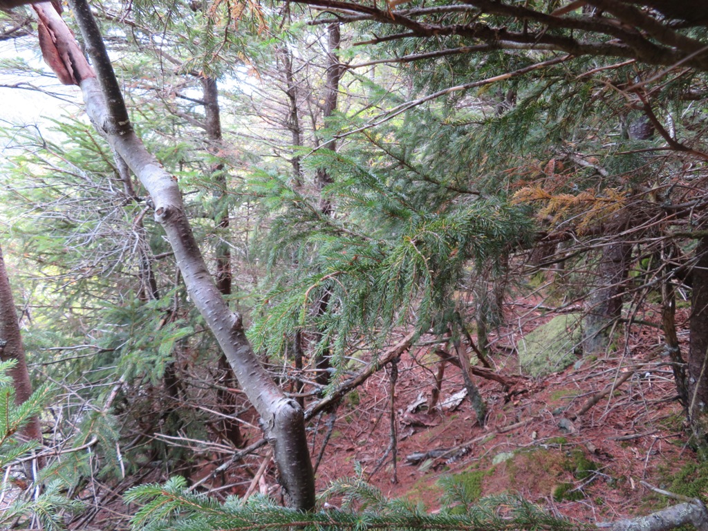
I continued up the rest of the road, and then the Tunnel Brook Trail, to the point where it encounters the the narrow runout tracks from the northern slides. I climbed up to the lower gravelly swath of the northernmost slide and took this photo of a patch revegetating with red spruce, white and red pine, and shrubs such as rhodora and sheep laurel.
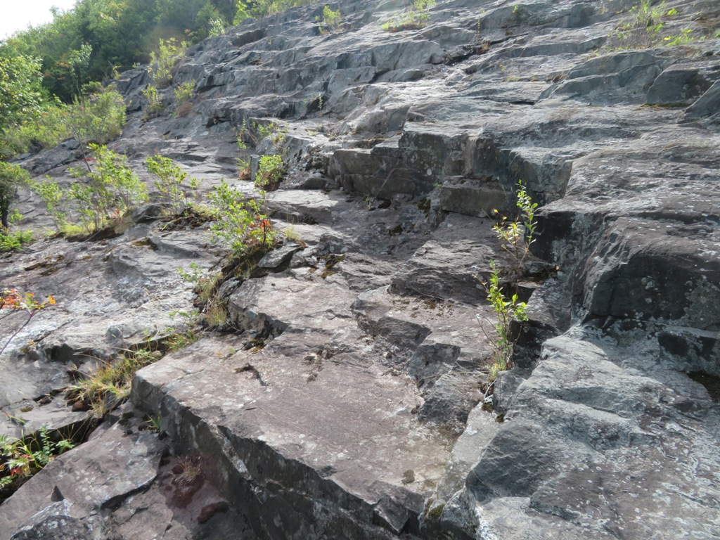
Farther up the slope are the first bedrock exposures on the slide, composed of schist, a metamorphic rock of the Littleton Formation. I had visited these lower ledges a couple of weeks earlier.
Looking north across the slabs.
Looking south across a higher band of ledge.
Reaching the lower ledges wasn't too difficult, but above here the bushwhacking was steep and rough, including areas of talus hidden in the scrub. Around the rocks the scrub was dense. Slow going.
Careful foot placement required.
After a prolonged struggle I emerged on the upper northern slabs of the northern slide, at the elevation where the fossils were discovered.
I edged out onto the slab for a look down.
Partway across the ledge was an unusual gouge in the bedrock, with an interesting trio of deep scratch marks just to the north.
I'm sure it's wishful thinking, but I thought one of them had a shape similar to the rock surrounding specimen #8709 collected by Marland Billings.
I exited this slab and traversed across the steep slope, sometimes on hands and knees due to the dense growth.
The next set of ledges - the upper southern part of the northern slide - appeared ahead.
This large outcrop featured many fractured tiers of rock.
Don't trip here!
This unusual fold caught my eye. Geologist Peter Thompson, who will soon be working on a new bedrock mapping project on the Mt. Moosilauke USGS quadrangle, commented, "The fold is beautiful, with two digitations marked by the inner distinctive layer. It appears to be an early fold in that the shape is quite isoclinal."
Looking back across the ledges.
More thick stuff heading to the next slide to the south.
There it is!
I carefully pciked my way across to a dramatic perch near the top of the slide, peering down at the northernmost beaver pond in Tunnel Brook Notch. Above the pond a wedge of spruce marks the track of a 1927 slide that helped bury the old road through the notch.
Casting a long shadow on the steep ledges below.
This bedrock is noticeably lighter in color than the schist beside and below it. Geologist Peter Thompson agreed that this was likely an igneous rock known as Bethlehem gneiss, which makes up the upper part of Mt. Clough. This is one factor that could point to this slide as a possible site of the fossil discovery, as Billings had mentioned the Bethlehem gneiss appearing above the site.
Neat spot to hang out for a while.
Long view to the north, all the way out to the Pilot Range.
Zoom on North Kinsman. Mt. Cabot is on the left, above Bald Peak.
Bird's eye beaver pond view.
The NW ridge of Mt. Moosilauke, enclosing Tunnel Ravine.
The side of this outcrop appears to show a contact between the dark Littleton Formation schist and the ligther Bethlehem gneiss.
I started slowly descending on the slide in switchback fashion, admiring this view to Moosilauke's South Peak.
Not taking the direct route down.
Looking north across the slide.
The slide extends farther across to the south. This one must have been massive.
I backed off from the dropoff at the bottom of these slabs and took to the woods.
Luxuriant moss growth on some lower slabs.
The moss-grown slide track deep in the woods below.
Birch glade on the floor of the valley.
Last sun of the day on the Tunnel Brook Trail.
I paid a visit to the northernmost beaver pond.
The slide from which I descended was in plain sight above. The contrast between the two types of bedrock is plainly visible from here.
A three-slide view. The big one on the left is the most open of all the Clough slides. I've gone up on it several times and once used it as part of the route to Mt. Clough's summit.
Thanks to Peter Thompson for his insights into the geology of the slides.


What an adventure! Thanks, Steve
ReplyDeleteFascinating history of the slides and the fossils, Steve. I hope you're able to satisfy your curiosity and find the fossil site eventually.
ReplyDeleteI've enjoyed your recent ramblings around Mt Moosilauke so much that I was motivated to hike the big "West Loop" that you describe in your 4000-Footer book (Glencliff/Carriage Rd/Benton/Tunnel Brook Trails) on Friday. I must have been walking through Tunnel Brook Notch while you were up on the slide above. It was a fantastic hike on a beautiful day. Thanks for providing the inspiration for it!
Thanks, BC - glad you enjoyed the loop. I doubt if it will be possible to definitively ID the fossil site without an accurate coordinate - there are many gouges on that slide! -- Steve
ReplyDeleteExcellent account of your exploration. I hit upon it while looking for information and photos of the Bethlehem gneiss. I recently bought an old gneiss scythe stone, most likely from the Pike quarry.
ReplyDeleteNo sign of a brachiopod in my whetstone :)