SLIDE BROOK SNOWSHOE RAMBLE: 1/25/17
Snowshoeing conditions were (surprisingly) excellent on this colder-than-predicted day. On a long meander along Tripyramid's Slide Brook, using the Livermore Trail and south link of the Mount Tripyramid Trail, plus a couple of bushwhacks, I visited an old dam site, a beaver pond, a cascade, a gorge, and a slide that fell in 2011. It was a most interesting day.
A mile in on the Livermore Trail (ungroomed in the morning), I followed an old logging road and sort-of-path to the site of the old Swazeytown Dam on Slide Brook.
A timber from the Swazeytown dam, used to build up a "head" of water for river log drives in the early 1900s.
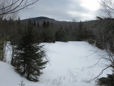
A nice meadowy area along the brook.
Nearby is the "Swazeytown beaver pond." The curving beaver dam is visible on the right.
I crossed the pond, with caution.
A short climb led to a bog on a shelf above the beaver pond.
Thin ice.
A crevassed little brook running through the bog.
The Tecumseh ski trails from a field next to the Livermore Trail.
A view of Snows Mountain.
Approaching the junction with the south link of the Mount Tripyramid Trail.
This is the route that leads along the upper part of Slide Brook.
A shaky snow bridge on Avalanche Brook.
An unbroken trail, leading into the Wilderness.There was 4-6" of new, very dense snow atop a solid base, both on and off trail.
A hardwood gateway.
Inviting.
In summer there's an attractive small mossy cascade here.
Following Slide Brook.
The trail crosses the cut of the tributary known as Cold Brook.
The crossing of Cold Brook.
An unusual ice formation on Black Cascade, on Slide Brook.
Why it's called Black Cascade. The rock is an outcrop of gabbro.
Slide Brook just above the Black Cascade.
The trail swings over another, smaller tributary brook.
I soon left the trail and bushwhacked up alongside Slide Brook.
The things you find when bushwhacking...
Approaching the small gorge known as the "V" on Slide Brook. Once a well-known landmark along the route to the South Slide, it is now mostly forgotten. This was my third or fourth visit to this spot, but the first in winter.
Coming into the lower part of the "V." Deep firm snow made this approach along the brook possible.
Rock strata on the south wall of the "V," caked in snow.
The upper part of the "V." In his early 1900s guidebook to Waterville Valley, Arthur L. Goodrich noted that the "V" was "not an easy place to pass."
I believe these photos from the archives of the Waterville Valley Athletic & Improvement Association show the "V" after it was scoured by one of the older South Slides. Trees have since populated the steeply sloping ledges on the left.
Steep climb out of the gorge.
Back on the Mount Tripyramid Trail.
Mount Tripyramid briefly emerged from its cloud blanket, to be illuminated by a break of sun.
Plenty o' snow up here.
Wonderful open woods.
One of my favorite hardwood glades, on the flank of South Tripyramid at 2900 ft.
A great stretch of trail.
Deep winter.
The glade where the trail turns left to climb to the South Slide.
Here I left the trail and traversed across to the east, quickly crossing the track of the older South Slide.
A steep climb alongside a deep gully (shown below) brought me to the newest South Slide, which fell during Tropical Storm Irene in 2011.
Looking up from the bottom of the slide. This was my second visit here after spotting it on Google Earth.
I snowshoed partway up the slide, but the hour was late and I decided not to go up the steeper middle/upper section.
Looking back at a western spur of Sleeper Ridge. The higher summits were socked in.
From the edge, a glimpse of the Tecumseh ski trails.
The upper half of the slide, which had 6 inches of dense new snow atop a crusty base.
Sweet snowshoeing on the two-mile descent to the Livermore Trail.
Heading towards evening. I did the last 1.4 miles by headlamp after encountering an XC trail groomer on the Livermore Trail and chatting with the driver.


No comments:
Post a Comment