
NORTH TRIPYRAMID VIA SCAUR RIDGE: 1/5/17
On a chilly, breezy day I joined Mark Klim for a longer, less-used approach to North Tripyramid via the Livermore, Scaur Ridge and Pine Bend Brook Trails. There was surprisingly heavy trail-breaking above Livermore Trail.
We started out at 8:00 am, snowshoeing along the 2.2 mile groomed section of the Livermore Trail.

Where the grooming ends, the Forest Service has posted a sign about trail etiquette on the ungroomed section of Livermore Trail. There was a solid, crusty track up to the junction with the South Slide end of the Mount Tripyramid Trail. After that, there was a somewhat softer track continuing up Livermore Trail.

A cascade on Slide Brook, next to the trail.

There was a small whirlpool in the brook where it slides into the next cascade.

At 3.1 miles, Livermore Trail passes the site of Avalanche Camp, a logging camp used in the 1940s. (An earlier Avalanche Camp was located down near the confluence of Slide Brook and Avalanche Brook.)

An apple tree at Avalanche Camp, perhaps grown from an apple core tossed away by a lumberjack.

North Tripyramid looms ahead.

These tracks paralleled the trail for some distance.

A calling card left along the tracks.

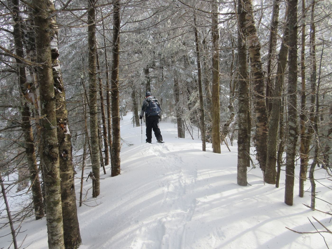
This moderately graded trail was our route to the ridge. Though this trail had been traveled several times after Christmas, we had to break soft, heavy snow, especially in the upper half.

This was going to be harder than we anticipated.

Into the Sandwich Range Wilderness amidst gorgeous open hardwoods.

Mark spotted this "mouse house."

Mark breaking trail along the section that follows an old tote road up the valley.

The higher we got, the more the old snowshoe track was filled in.

Soon there was no old track at all.

Great open hardwoods on this slope.

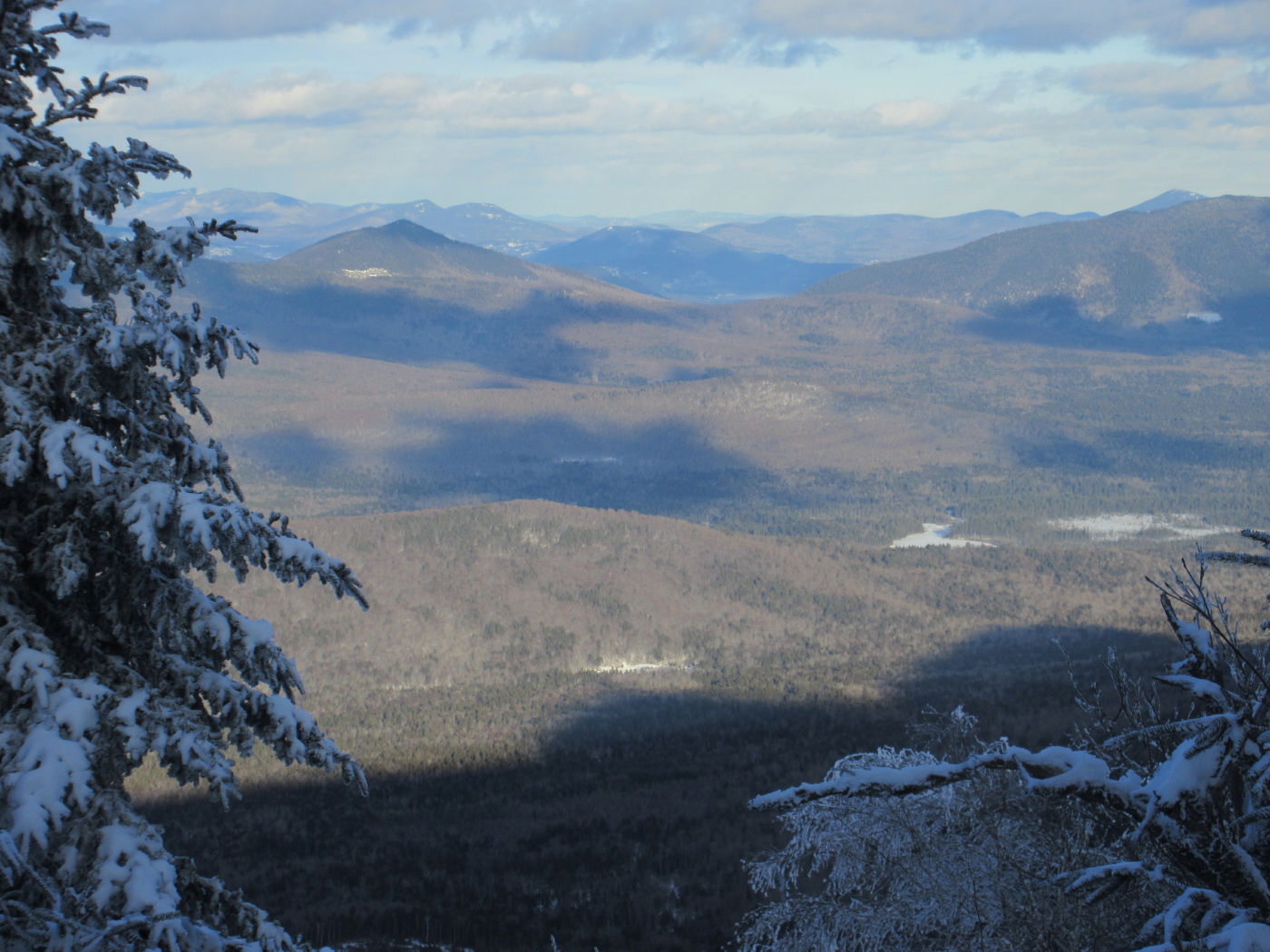
In the winter the Scaur Ridge Trail provides a close-up vista of North Tripyramid across the valley.

The North Slide looks impossibly steep from this angle.

At 2950 ft. we left the hardwoods and entered a birch/small conifer area.

In places the trail was closed in.

Mark claws his way up from a small drainage crossing at the head of the valley....

...and leads us up across the slope.

Soon we swing left for the steadier climb to the ridge.

This was slow going up through here. Heavy breaking ahead.

Low bridge.

Almost to the top of the trail. Looking suitably wintry up here.

A big duck-under.

It took us 1 hour, 40 minutes to cover the 1.2 miles to this junction. The signpost shows a respectable snow depth for early January.

To our surprise, the deep, soft snow continued on the more heavily traveled Pine Bend Brook Trail, but luckily for us, two guys - strong hikers who we later met on the summit - had come up from the Kanc Highway and partly broken it out ahead of us. Here Mark snowshoes along the wonderful level section of the ridge between Scaur Peak and North Tripyramid.
Snowshoe hare tracks.

The last half-mile of Pine Bend Brook Trail up the steep cone of North Tripyramid offers up a series of ledge steps and short bursts of steep climbing. Here Mark kicks his way up one of the ledge steps.

Up we go!

Soft, heavy snow was the rule.

Tunneling up through the snow-caked firs.

A view north from the trail.

Working hard on the steeps.

This near-summit sign, at the junction with the Mount Tripyramid Trail from the North Slide, was a welcome sight.

A peek at Middle Tripyramid from the summit of North.

At the NE viewpoint on North Tripyramid, reached by a short side path.

Long vistas, somewhat fuzzy with thin wind-fog.

Looking down on Potash and Hedgehog beyond the flat crest of the Fool Killer.

Church Pond and its adjacent bog show up as white patches in the broad Albany Intervale.

A ghostly Chocorua.

Mount Passaconaway, Sandwich Range neighbor.

Green's Cliff, Mount Tremont and Owl Cliff.

A lovely stretch of trail at the bottom of the descent off the cone.

On the descent, we made a short bushwhack to a gorgeous open snowy glade on the north side of Scaur Ridge.

With deep snowpack, this spot offers good views north....

...including Mount Carrigain, Mount Willey (sunlit) and Mount Lowell...

....out towards Bear Notch...
...and beyond to distant Carter Dome.

The Presidentials looked cold.

Mark takes in the views from the glade.

Heading down the Scaur Ridge Trail in late afternoon sun.

Admiring the North Slide again.

The double summit of Sandwich Dome.

Taking a break on the descent, which was still tiring due to the soft snow.

Sunset at the bottom of Scaur Ridge Trail. We plodded out the last two miles of Livermore Trail by moonlight, capping a memorable 12-mile, 10-hour day on snowshoes.

No comments:
Post a Comment