
TABLE MOUNTAIN: 4/30/12
The hike up the Attitash Trail to the ledges of Table Mountain is one of the best unheralded treks in the Whites. I can't recall encountering any other hikers on a half-dozen jaunts here over the years, and this day was no exception. After a below-freezing night, the day blossomed into a sunny spring beauty with highs around 60. I parked in the small trailhead lot off Bear Notch Rd. and set out late morning.

Most of the first 1.3 mi. up to the Table-Bear Mountain col is at an easy to moderate grade on ancient logging roads.

At 0.6 mi. the trail passes above a nice cascade on Louisville Brook. The bank is too steep to access the pool at the bottom, but a side path does lead down to ledges at the top of the cascade.

After a brook crossing and a climb through a hemlock glade, the trail emerged in a sunny hardwood forest, a wonderful place to be in spring.


The Saco Ranger District trail crew did some fine work in here a few years ago.

The col between Table and Bear Mountains.


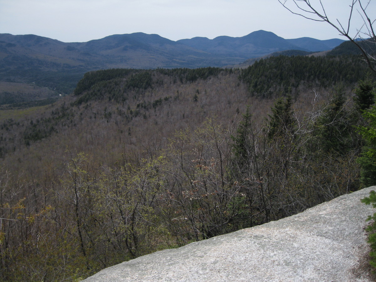
First view - Mt. Paugus above a spur of Bear Mountain.

Looking back at Bear Mountain. A trail once connected Table and Bear.

A steep ledge-and-gravel scramble, the only really tricky spot on the climb.

The trail leads up over more ledge slabs.

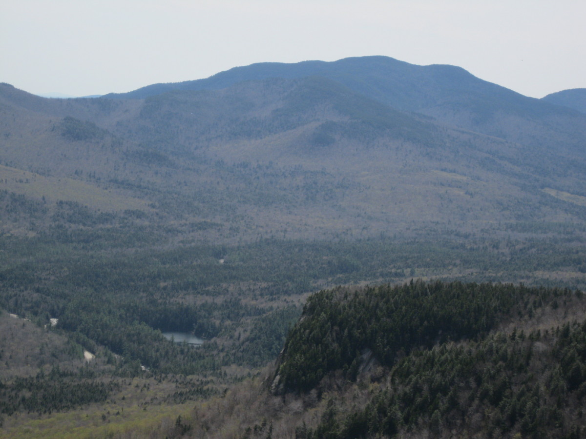
View of the Sandwich Range.

A spruce-lined corridor.

A wonderful flat perch reached by a very short side path.
Mt. Passaconaway and the Sleepers. It was here that I first noticed a new slide on the lower flank of West Sleeper. I assumed it was caused by Tropical Storm Irene, but it does not show on the Google Earth image dated 11/8/2011, and Irene-caused slides on Mt. Bond and North Carter do show up on the Google Earth image with that date. Yet the slide does appear to be visible in John "1HappyHiker" Compton's blog post about Potash Mountain on 9/19/11. So apparently it was an Irene slide after all.

The trail is marked with faded yellow and sometimes blue blazes.

From yet another outlook ledge, a view of the many sprawling northern spurs of Mt. Chocorua.

Looking out the east end of the Swift River valley to distant hills in southern Maine.

Another slippery gravel spot.

I continued past the highest outlook (about 2600 ft., 75 ft. below the wooded summit), and in another 0.15 mi., after descending a short way towards Big Attitash Mountain, a somewhat obscure short side path led to a ledge with a great outlook at the wild western side of the Moat Range.

Looking across at Big Attitash (L) and North Moat (R). Some remote country out there.

Northward there was a peek at distant Carter Dome and Black Mountain.

I returned to the highest outlook, an appropriately table-flat ledge with a 180-degree view.

There's a large scar on the southeastern spur of Table, a reminder of the 1984 forest fire, which started from an unattended campfire and burned 105 acres. (For more about this, and a whole lot more about Table Mountain, click here.)

Falls Pond can be seen down in the Swift River valley, with Mt. Paugus beyond.
Time to relax in the springtime sun, with no bugs around!

A side path up behind the flat view ledge leads to another ledge with a stand-up view NW to South Hancock, Mt. Tremont and Mt. Carrigain.

This part of the Attitash Trail has generally good footing, making for a pleasant descent from Table.

A nice scene where the trail comes beside Louisville Brook.


On the way home I stopped at one of the outlooks on Bear Notch Road, where there is a great view into the Razor Brook valley surrounded by Mts. Crawford, Resolution and Parker.

Thanks for the report, Steve. I'll make a point to look for this trail next time I'm in the area.
ReplyDeleteSeparately, when are the bugs at their worst in the White Mountains?
Table Mountain is such a nice spot!
ReplyDeleteIt was a terrific idea to include the link to the write-up that is included on the "Paths & Peaks" tab of your website (http://www.mountainwanderer.com/). What a treasure trove if info!
John
Thanks for your comment, Steve. The bugs are generally at their worst in late May and June. Who knows what will happen this year with the early spring followed by a few hard freezes?
ReplyDeleteSteve
Thanks, John - Table is a great little peak. A worthy replacement on the 52 with a View list for, say, Starr King or Black in Jackson.
ReplyDeleteSteve
Why no mention of the volunteer crew of Thompson School (UNH) Forest Technology students who worked hard on developing and maintaining a fire line that helped contain the fire of '84? I was proud to be a member of that crew.
ReplyDeleteI wasn't aware of that - thanks for your comment and for your efforts on the fire line. I'll add a mention of that to the Table Mountain document.
Delete