
ETHAN POND: 2/16/11
Ethan Pond, tucked under the steep brow of Mt. Willey on the eastern edge of the Pemigewasset Wilderness, is most rewarding in winter, when dramatic views can be enjoyed from its frozen, desolate expanse. The hike into the pond is at moderate grades with only an occasional steeper pitch, and is ideal for a snowshoe journey. In addition to its own beauty and remoteness, the pond is a launching point for explorations into other areas around the eastern Pemi.
With moderate temperatures and light winds in the forecast, John Compton and I decided that a visit to Ethan Pond - a place we were both familiar with in winter - would fit the bill perfectly. A bonus would be a visit to a nearby off-trail viewpoint.
In winter, the trek to the pond starts at Rt. 302 with a 0.3 mi. climb up the unplowed access road. The snowshoe track here was hardpacked, almost glazed, making for easy bare-booting.
A trail sign marks the crossing of the railroad tracks just above the end of the access road.
 From the tracks, you can see Mt. Willey looming to the NW.
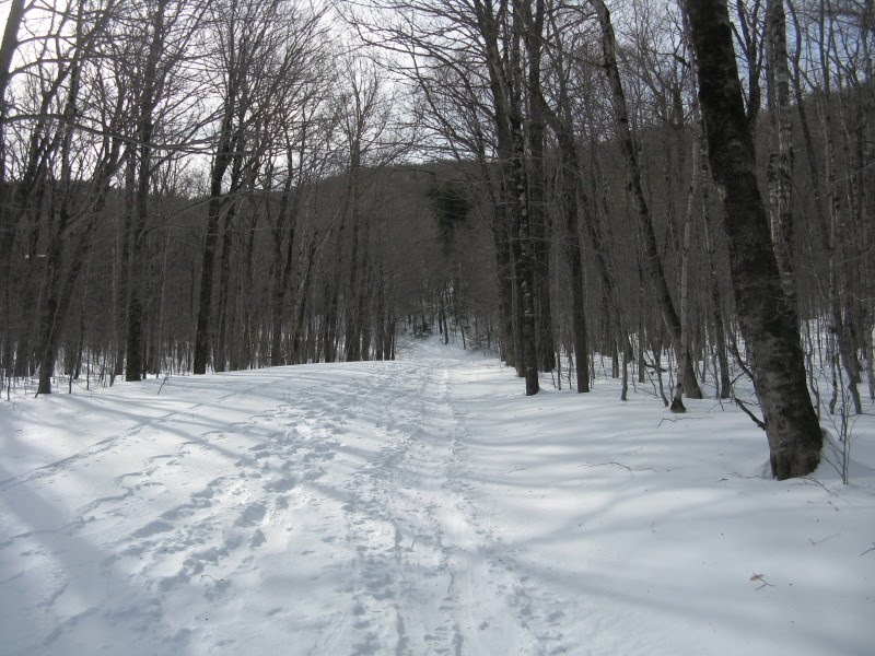
Partway up an initial section of stiff climbing, we stopped to put our snowshoes on, as there was now an inch or two of new snow atop the old track. Above that first long pitch, the Ethan Pond Trail eases off and traverses a hardwood slope on the west side of Crawford Notch.
 The next landmark, 1.6 mi. from the start, is the junction with the Kedron Flume Trail, a steeper route that's prone to blowdown. By this point there was 4" of new snow, even deeper in some drifted areas.
In the next section we followed a set of animal tracks for some distance along the trail. Could they be fisher tracks? Or, after further research, more likely pine marten?

In another 0.3 mi., the Ethan Pond Trail turns L as the Willey Range Trail continues ahead for a very steep climb to Mt. Willey.
 Upon reaching the broad height-of-land between Mt. Willey and trailless Ethan Ridge to the south, we made a short bushwhack to a tiny pond with a close-up of Mt. Willey. This is sometimes called Lucy's Pond, in honor of Ethan Allen Crawford's wife, who was the real author of the classic History of the White Mountains.
 The trail continues across the vast, spruce-wooded plateau that slopes gently into the eastern Pemigewasset Wilderness. Though just 2 1/2 mi. from the road, this area exudes remoteness. No highway noise here!
 At the three-mile mark we took the side path down to Ethan Pond, where we clambered over big windpacked drifts to reach the shore.
 The pond was, of course, named after Ethan Allen Crawford, the legendary pioneer of Crawford Notch who first discovered the pond in 1829, and came here in the ensuing years to fish and hunt. Its other name, Willey Pond, references the mountain at whose base it lies. On its N side the pond is enclosed by a long western arm of Mt. Willey.
 The view west from Ethan Pond takes in several peaks of the Twin-Bond Range in the heart of the Pemi. Though sun was lacking, the high cloud deck allowed for good visibility.
 Most dramatic is the imposing SW face of Mt. Willey. You get a much better perspective on this in winter, when you can get out onto the frozen pond.
 Across the pond, this beautiful icefall adorned the western arm of Mt. Willey.
 John admires the close-in vista.
 After spending some time taking in the sights at Ethan Pond, we headed back towards Mt. Willey for a bushwhack to one of the several talus slopes that provide openings in the trees along the lower flank of the mountain.
 En route we paid a visit to the Ethan Pond Shelter, bearing a serious snow-load on its roof. This is a favored stopover for Appalachian Trail thru-hikers in late summer.
 We slowly made our way towards the base of Mt. Willey through fairly thick woods. Ski pole probing showed that the snow was waist-deep in here.
 The woods were thicker than I remembered from previous visits, and it was a slow, meandering whack in which we were each ensnared several times by spruce traps.
 John led us up a final steep pitch towards the talus slope.
 It took us 43 minutes to cover a mere 0.3 mile to the bottom of the talus. The snow on this open slope was well-consolidated, with a thin crust on top. Our snowshoes punched in well, giving us good purchase for climbing.
 A boulder near the top provided a landmark for a lunch and viewing break.
 And what a wild view, sweeping across the vast spruce-clad plateau of the eastern Pemi to the long spine of the Bond-Twin Range. Part of Ethan Pond can be seen in the foreground.
 A zoom on Mt. Bond, with its two mid-elevation alpine areas well-displayed. Bondcliff juts up to the L.
 The sprawling ridge of Mt. Hancock, to the SW. Most striking is the sharp ridge leading from rounded North Hancock to the nubble of NW Hancock on the R.
 The flattened mass of Shoal Pond Peak rises, trailless and remote, in the center of the eastern Pemi.
 With the temperature around 25 and virtually no wind, we were able to enjoy a long sit-down break high on this open snow slope.
 After drinking in the views for an hour, we headed back down for the woods.
There were some thickish spots on this route.
 This spruce trap area was slow going.
 We enjoyed at least one short stretch of open woods. With a broken track, our return trip to the shelter took only 16 minutes.
 A last look at the pond in stark late afternoon light.
On the way out, just past the Kedron Flume junction, we noticed this old AT marker embedded in the trunk of a long-deceased tree.

I've been to the Ethan Pond area a number of times in winter over the years, and it is always a rewarding journey into one of the wildest corners of the Whites.
Neat AT sign, and I do think those are fisher tracks.
ReplyDeleteHi Jason,
ReplyDeleteI was taking another look at a couple of tracking books, and now I wonder if they might be pine marten tracks. A couple of the descriptions note that martens have lots of fur on their feet, making for a somewhat indistinct track, and the heel shows in the track because of the fur. What do you think?
Steve
hmmm. I'm looking at my book now...it definitely could be a marten. The track does look more ovoid for a marten.... you've got me convinced! Marten tracks seem smaller in my book, but I would guess there might be some overlap between a large marten track, and a small fisher track.
ReplyDelete