
BRIDAL VEIL FALLS & COPPERMINE BROOK: 2/9/11
Bridal Veil Falls is one of those beauty spots that has a special magic in winter. Tucked into the deep ravine of Coppermine Brook on the west side of Cannon Mountain, its amphitheatre of forest, snow and ice is a great destination for a generally easy five-mile round trip snowshoe trek. Lately it seems I've been going in there almost every winter.
On this brisk morning I parked at the designated area near the entrance of Coppermine Road off Route 116, 3.5 mi. south of Franconia, and walked up the quiet country lane under tall pines, carrying my snowshoes.

At 0.4 mi. a hiker symbol shows where the trail turns into the woods. It was well-packed, especially in the first section where local residents use it for short walks.
 A half-mile in, a sign points the way where an obscure trail branches off to the right. Soon after this, I saw that fresh ski tracks - from alpine touring skis - had been laid down on the trail. I figured they had probably come down from the top of Mittersill Peak by the Tucker Brook Ski Trail and the old Coppermine Ski Trail.
A mile from the trailhead, the trail comes near the spot where the famous "Betty Davis plaque" is located on a boulder in Coppermine Brook.
 Of course, in winter it's hidden by snow. Here's what it looks like in summer. For more on this story, see our blog post from February 23, 2010.
 In this section the trail leads through some fine hemlock forest.
Along the next stretch there were several nice views of the snowbound brook.

 About 1.8 miles in, the trail rose into a gorgeous sunny hardwood glade. The skiers had fun swooping through the powder in here. This third of a mile or so section through the hardwoods is always a favorite part of the trail for this snowshoer.
 A latticework of branches arched over the snowshoe/ski track.
 The footbridge over Coppermine Brook had an ample snowpack.
 On the far side of the bridge is the junction with the old Coppermine Ski Trail, and the ski tracks did come from there. This trail was cut in the mid-1930s and connected with the Taft Trail near the top of Mittersill Peak. Only the upper part is still officially maintained (as part of the Tucker Brook Ski Trail), but the unmaintained section above Bridal Veil Falls can be followed fairly easily except for one very obscure section, and it does get used occasionally by diehard backcountry skiers and snowshoers.
 The Coppermine Shelter, built in the 1930s by the CCC. Where's the roof rake when you need it?
 Amazingly, the inside of the shelter was nice and dry.
 Beyond the shelter, I was breaking trail through several inches of beautiful powder.
 Approaching the bottom of Bridal Veil Falls. There was a good snowbridge across the brook by the pool at the base of the falls.
 As I climbed a steep ramp of snow (a ledgy waterslide in summer) towards the snow platform at the base of the main falls, this picturesque scene presented itself.
 The waterfall itself was well-sheathed in snow, but the walls all around were draped with ice columns wearing various shades of blue, gray and brown. A stunning winter setting, standing on the snowy floor of that natural amphitheatre!


After a lunch break, I descended to the footbridge for some exploration up the valley. (Climbing out from the vicinity of the falls is very steep and difficult.) My original plan had been to use the old ski trail, which I had snowshoed on several times before. But I didn't want to mess up the skier's tracks, so I bushwhacked through open woods some distance away from the ski trail, following a side stream for a while.
 Then I traversed across the slope, heading up the valley through open glades buried in powder.
 I dropped down across the ski trail and continued descending to Coppermine Brook just above Bridal Veil Falls. There were big drifts along the brook here.
 I snowshoed along the brook to near the brink of the falls, enjoying a view down the valley and far out to Vermont. Ore Hill in Franconia is on the R, and the Worcester Range near Stowe, VT can be dimly seen on the far L.
 Looking down, I could see my snowshoe tracks where I had lunch at the base of the falls.
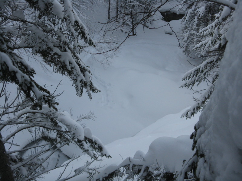 A beautiful scene at the top of Bridal Veil.
 I wandered another quarter mile up Coppermine Brook to a scenic area of cascades and pools, now fully smothered in snow.
 This is a November photo of the lower cascade in this spot.
 Late afternoon sun was beaming in.
 I crossed tracks with one of the local residents.
 I retraced my route along the brook and back up across the ski trail.
 On the way back I visited snow-bound Holden Falls, located on a tributary of Coppermine Brook. A photo of this cascade appeared in the History of Franconia, by Sarah Welch. The caption said it was located above Bridal Veil Falls. A couple of years ago I bushwhacked up along the brook looking for it and its supposed companion, Noble Falls. I found the nice cascade area that I had just snowshoed to, but no major waterfalls.
Last summer, Chris Whiton and John Compton set out to find the two waterfalls. They went even farther up Coppermine, but still found no significant waterfalls. On a whim, Chris checked out this tributary on the way out, and there it was - rediscovered! He posted a great report on their exploration on Views from the Top: Holden out for Noble: a Waterfall story.
 On the way back down Coppermine Trail, I was passed by a young woman effortlessly skiing out from the falls. I stopped for a few minutes to enjoy the expansive hardwood forest partway down, then plodded out at the tortoise-like snowshoer's pace. Near the parking area I exchanged greetings with two women who were heading in for a nighttime snowshoe trek. Bridal Veil Falls has many admirers, and rightly so.
yet another one to add to the list. thanks for posting the weekly sorties.
ReplyDeletePB