
One of the quietest yet nicest approaches to a 4000-footer is the Flat Mountain Pond Trail/McCrillis Trail route to Mt. Whiteface from the southwest. On this gorgeous spring day I was not aiming for the summit of Whiteface, but rather for various ledge viewpoints on and off the trail, along with several other attractions.
The trailhead is on Whiteface Intervale Rd. off NH 113A, at the eastern end of the Flat Mountain Pond Trail.

Newletters from the Wonalancet Out Door Club are available at the trailhead kiosk. Great reading from a terrific organization that has cared for the Sandwich Range since 1892.
 The first part of the trail follows a gravel road alongside a placid stretch of the Whiteface River.
 At 0.4 mile the road crosses a culvert over an outlet from a large beaver meadow; just beyond a short side path leads to a bench and a beautiful vista over the meadow. Either this is new or I never noticed the side path before.
The view across the meadow to Sandwich Dome.
 The southern Flat Mountain rises close by to the NW.
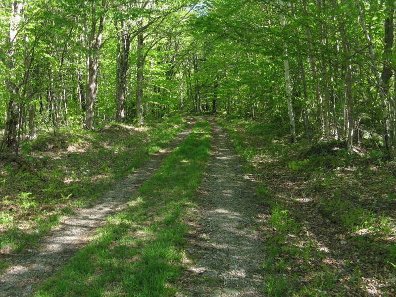
A pleasant grassy section of the road.
 Soon after the trail leaves the old roads, it comes to a high bank above the Whiteface River with a fine view of Mt. Whiteface. The McCrillis Trail follows the ridge that descends on the L; the Blueberry Ledge Trail ascends the humpy ridge on the R.
 The next section of Flat Mountain Pond Trail is a pleasant meander through a mostly hemlock forest. The first 1 1/2 miles of the trail are on private land protected by conservation easement.
Until 2000 there was a bridge for the major crossing of the Whiteface River at 1.6 miles. It was taken out by high water, leaving only this abutment.
 There are alot of big rocks, but I don't consider this an easy crossing as some of the key step stones are often wet and slippery. In high water, it's quite difficult.
On the far side the trail enters the Sandwich Range Wilderness and turns left to follow the boulder-choked river upstream.
 In 0.1 mile the McCrillis Trail departs on the R and traverses across the slope. This section of trail wanders through open hardwood forest and can be difficult to follow as it is lightly used and infrequently blazed.
 At 2.1 miles the trail turns left onto the original route, an ancient logging road. The McCrillis is one of the older trails in the Whites, dating back to the 1850s. Yet it receives very little use these days; the vast majority of Whiteface hikers go up the shorter and more spectacular Blueberry Ledge Trail.
If you like forest solitude, this is your kind of path. For the next mile and a half the McCrillis ascends at easy to moderate grades through a vast leafy forest - one of the finest "forever wild" hardwood walks in the Whites.
 Near the L turn I made a short bushwhack down into a fairly steep ravine to have a look at White Brook, which drains the basin under the south cliff of Mt. Whiteface.
 Back on the trail, I passed numerous patches of Dwarf Ginseng in bloom, including this one arranged like a rock garden.
 In places beech saplings crowd the trail, adding to the Wilderness feeling. Even so, hikers with a decent nose for following trails should have little trouble on this section.
 Farther up the broad, gentle ridge, I made a side trip down to the L to visit the East Branch of Whiteface River, which drains a scoop-like valley between Mt. Whiteface and its trailless West Spur.
A short distance upstream I found this small cascade. Someday it would be fun to traverse the entire valley, but that was not the plan for today, and I climbed back up to the trail.
 Beech, sugar maple and yellow birch dominate these woods, but there are also some tall specimens of white ash.
One of a number of large old sugar maples seen along the trail.

Higher up there were still a few Red Trilliums in bloom, but they were fading.

Some Painted Trilliums, too.
 Above 2000 ft. the canopy was just starting to leaf out, giving a filmy lime green look to the forest.
 This massive beech blowdown completely blocked the trail.
 At 2350 ft. the trail abruptly enters a spruce-dominated forest for about 0.2 mile. It transitions back to hardwoods for a while, then at 2650 ft. the conifers take over for good.
 In the next section there was a heap of blowdown, the worst being this spruce that required a detour around. The others could mostly be clambered over, ducked under or skirted along the edge.
 This big old spruce was one of the clamber-overs.
 These wild woods are peppered with some large boulders.
 This blowdown mess was not as bad to get through as it looks.
Farther up the ridge I followed a hint of a path to a ledge with a fine standing view to the SW. The prominent peaks are (L to R) Mt. Israel, South Flat and Sandwich Dome.
 A zoom on Sandwich Dome, with a shoulder of the south ridge of Whiteface's West Spur in the foreground, across the valley of the East Branch of Whiteface River. In 1996 I bushwhacked to the cliffs on that shoulder, and then on up the ridge to an opening on the West Spur. Excellent and unusual views from both spots.
 From the standing view ledge, I made a careful descent to a lower and more open perch, poised on the edge of the East Branch valley.
There's some crazy terrain here, emphasis on the word "careful."

Some of the ledges are separated by cracks that could easily swallow a careless bushwhacker.

From the comfortable ledge perch I could see up to the headwall of the East Branch valley, with the West Spur on the L. I also spotted two ledge outcrops on the headwall (on the R side of the photo), and decided it would be worth a try to find them later in the day.
 From this commanding spot I could see down to the floor of the East Branch valley and out to Sandwich Dome.
 Looking out towards the mouth of the valley.
 There was room to spread out and relax for a while.
 After a nice stay in the sun, I climbed back to the trail. Farther up there is a trailside ledge that requires a short scramble to get up on. The reward is a view towards Sandwich Dome with part of Flat Mountain Pond visible.
 A bit higher there are two viewpoints on the E side of the trail, with good vistas SE, including the Ossipee Range.
 Another ledge very near the trail, but with no side path, offers a remarkable view up to the south cliff of Mt. Whiteface. The viewpoint on the south summit is on the top of these cliffs.

I continued up the trail, which climbs fairly steeply through the woods in its upper part, and after several short off-trail forays found a large granite ledge I had spotted from the viewpoint down in the valley. A fine view south here to the Lakes Region, with the fields of Whiteface Intervale in the foreground. The little curve of darker woods seen L of center just over the treetops is the lowest part of the East Branch valley, where the East Branch joins the Whiteface River.
 The Belknap Range and Lake Winnispesaukee.
 On the way back I attempted to find one of the ledges near the top of the headwall of the East Branch valley. It was a futile hour-long effort amidst some areas of very dense, blowdown-laced small conifers. Progress was slow, and I had to cut the side trip short due to the lateness of the hour. This glimpse through the trees was the best I could do for a view.
 Luckily, I found much more open woods higher up the slope, and the return trip to the trail went quickly.
 On the way down I paused briefly on one of the view ledges to look across at the evening sun lighting up the Blueberry Ledge Trail ridge.
 The long walk through the hardwoods was enjoyable on the descent, too. Down at the beaver meadow the spring peepers were calling, and I made it out just as darkness was falling.
The next blog entry won't be made until I return from a few days in the Catskills next week. Thanks for reading!

Great post Steve. We did this on 6/9/13. The photos are an excellent reputation. The reroute sign is not apparent. We took the old Mccrillis trail; it got confusing where it rejoined the mail trails. That wasn't at all apparent, we spent about 20 minutes walking in circle with compass, re-finding the continuing trails. The true Mccinnis trail sets off over the water crossing, pretty much with no markings at all. With vegetation in full bloom, would only advise it to those who are comfortable with navigating unmarked trail. It was clear that no person had been on this trail in quite a long time, perhaps last winter. The blowdowns are well-described by Steve. When you get to the summit, make sure you note where you came up from. There is no trailhead marking to get you started.
ReplyDeleteSteve's right - this is quite a wilderness parcel. The only people we met all day were headed along the river to the Flat Mt. Pond shelder.
The best part of this trail is that it's quite gentle under foot. Not a lot of rocks or climbing on stone. Very few exposed roots. Even a lot of the steep stuff was on dirt. I'm sure that's because it's a very under-utilized trail.
It's a long hike, mileage-wise. I'd go back.
Thanks, billski - it is definitely a trail worth returning to. The footing is remarkably good for a 4K peak. I came down it last month. It can be obscure in places, especially the part where it comes across from Flat Mountain Pond Trail.
DeleteSteve
Great hike! Do you think the Whiteface stream crossing would be rock hoppable at normal water(8.28.2017)? I always use sticks for balance. A hike to Isolation revealed my boots to be no longer waterproof...
ReplyDelete