
The four peaks of the "Bushwhack Range" - Lone, Rocky, Balsam Cap and Friday - are considered to be the most difficult hikes on the Catskill list of 35 3500-ft. peaks. In places along the crest of this ridge there is reportedly spruce-fir forest as dense as anywhere in the Northeast. Located in the southern part of the Slide Mountain Wilderness, these mountains are bordered on their NW side by the beautiful and remote valley of the East Branch of the Neversink River. An unofficial "fisherman's path" provides access up this valley, enabling one to make bushwhack ascents to any of these summits.
In the photo below, taken off-trail on Peekamoose Mtn., the peaks seen are (L to R) nearby Lone, the more distant trailed summits of Cornell and Wittenberg, then Friday, lowly Rocky, and Balsam Cap.

Of the four peaks, Lone Mountain is reputedly the easiest by a good margin. On this fine spring day I decided to climb Lone by itself, rather than do the common pairing with Rocky, for a leisurely introduction to this storied region. This would give me ample time to poke along the valley and enjoy a viewpoint located near the summit of Lone. I made the long drive from Hunter up over Route 47, past the Slide Mountain trailhead and down the valley of the Neversink West Branch on the south side, then back up the East Branch valley to the major trailhead in Denning.

The setting for this parking area is agreeably pastoral.
 The first 1.2 miles is on the Phoenicia-East Branch Trail, following an old woods road through private land and one corner of Forest Preserve.
 Just after entering the Forest Preserve and Slide Mountain Wilderness for good, I turned right on the Peekamoose-Table Trail.
The biggest obstacle to accessing the East Branch valley has always been the crossing of the river on the Peekamoose-Table Trail. Various bridges have been washed away over the years here. Now there is a very heavy-duty bridge recently constructed by the NYDEC.


Looking upstream from the bridge. Even in low water, this crossing would require wading.
 The trail soon crosses a second, much smaller stream on a high, two-log bridge with a handrail cable. At normal flow it's just as easy to hop the rocks in the brook.
 A short distance beyond here, just past a dry brookbed, the fisherman's path departs on the L, marked by a small cairn. This proved to be an easy and delightful route up the broad floor of the valley. (A sharp contrast to the rough, muddy, blowdown-strewn "fisherman's path" along Franconia and Lincoln Brooks in the Pemigewasset Wilderness in the Whites.)
The East Branch of the Neversink is a lovely stream shaded by hardwoods and hemlocks.


This hemlock glade was a particularly scenic section of the path.

About a mile up the valley, the path skirts this beaver meadow, with a low SW spur of Slide Mtn. seen to the N.
 Just beyond, the path fords Donovan Brook - an easy crossing today.
The path passes by this large old hemlock.
 The route up to Lone from the East Branch valley follows an obvious NW spur ridge. I started the whack in a hemlock forest.
 Soon I emerged in open hardwoods. According to Dr. Michael Kudish's The Catskill Forest: A History, this entire area is "first growth forest" and has never been cut.
 Though this has the reputation as an "easy" whack, there are many rocks strewn through the woods, requiring attention to footing, especially on the descent.
Halfway up the ridge I passed through several interesting ledge bands.

 I backed off this rugged looking slope on the south side of the crest and contoured around to an easier route on the north side.
 Nice open going around 3000 ft.
As I continued up the ridge the hardwoods became smaller and scrubbier.

At ca. 3500 ft. the ridge leveled off and I traversed a long shoulder through wonderful meadows amidst gnarled old birches. Up to this point there had been only occasional faint traces of a herd path (none at all on the broad lower ridge); now a light path became more evident in places, though not continuous.

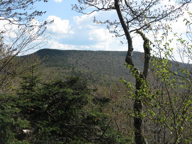
I caught a glimpse back at massive Slide Mtn.
 More meadows.
 Trout lilies were still in bloom at this high elevation.
The last part of the whack was a gentle climb through fairly open conifer forest, with an intermittent herd path. As usual, there were well-beaten paths around the summit canister.

I signed in the register, then headed off to the SE, seeking the ledge viewpoint I had read about.

I soon found a restricted viewpoint, then with a bit of searching I came down to this little ledge perch...
 ...which opened one of the finest views I've seen thus far in the Catskills. Dropping off abruptly in front, the ledge overlooks a large wild, trailless area on the SE side of the Bushwhack Range, with the shapely summit of Ashokan High Point and its neighbor, Mombaccus Mtn., beyond.
 Close by to the S are Peekamoose (L) and Table (R).
Beyond the long E slope of Peekamoose I could see all the way to the Hudson Highlands.

Nearby to the E are Rocky (in front) and Balsam Cap (in back).
 A long trailless ridge descends S from Balsam Cap - this would make an interesting bushwhack ascent from Peekamoose Rd.
Looking down on the old growth hardwood below the steep SE face of Lone. An unusual traverse of this remote area is described in "The Hard Way to Peekamoose Mountain," a piece by Bob "Grey Dog" McElroy that originally appeared in Appalachia and was reprinted in Catskill Peak Experiences, edited by Carol Stone White. Great reading.

The outlook is a comfortable spot for one to two hikers. By choosing not to loop over to Rocky, I was able to spend an hour and a half here on this glorious day.

On the return trip down the NW ridge of Lone, I ranged along the N edge, looking for views into the upper East Branch valley. I found one opening that gave some fine perspectives on Friday Mountain...
 ....and Slide...
...a zoom on Hunter Mountain over the Cornell-Slide saddle...

...and, best of all, a great look at Cornell Mountain lifting from the upper valley.... the wild heart of the Catskills.

I couldn't find any real openings on the S side of the ridge, but Table and Peekamoose Mountains could be seen through the trees, rising beyond the Donovan Brook valley.

I found one good look at the flat crest of Table, emphasizing the layered sedimentary bedrock structure of these mountains.
 I passed more interesting ledges in the woods on the way down the ridge.
 Evening light on the East Branch of the Neversink capped a memorable Catskill day.
Thank you for the detailed report on the area. I plan on setting up a base camp in there to tackle these mountains. How are the conditions for campsites in that valley? If I'm feeling strong I'll possibly try to trek all the way to Cornell...
ReplyDeleteThanks for reading - there should be many potential campsites in the valley. That was my first time in there and I look forward to returning to climb the other peaks. That valley has a magical feeling. It sounds like the fisherman's path will eventually lead you to the Cornell-Slide col. Enjoy!
ReplyDeleteSteve
Great guidance. Thanks. I hope to do this hike soon.
ReplyDeleteSteve, Thanks for the awesome photos and detailed report. I'm looking for a partner to hike this valley and make an ascent from the south to the official campsite between Cornell and Slide Mtns. Any takers? Mike Cohen, majmhc@hotmail.com.
Delete