Friday, October 4, 2024

Foliage & Tripyramid South Slides: 10/3/24


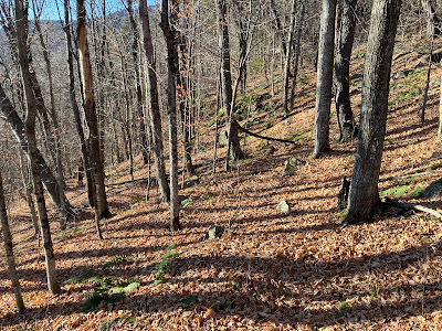
The walk out to the South Slides of Mount Tripyramid is a favorite of mine at any time of year. It's especially rewarding during foliage season since most of the approach is through a glowing hardwood forest, as seen here on the smooth and easy Livermore Trail.


White Cascade on Slide Brook.


Above the cascade.


Best time of the year on Livermore Trail.


One of the best trails.


Into the Wilderness.


Gateway glade.


Slide Brook.


Big sugar maples.


Gazing upward.


I made a short foray off-trail to admire this glade.


The trail climbs through a magnificent sugar maple glade at the 2700-2900 foot elevation.


At the point where the trail turns up to climb the first (1869) South Slide, I bushwhacked across to the smaller third (2011, Tropical Storm Irene) South Slide.


Emerging on the runout of the 2011 slide.


It made quite a gouge in the mountainside.


Looking back at a spur ridge of West Sleeper and Sandwich Dome beyond.


I checked in on the first and so far only pioneering white pine I've found on this slide, discovered this past June. It didn't grow much over the summer.


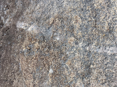
The ledges on the slide display a number of tan-colored aplite dikes - intrusions of fine-grained granite that cut across the monzonite bedrock.


View down the main part of the slide. Its track is partly overlain on the course of the second (1885) South Slide.


Looking across to Mount Tecumseh.


A short, thick bushwhack led across to a big gouge that could be part of either the first or second South Slide - it's hard to tell for sure.


A broad and colorful view here.


Looking down to the upper elevation maple glade.


Adding Mount Moosilauke (through Thornton Gap) and Mount Osceola to the view.


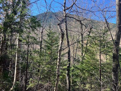
The conifers are thick and prickly in between the slide swaths.


Looking back while climbing another slide swath.


At 3400 ft. is one of my favorite slide dwelling white pines.


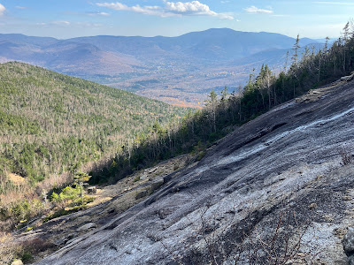
Emerging on the Mount Tripyramid Trail halfway up the 1869 South Slide, with a fine view over the Lost Pass region.


A wide view out to the southwest, with Vermont peaks such as Killington, Salt Ash, Dorset and Ascutney in sight.


Late afternoon in the upper elevation hardwoods.


Wednesday, October 2, 2024

Hellgate Brook & Guitar Slide: 10/1/24


Early October is my favorite time to venture into the western lobe of the Pemigewasset Wilderness. The preponderance of hardwoods in the valleys and on the lower slopes makes for great foliage viewing and gold-tinted walking along the trails. This journey took me up into the Franconia Brook valley and then on a long bushwhack out to the big westernmost slide on the steep south slope of West Bond, popularly known as the "Guitar Slide" due to its resemblance to a rock band electric guitar. The Guitar Slide is prominent in the view from Bondcliff.


It was a fine fall morning for a stroll up the Lincoln Woods Trail.


Foliage along the East Branch.


Into the Wilderness after crossing the bridge over Franconia Brook.


Turning left.


Camp 9 Brook at the first of its three crossings.


Railroad grade cruising on Franconia Brook Trail.


The south peak of Owl's Head rises beyond a beaver swamp near the site of J.E. Henry's Camp 9.


A western spur of Bondcliff seen across a beaver pond just north of the Lincoln Brook Trail junction.


A peek at West Bond through the trees.


View across another beaver pond as the trail approaches Hellgate Brook.


Hellgate Brook at the trail's crossing, 5.5 easygoing miles from the trailhead. The water flow was quite low.


The first part of the two-mile bushwhack up the Hellgate Brook valley was through mildly scrappy woods.


One of many attractive scenes along the brook.


Could this cascade and small gorge not too far up the valley be the inspiration behind the name of the brook?


For some distance I was able to utilize the bed of an old tote road for easier walking, though it wasn't often as open as shown here.


Blowdowns frequently block the old logging road.


Lots of birch color along the brook.


Another old road section.


Farther up the valley the road became obstructed and the slopes squeezed in, necessitating a couple of crossings back and forth over the brook.


Well up in the valley there is an extensive area of blowdown north of the brook that can be seen in recent satellite photos. These were likely caused by the October 2017 "Halloween Storm."


I skirted most of these patches but did manage to find a passage right through this one.


Some of the nice birch glades in the middle part of the valley were decimated by this storm.


Thankfully, many glades survived the storm's powerful winds.


Mostly pretty good woods as I ascended rather steeply towards the slide runout.


Ferns and birches, deep in the Wilderness.


Emerging on the slide runout below the slide's western prong, with the main event in sight above.


Almost there.


This is the third time I've visited this slide, and its breadth never fails to impress.


Wow!


Bondcliff coming into view.


First view out to Mounts Flume and Liberty and the south end of Owl's Head.


Bondcliff, robed in birch gold.


Looking down the eastern prong. There are six fresh-looking slides on West Bond, including this one, on a 1939 aerial photo, suggesting that the trigger was the September 1938 hurricane or perhaps the epic November 1927 rainstorm.


Most of the wide main part of the slide is covered in loose rock, making for tricky footing, but there are some ledge slabs along the west side.


I made my way up to the longest ledge slabs  at a pitch of 30-31 degrees for some fun scrambling. On this day the granite was dry and grippy, even for worn hiking boots.


Looking down the slabs.


I found a seat next to the top of the slabs (3500 ft.) and sat for an hour enjoying the show, including a break of sun lighting up Bondcliff.


Spotlight on Bondcliff's western spur ridge and the floor of the Hellgate Brook valley.


Zoom on Bondcliff's crags.


Looking up to the top of the wider lower part of the slide, which forms the "body" of the guitar. The narrow "neck" of the guitar extends above a strip of woods to an elevation of 4050 ft.


One reason for revisiting the slide, aside from the magnificent scenery, was to see if any white pines had taken seed here. I was delighted to find this diminutive specimen just above my seat. On the way back down I found three more white pines of about the same size.


One last look before heading down.


Top of the slabs.


Heading down over the loose rocks. Careful foot placement required.


Side view of the slabs.


Towards the bottom of the slide I spotted one larger white pine, maybe six or eight feet tall, seen in the center of the photo.


Pearly everlasting, a frequent slide colonizer.


A bit of thick going exiting from the slide runout.


Birch and hobblebush palette.


Evening scene at the northern beaver pond.


Owl's Head at dusk. I walked the last 3.6 miles by headlamp, hoping I didn't see a pair of eyes reflecting back at me, several feet above the ground.