
I woke up with an itch for a long walk into the Pemigewasset Wilderness, and with some last minute planning decided to reprise a bushwhack journey I had made back in the summer of 1998 with the late Creston Ruiter. This trip was a probe deep into the beautiful bowl-like valley on the east side of Mount Liberty, featuring a climb up onto the headwall to visit an open patch on an old landslide and a nearby small talus slope. My notes from that hike told of beautiful hardwoods in the valley and fine interior views of the Pemi from the headwall. I knew that a quarter-century later the slide was almost completely revegetated, but I hoped there would still be a view from one open spot, and I figured that the talus slope would still be an open vantage point.
I set off on the Lincoln Woods Trail a bit before 9:00 am - later than I would have liked for a long hike, but knowing this would be one of the longest days of the year. I strode past familiar landmarks such as the clearing of J.E. Henry's Camp 8....

...and the view of Bondcliff and its sharp southern spur seen up the East Branch, a quarter-mile beyond the Osseo Trail junction.

The Lincoln Woods Trail is often maligned, but it provides an easy pathway to many Pemi adventures.

Bed frame at the Camp 7 site, next to the Black Pond Trail junction.

The quiet and lovely Black Pond Trail.

The familiar view of the Owl's Head spire from the outlet of Black Pond. Green frogs were twanging here.

Serene view across the pond to Bondcliff.

The well-worn, roly-poly herd path of the Black Pond "bushwhack," which meanders through nice hardwood forest.

A nicely graded section of the Lincoln Brook Trail. Thanks to adopter Adam Mooshian for keeping this trail in good shape.

These ledge slabs on Lincoln Brook always beckon for a rest stop.

Cascade on Lincoln Brook. This streamside walk is one of the pleasures of hiking out to Owl's Head and vicinity.

A nice remote feeling in this interior Pemi valley.

A gnarly brookbank stretch shortly before the trail crosses the brook that drains the Mount Liberty Bowl.

I launched my bushwhack along a short railroad spur that heads off from the main Lincoln Brook line. This is at the point where the main line crosses Lincoln Brook after wrapping around the south slope of Owl's Head.

Moss-grown railroad ties along the spur.

After a bit of wandering I found the ghost of a J.E. Henry logging road that Creston and I had followed halfway up the valley in 1998. It was more overgrown and obstructed now, but was still easier going than pure whacking through the adjacent woods.

The lower half of the valley is loaded with ethereal hardwood glades.

Some of the nicest woods in the Pemi.

In places the old road comes close by the valley's nameless stream.

Still following the road.

As the gradient increased, the road became eroded and more difficult to walk.

Just plain bushwhacking from here on up.

Birch and fern glade, high in the valley.

One of several headwaters that drain the steep slopes of the bowl.

Found the lower track of the old slide.

Looking slide-y.

When the slide track got slippery, I climbed through the woods beside it. Not too thick, but steep, with a slope of about 33 degrees. A rain shower came by while I was climbing - not good when you're more than a mile off trail. Thankfully it was brief.

Up at 3400 ft. is where the slide was open in 1998. All overgrown now....

...except for one remaining open patch. Would there still be a view?

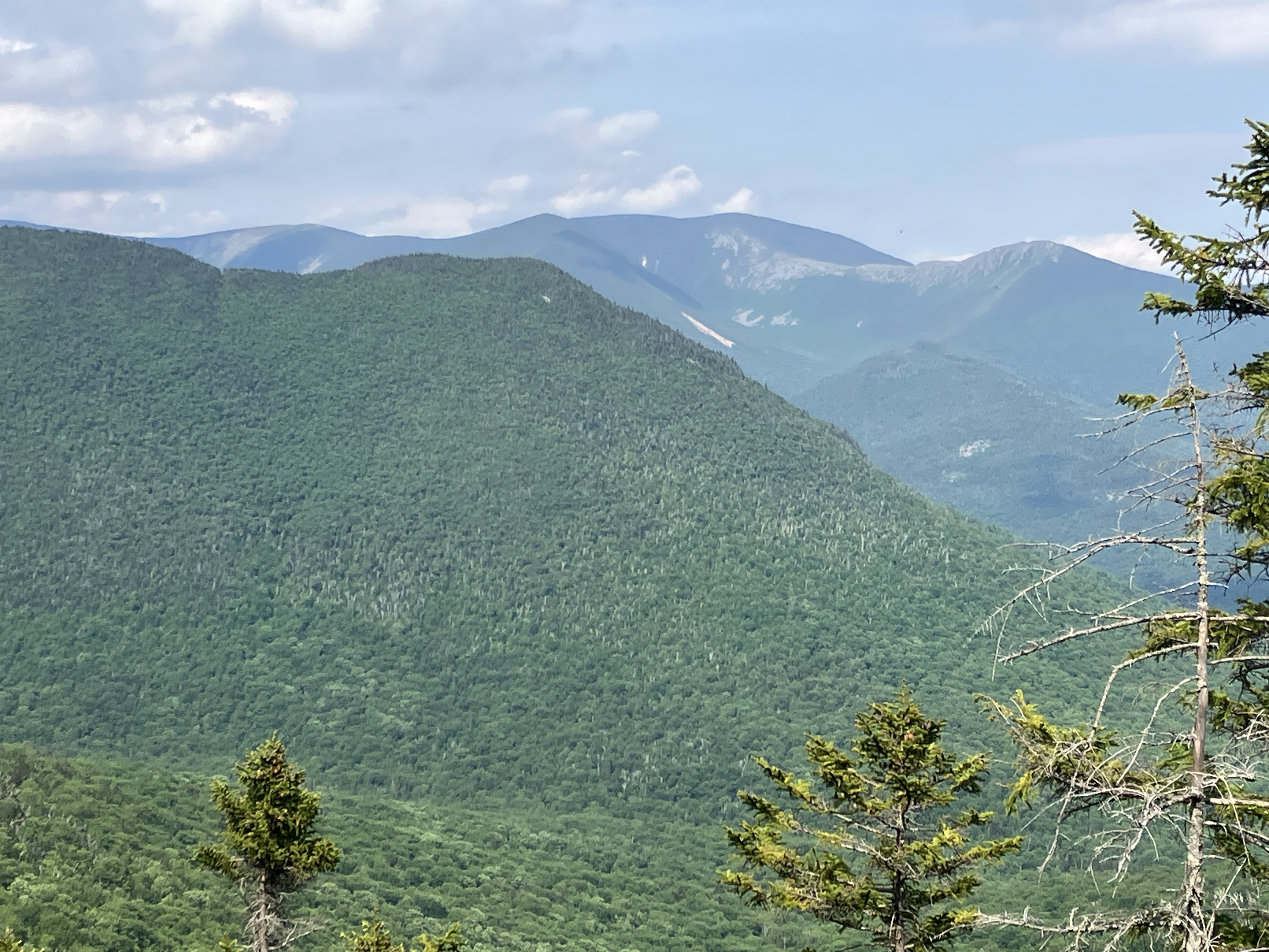
Yes, but not out over the valley....mainly looking up at the massive east ridge of Mount Flume.

From the edge I could see Northwest Hancock and Mount Carrigain, but Carrigain was engulfed in a rain cloud.


I don't usually post GPS tracks, but thought it useful for showing this little-known area. This Google satellite photo highlights the predominance of hardwoods in much of the valley. The snowy area just above the headwall is a massive area of blowdown probably caused by the 2017 Halloween storm. Ascending Mount Liberty by this route would not be advisable.

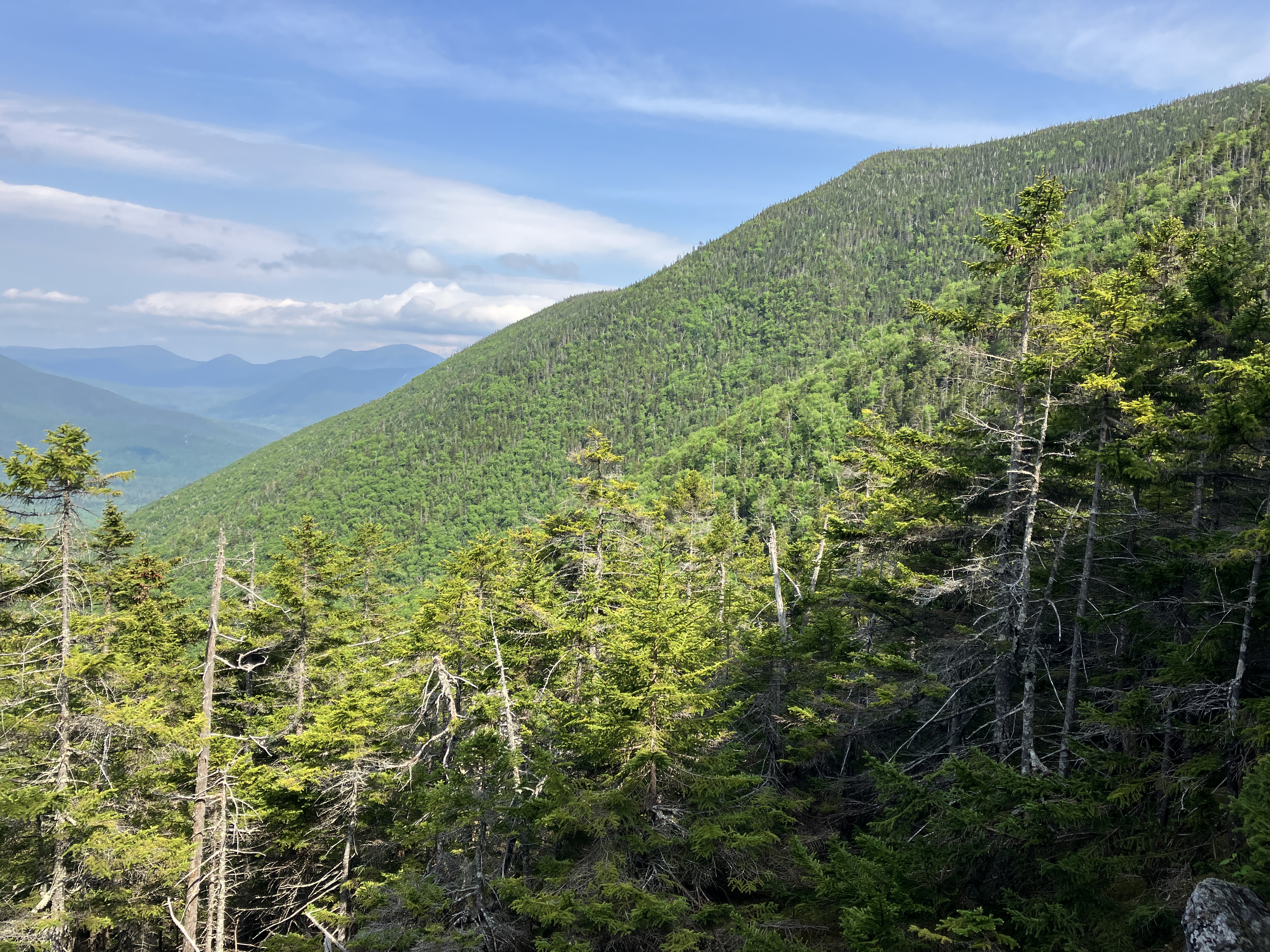
A closer look at the bowl. An impressive feature of the Pemi!

No comments:
Post a Comment