
On one of the very few recent days with some sunshine, I did a two-part hike from the hiker's parking lot at the Cog Railway. Part one was checking out a partly completed mile-long relocation of the lower Ammonoosuc Ravine Trail so that it can be incorporated into the forthcoming third edition of The 4000-Footers of the White Mountains. Part two was a bushwhack up the Franklin Brook drainage to a slide that fell during the 2017 Halloween storm, where I encountered some wild and crazy terrain.

The relocation, intended to move the trail up and well away from past and potential future river erosion, will extend from a point ~0.1 mile west of the junction with the link trail from the Cog all the way to Gem Pool. Since the Forest Service crew's work is ongoing, the relocation is not yet linked with the existing trail. I bushwhacked up the slope for quite a ways, encountering the newly cleared footway about 300 ft. in elevation above the current trail.

I followed the footway east about a half mile to its current end.

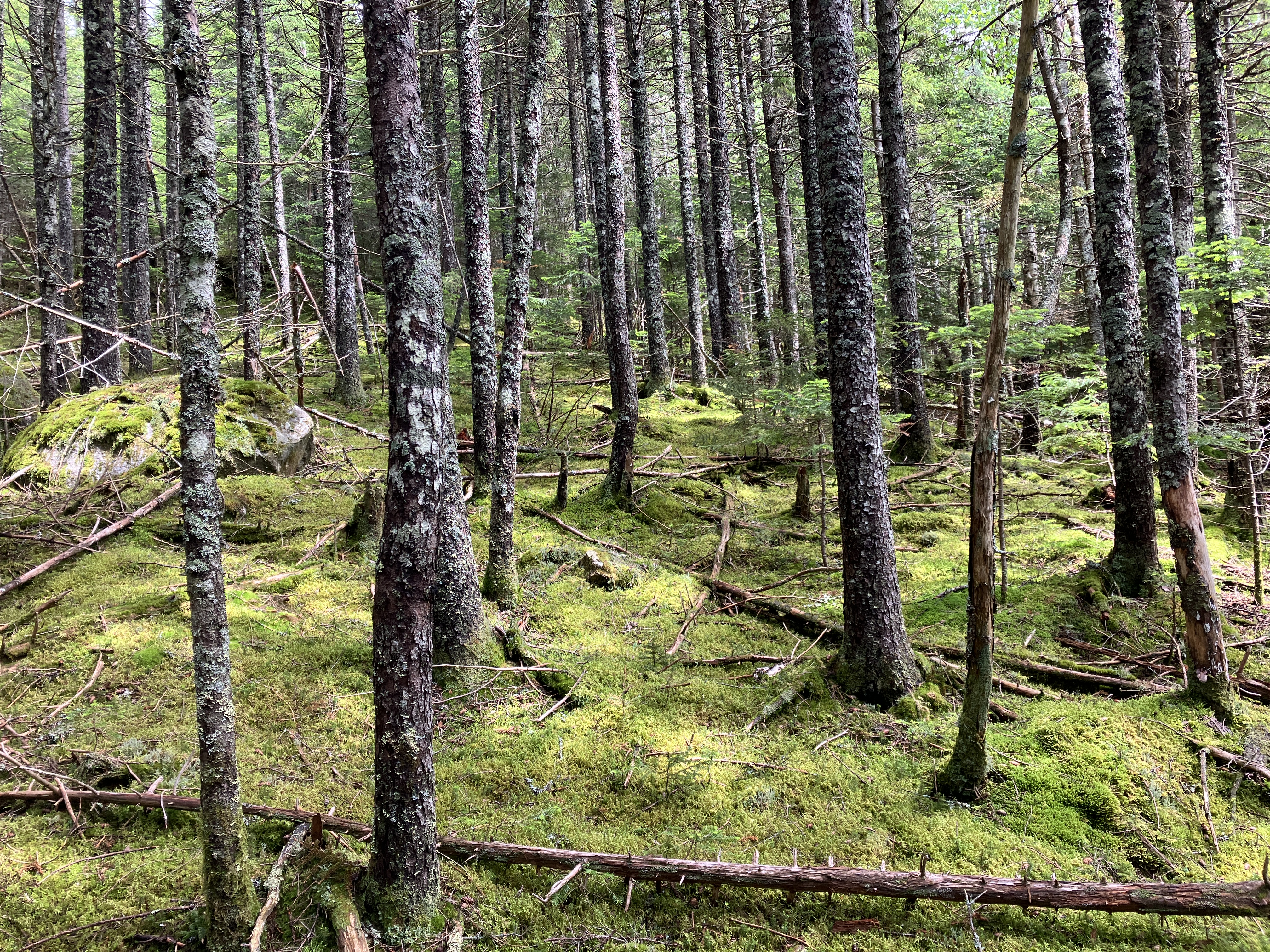
The reroute will trade river scenery for an extended passage through beautiful fern-filled balsam forest.

I then followed flagging descending towards Monroe Brook.

There will be a sharp descent to cross the brook. I figure some kind of staircase will be built here.

I did not attempt to follow the flagging another ~0.4 mile to Gem Pool. The water was running high and blowdown lurked on the other side.

There's a nice cascade just below the flagged trail crossing.

I backtracked to where I had first encountered the relocation, then started bushwhacking southward into the Franklin Brook drainage.

I followed seams of open and "ferny" woods between blowdown patches and thicker copses.

Even in the "good woods" there was plenty of weaving around and stepping over blowdowns.

In some places the going was slower.

After crossing a couple of small tributary brooks, I emerged in a beautiful spruce forest carpeted with dry moss. I was able to climb a fair distance through these open woods, stepping as lightly as possible. This moss seemed much more resilient than wet sphagnum.
Getting closer to the slide, I came across a remarkable spring seeping out of the ground.
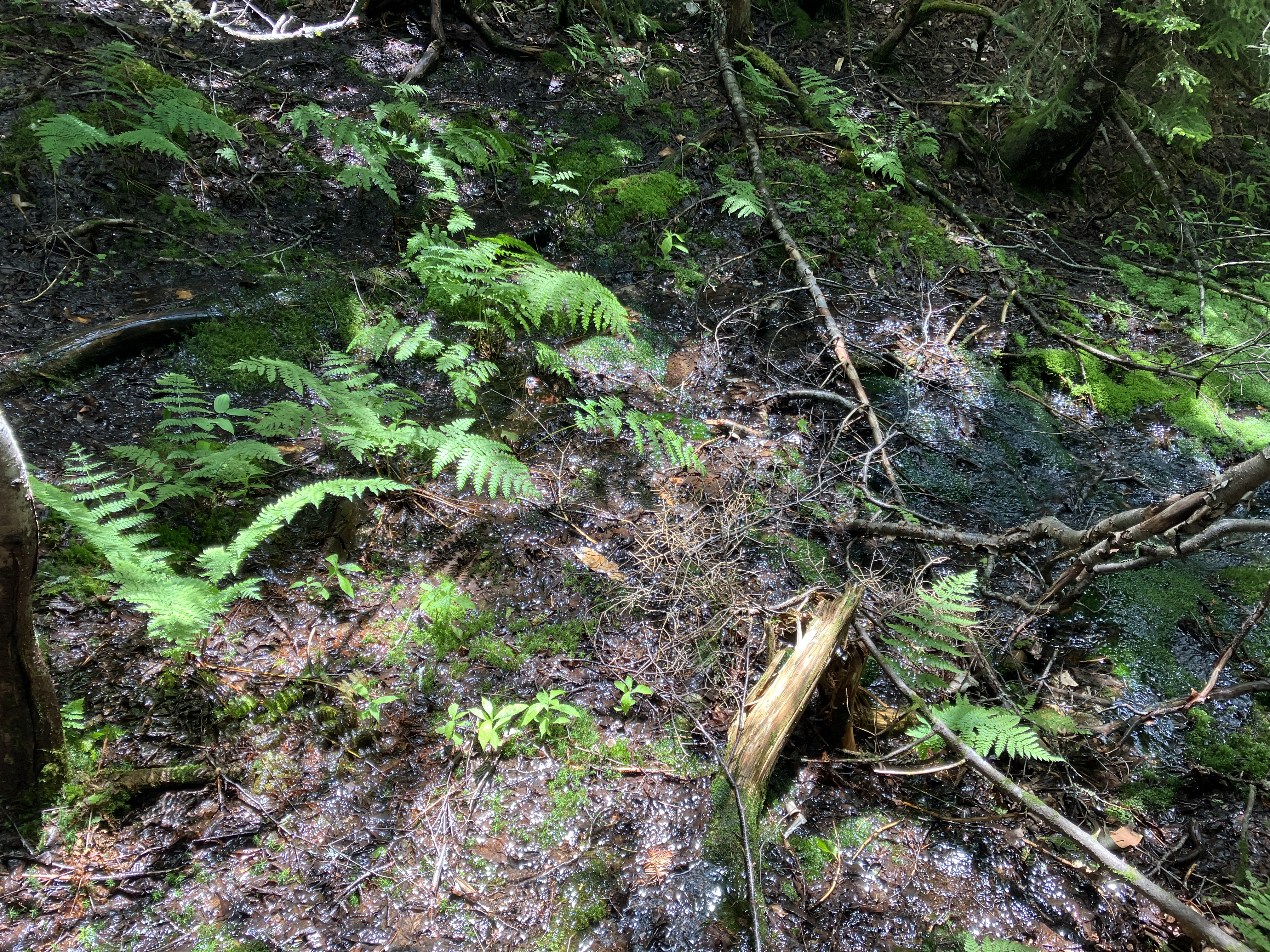
A few yards below, it was a surging brook...

...which coursed down between verdant carpets of sphagnum.

Next I came to a remnant open patch of an old slide that is prominent on a 1955 aerial photo. There was a view of Mt. Deception in the distance.

Typical slide-side woods.

In a few minutes I emerged near the bottom of the 2017 slide, which is rapidly revegetating with saplings of pin cherry and birch, classic pioneer trees.

A steeper rise ahead.

I knew from studying Google Earth and the two-foot lidar contour map on the NH Granit website that the middle portion of the slide, starting at ~3550 ft., would be unclimbable due to a 40-45 degree pitch and a prominent crack or crevice running down the center. That section was looming above.

Zooming in on the lower end of the crevice formation.

There are excellent exposures of gneiss, a metamorphic rock that is widespread in the southern Presidentials.

I took a long break here in the sun, with a distant view to the west.

Hazy layers.

I could not find a safe route to climb higher on the slide here, so I dropped down and took to the steep woods on the north side and pushed and pulled my way up to a spot where I could peer down at my sitting ledge.

Getting up through the 40+ degree pitch along the edge of the slide required a full body workout. Several times I thought I had hit a dead-end, but managed to find a way through. A wild and crazy terrain indeed.

There were a couple of cliff bands to get around.

Still too steep to get out on the slide.

From the edge I had a good view of an older slabby slide at the head of Franklin Brook.

Zoomed. An ephemeral cascade was spilling over the ledges.

Yikes! I think you would need to be an experienced rock climber to ascend this part of the slide.

A look down into the crevice formation.

This is unlike any other slide I've been to in the Whites.

After some more struggling up through the woods, I came out on a rock at a point where it looked like the slide was passable again.

I dropped down onto it and immediately was confronted by this. Luckily I was able to make my way up through the birch saplings to the left.

Steep but doable.

Views expanding.

I had to take to the woods one more time to get around a tangle of blowdown covering the slide. Then I popped out onto the wider, gravel/loose rock upper section. The pitch is still steep here at 34 degrees, but comfortable compared to the terrain below. A SW spur of Mt. Franklin rises in the background.

A strip of trees divides the two upper prongs.

A beautiful wide view up here, with Mt. Deception on the right and the Twins on the left. On a clearer day Mt. Mansfield, Camel's Hump and other Vermont peaks would be visible.

Looking up the right prong.

The top in sight above, at 3900+ ft.

The ubiquitous birch saplings.

This was my exit point onto the upper slide, about the only passage through the tangled blowdowns along the edge. Took a few minutes to find it for re-entry into the woods.

I did not relish the thought of descending via my ascent route along the edge of the slide. Instead, I looped out a bit to the north, where the terrain was steep but not crazy.

Looking back up.

For the steepest part I resorted to a buttwalk down through a small gully.

This provided a passage between wild ledges on the right...

...and the left.

Farther down, where the terrain moderated, I came upon what appeared to be a den dug out by a bear.

I was happy to get down to the open spruce forest.

A pleasant scene as I bushwhacked north towards the trail relocation.

Long view ahead through the "good woods."

I picked up the relocation near where I left it, and followed the cleared footway northwestward down through several switchbacks, passing the crew's tool cache along the way.

Spectacular fern glades will greet hikers when the relocation opens, presumably later this year.

No comments:
Post a Comment