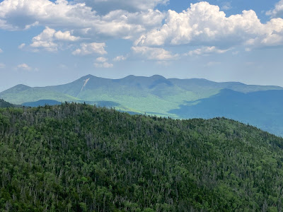
As regular readers of this page know, one of my favorite off-trail destinations is the massive Southwest Slide of Mt. Osceola, which is prominent when viewing the mountain from the village of Waterville Valley. In addition to its exciting terrain and excellent views, I wanted to return to the slide to enjoy its abundant Rhodora blooms, and to see if the Fox Sparrow I had heard singing there last year at this time had returned for this nesting season. (This species has recently expanded its breeding range south from Canada to the White Mountains but is still quite uncommon here.)
The approach on the Waterville Valley X-C ski trails is always a pleasant ramble through the hardwoods.
Starflowers were blooming in abundance.
When the Southwest Slide came crashing down during Hurricane Carol in 1954, its track surged a mile and a half down a nameless brook drainage, depositing a long train of boulders at the bottom.
A neat boulder tucked into the forest on a southern spur of Osceola.
I wondered if this pile of rocks had been removed from the bed of a logging road and dumped beside it.
The nameless brook that drains the slide.
Looking "slidey" with Mt. Osceola looming above.
Approaching the base of the slide proper.
A massive, steeply-pitched footwall slab marks the bottom of the slide.
The footwall (and the slide in general) was unusually dry on this visit. I took a few steps up the bottom of the footwall and thought, if I had approach shoes maybe it would be scalable by a non-climber.
But I took my usual detour around the footwall, and when looking down on it was glad I didn't try to scramble up.
An impressive view up the slide at the top of the detour. In a 1958 study of White Mountain landslides and
their revegetation, Edward Flaccus measured the slope of this slide as
29 degrees on the average with a maximum of 34 degrees. It was 367 yards
long with an average width of 75 yards, and covered 5.7 acres, with its
track extending 1.5 miles down the brook. He estimated that 29,724 tons
of debris were moved by the slide! Nearly seven decades later it is still largely bare.
First view on this hot, somewhat hazy summer-like day, looking out towards Sandwich Dome. A week earlier I was atop that summit, wearing gloves and a warm jacket while taking in the views.
The slide was mostly dry, but water was still collecting in this pothole pool.
Some fun scrambling ahead on these dry, grippy ledges.
Looking back.
In this vicinity an older slide (possibly from 1882) joins from the right, displaying its own impressive footwall. When seen from Waterville Valley, the two slides together form a "V."
That's well beyond my skill level for scrambling.
Looking back towards the larger 1954 slide.
Next scramble on the big 1954 slide.
There was plenty of Rhodora to be admired, though overall it may have been a couple of days past the peak bloom. No Fox Sparrows were heard, though I did hear Yellow-bellied Flycactcher, Bicknell's Thrush, Black-throated Blue Warbler, White-throated Sparrow, Purple Finch, Dark-eyed Junco, and Blue-headed Vireo at the slide.
So many neat angles on this slide.
I stayed to the left of these wide exposed slabs. They are often wet, and even though they looked dry this time, I wasn't sure how they would grip. You don't want to get out in the middle of an expanse like that and discover it's trickier than it looks.
Looking up.
More Rhodora blooming over there.
Down-look from the next scramble.
Tripyramid coming hazily into view.
A section of crumbling granite known as rottenstone. Where it's deep enough you can step through it, but beware if there's a thin layer atop sloping ledge!
More slabs. Great variety of terrain and scenery on this slide.
A particularly fine patch of Rhodora. This is an adaptable shrub that is common in low elevation wetlands
but also thrives in barren ledgy areas at higher elevations.
Ledges getting steeper. Skirted along the right edge here.
Cross-slab view to Sandwich Dome.
I climbed to ~3400 ft., about 4/5 of the way up the slide, and settled in for a two-hour sojourn in the sun that might have included a snooze. The view of the Sandwich Range from here is excellent.
View without the boots, including Scaur Peak, the Tripyramids, the Sleepers, Mt. Whiteface, Lost Pass, and the northern Flat Mountain. The village of Waterville Valley nestles in the broad lowland to the right.
A perfect mountain scene: ledges, Rhodora and the crags of Osceola.
I scrambled a little higher to have a look at the top of the slide. I had no intention of repeating the gnarly whack above the slide to reach the Mount Osceola Trail.
Nice illumination of the Sandwich Range.
Good perspective on Tripyramid's iconic North Slide.
That was interesting coming down. The butt came into play in a couple of spots.
Descending grippy, Rhodora-fringed slabs to avoid the rottenstone area.
Looking back up.
Working around the big smooth slab area.
Wide-screen vista.
Parting shot. What a place!
Descending along a prickly old logging road.
Uprooted.
Birch mortality.
This looked like it could be an old trail corridor, from the original path up the south ridge of Osceola opened by Nathaniel Greeley in the 1850s and remaining in use into the 1930s.
Open glade, good moose hangout.
Hardwood forest rules on the lower south slopes of Osceola.
Crossing the slide's boulder train.
The road home.


Nice report, Steve. Osceola is one of my favorites, and I've admired those slides many times from a distance. They look really impressive in your pictures; it looks like it would be well worth visiting them.
ReplyDelete