In my annual spring quest to avoid mushy snow and rotting monorail, a favorite destination has been the south-facing slopes of the lower mountains in the Evans Notch region. This is one of the earlier places to melt out in April. The eastern mountains received a lot of snow late in the winter, so I wasn't sure what I would find over here. An early pleasant surprise was the condition of Route 113 heading north to the notch. Often at this time of year its frost heaves are akin to a heaving sea, but this year the road was mostly smooth and even the several signed "Bumps" were barely noticeable.
I pulled over across from a field to briefly admire this view of the Baldfaces. The South Baldface ledges were still quite snowy.
But when I reached the end of the winter-maintained road and parked by the entrance to Cold River Campground, I saw that the woods and the road beyond the gate were snow-free. Yee-hah!
The Cold River was running free and strong.
A roadside wildlife clearing opened a view of the ledgy mass of West Royce.
After a 0.3 mile road walk I reached the trailhead at Brickett Place. This house was built by homesteader John Brickett in 1812. He fired his own bricks on-site. It's listed on the National Register of Historic Places. A little-known factoid is that from
1948-1956, this was operated as a hut by the AMC under a special use
permit from the Forest Service. Evans Notch Hut, as it was called, was
the easternmost in the chain. Nowadays it serves as a seasonal USFS information center. I noted quite a bit of bird activity around this clearing: Pine Warbler, Robin, Eastern Phoebe, Hermit Thrush, Northern Flicker, Blue-headed Vireo, Black-capped Chickadee and Yellow-bellied Sapsucker.
The Bickford Brook Trail, which mostly follows an old service road used for the former firetower on Speckled Mountain, served as the approach to my planned bushwhack up to Sugarloaf Mountain and a ledgy crest once known as Long Mountain.
This little strip at the start was the only snow or ice I saw on the trail in the mile or so that I followed it.
After climbing for 0.3 mi., the trail turns right onto the well-graded old service road, providing wonderful walking in the brilliant spring sun.
At 0.5 mile the trail enters the Caribou-Speckled Mountain Wilderness, a small (12,000 acres) but extremely interesting area.
I had this fine valley to myself on this gorgeous day.
A massive oak blowdown. A bit more than a Silky could handle.
I headed steeply up through the hardwoods to a favorite ledge high on the flank of Sugarloaf Mountain. The biggest hazard today was the very dry and slippery leaves, which were almost like ice on the steeper pitches.
I emerged on the ledge, stepping carefully to avoid trampling lichens, and stayed a while to enjoy the view south down the Cold River valley to Kearsarge North on the horizon. Big Deer and Little Deer Hills are in the foreground on the left.
Looking SW to Eastman Mountain and South Baldface.
South Baldface is mostly a mass of bare granite ledges.
Looking across the Bickford Brook valley to the ridge followed by the scenic Blueberry Ridge Trail.
A short climb lifted me to the open south summit of Sugarloaf Mountain and a fine view of the Baldfaces.
I headed north along the ridge, skirting the 1451-ft. true summit of Sugarloaf, marked by a melting snow patch.
I lugged snowshoes on this whack, figuring I might need them up on this little ridge, but it was for naught.
Beautiful hardwoods in the col between Sugarloaf and the next prominence on the ridge, which was once called Long Mountain and appeared as such on the 1931 AMC trail map for this area.
I've done this ridge traverse several times in the past, and knew I was in for a short but steep climb to access the view ledges on Long Mountain. Here the cliffs can be seen looming through the trees.
Won't be going up that way.
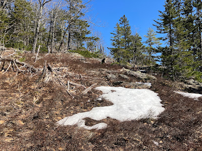
This is the way up.
Near the top of the climb there was evidence of the old WMNF Brickett Trail, which once traversed this ridge. It was opened around 1936 but was abandoned 10 years later.
My next objective was a fine west-viewing ledge.
Another good look at the Baldfaces and neighbors.
The imposing mass of West Royce looms across Evans Notch.
My favorite perspective from this spot peers through the gap of The Basin, between West Royce and Mount Meader, and out to the high peaks of the Carters. Basin Pond can be seen on the left.
Carter Dome, Mount Hight, and South, Middle and North Carter.
This remote slide fell on the steep headwall below Middle Carter during Tropical Storm Irene in 2011.
Parting shot over the ledge.
A short climb through a burned-looking area led to the next outlook.
Looking down to the col from the top of the cliffs I had seen from below.
Time for a snooze in the near 80 degree sun. Blueberry Mountain on the left.
Looking out over the clifftop from the back of the ledge. Sugarloaf Mountain is seen down in front. I circled around the edge of the ledge to avoid trampling lichens.
A small cairn that perhaps marked the old Brickett Trail.
Heading north up the scrubby ridge.
Across to Blueberry Ridge.
Another good view to the south.
I wandered across the ridge in search of another, more expansive area of ledge, passing this stand of red pine.
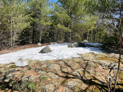
After slogging through a number of snow patches, I found these ledges, with a view NW to West and East Royce.
Yet another fine spot on Long Mountain. Enjoyed this one for a bit, then headed back down the ridge, making a careful descent on slippery leaves off the steep end of the Long Mountain crest.
Then it was easy whacking down through hardwoods to the Bickford Brook Trail, concluding a spectacular spring day.


Amazing that all the snow is gone. This winter was so back loaded with snow that I thought it would persist down low until May.
ReplyDelete