I enjoyed an unexpectedly pleasant spring day for a maintenance trip on the Kettles Path in Waterville Valley, which I adopted last year. Afterwards I had a leisurely ramble eastward along the ridge beyond The Scaur.
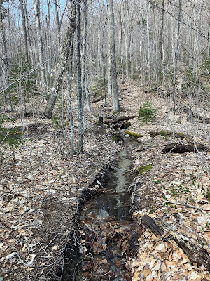
As expected, the first 0.1 mile of Kettles Path coming off Livermore Trail was a running brook. This stretch dries up in summer, but I'm thinking a relocation just to the west might be in order to get the trail out of this channel. The first order of business this day was swinging this heavy, waterlogged blowdown off of the trail/brook bed.
I traced the course of the little brook off to the east, where it appears to originate up on a slope. It flows through a fairly well-defined channel on its way to the trail.
This big one is trail crew material.
This one we can handle.
Cleared.
I fear for the giant white ash at the base of The Scaur. It appears it may have some early blotches caused by the notorious emerald ash borer.
Drainage cleaning on the ascent to The Scaur.
This is the most important task of the trail adopter. As the late Hal Graham, a giant of New Hampshire trail maintenance, used to say: "Drainage, drainage, drainage." Hal, a stalwart of the Trailwrights and Belknap Range Trail Tenders (BRATTS), will be sorely missed.
A prickly blowdown that was sticking out onto the trail.
Done. In addition to a few blowdowns, there were dozens of small limbs, brought down by winter winds, to be tossed off the trail.
After cleaning the upper waterbars in the steep spruce section of Kettles Path, I stashed the hoe and clippers, keeping the saw with me, and headed east on Irene's Path. A short side scramble reveals this view of Mt. Tecumseh beyond the cliff face of The Scaur.
The "Rock of Gibraltar" never fails to impress.
Irene's Path, opened in 2014, offers a pleasant ascending walk along a wild wooded ridgecrest.
Leaving the ridgecrest after 0.6 mile, it descends along the north slope down to the Waterville Flume. I knew there would be deep snow lurking in that dark hollow, so I went only as far as the outlook partway down.
Still a few lingering patches of snow through here.
The unique view of Mad River Notch was enhanced by big billowing clouds.
Fresh snow up on Mt. Osceola.

Owl's Head in the distance, through the Notch.

Rock step work by the OBP Trailworks pro crew.
Climbing back to the ridge, I rambled eastward along the crest, noting this unusual root pattern reaching down a ledge face.
Silhouette of a giant maple.
I returned to a favorite open sugar maple glade on the south side of the ridgecrest.
I lounged here for a while in the warm spring sun.
The hardwoods contrast with the dark spruces marking a sharp rise on the ridge.
Spring beauties take advantage of the open canopy. There were many trout lily leaves emerging, but too early for flowers.
Heading back down the ridge, a neat corridor on Irene's Path.
Fern-capped trailside boulder.
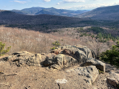
Late afternoon at The Scaur.
Sandwich Dome, Noon Peak and Jennings Peak.

Looking out to the wild Lost Pass area.
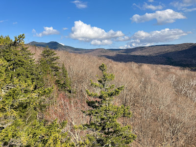
Middle & South Tripyramid and part of West Sleeper.
Down-look to the hardwoods.
Moody Tecumseh.
Tenacity.
This little rill flows from a spring and crosses the trail at the base of The Scaur. The spring was shown on the early Waterville maps (1892, 1904, 1915) prepared by Arthur L. Goodrich. The Kettles Path was opened by Goodrich around 1890. The steep upper part of the trail was originally part of the Scaur Trail, but became part of the Kettles Path when the eroded lower section of Scaur Trail was closed by the WMNF in 2014.


No comments:
Post a Comment