Followed a long and interesting route to Mt. Whiteface: went most of the way up the Downes Brook valley on the Downes Brook Trail, then climbed the big slide on the north ridge of Whiteface. From the top of the slide bushwhacked to the Rollins Trail, and followed that fine trail to the summit. After dropping a short way down Blueberry Ledge Trail to the great viewpoint, descended via Kate Sleeper Trail and the full length of Downes Brook Trail.
The Downes Brook Trail leads up a long valley deep into the Sandwich Range Wilderness and offers a real sense of remoteness. Because of its length (5.2 miles) and ten brook crossings, it receives light usage. (This route is not recommended in high water as the large crossings may be impassable.) In the first several miles there are long sections with good footing.

This valley was heavily logged by the crews of the Conway Lumber Company's Swift River Railroad (1906-1916). Evidence of the logging era can be seen in several locations.
High in the valley the trail passes two logging camp sites, where artifacts can be seen. (As always, please note that these are protected by law and it is illegal to remove them.)
This broken tree spent its life with its trunk inside a barrel hoop.
Downes Brook at the base of the big slide.
Looking up the slide from the base. Time to put some sunscreen on.
The bottom of the slide is a steep slope of gravel and stone.
This slide is massive. It most likely fell in 1921, as the 1922 edition of the AMC White Mountain Guide reported in a description of the route to Mt. Whiteface via the Downes Brook logging road: "A new slide from near the top of the northerly part of Mt. Whiteface is continued down the brook for a mile by a washout, which has destroyed the road."
First views to the north, with Carter Dome in the distance.
About halfway up, the slide becomes mostly ledge slab, and gets steeper.
Looking across.
Wide and steep.
Heading up the left side of the slabs.
The upper half of the slide has a slope of 34-35 degrees, with some shorter pitches even steeper.
Yikes!
Interesting crags on the north side of the slide.
Time for a break.
The Presidentials were socked in all day long. Potash Mountain and Owl's Cliff/Mt. Tremont are seen in front.
A short stretch of shaly broken rock.
Down-look on the still-gravelly north side of the slide.
Some of the steeper slabs encountered.
One pitch measured at 38 degrees. Approach shoes would have been best here. The steepest spots could be skirted along the edge.
Expanding views.
I started up this slab but backed off due to the bulge and wetness at the top.
Mt. Carrigain and Carrigain Notch, with Mts. Field and Willey in back.
The broad crest of East Sleeper rises across the valley.
Mountain holly, bearing berries.
Carrigain Notch, with the slides, cliffs and talus of Mt. Lowell well-displayed.
Sundew.
Approaching the top of the slide. Stay to the left, off the slime!
Down-look from the top.
View from the top. The tips of Middle and North Tripyramid peer over on the left.
A bit farther up this little headwall cliff probably marks the ultimate top of the slide.
Into the woods. On my 1995 trip I had a tedious tussle with dense conifers and blowdown. I chose a different route this time and fared better.
Higher on the slope I came to this neat rock wall.
While skirting along its base I found this entrance into a remarkable cleft in the rock.
Portal of stone.
I continued up to the Rollins Trail and headed south along that ridgecrest path to this viewpoint looking towards Mt. Passaconaway and the headwall of The Bowl, with Mt. Chocorua in the distance.
A pleasant stretch of the Rollins Trail.
The wooded bump that is the true summit of Whiteface.
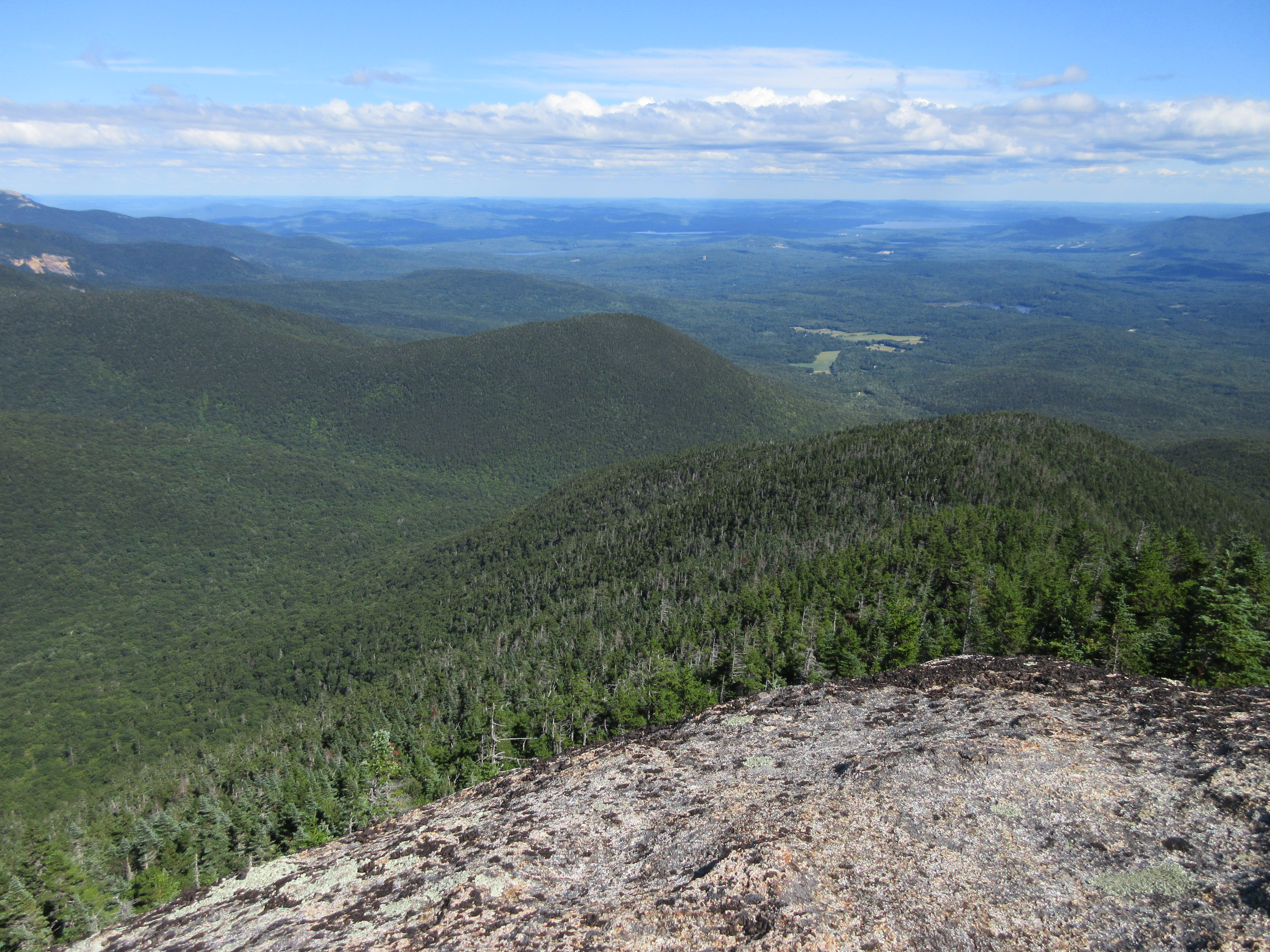
Vast vista from the ledges of Whiteface's south summit.
Bulging ledge on the south summit.
A climb of Whiteface must include a visit to the highest and most spectacular ledge perch on the Blueberry Ledge Trail.
Classic view of Mt. Passaconaway rising above The Bowl with many peaks beyond.
East to the Wonalancet Range, Mt. Paugus and Mt. Chocorua.
Southeast over Mt. Wonalancet.
Descending along the secluded Kate Sleeper Trail.
Junction in the Whiteface-Sleepers col.
An old beaver meadow to the south of the junction.
Moose pie.
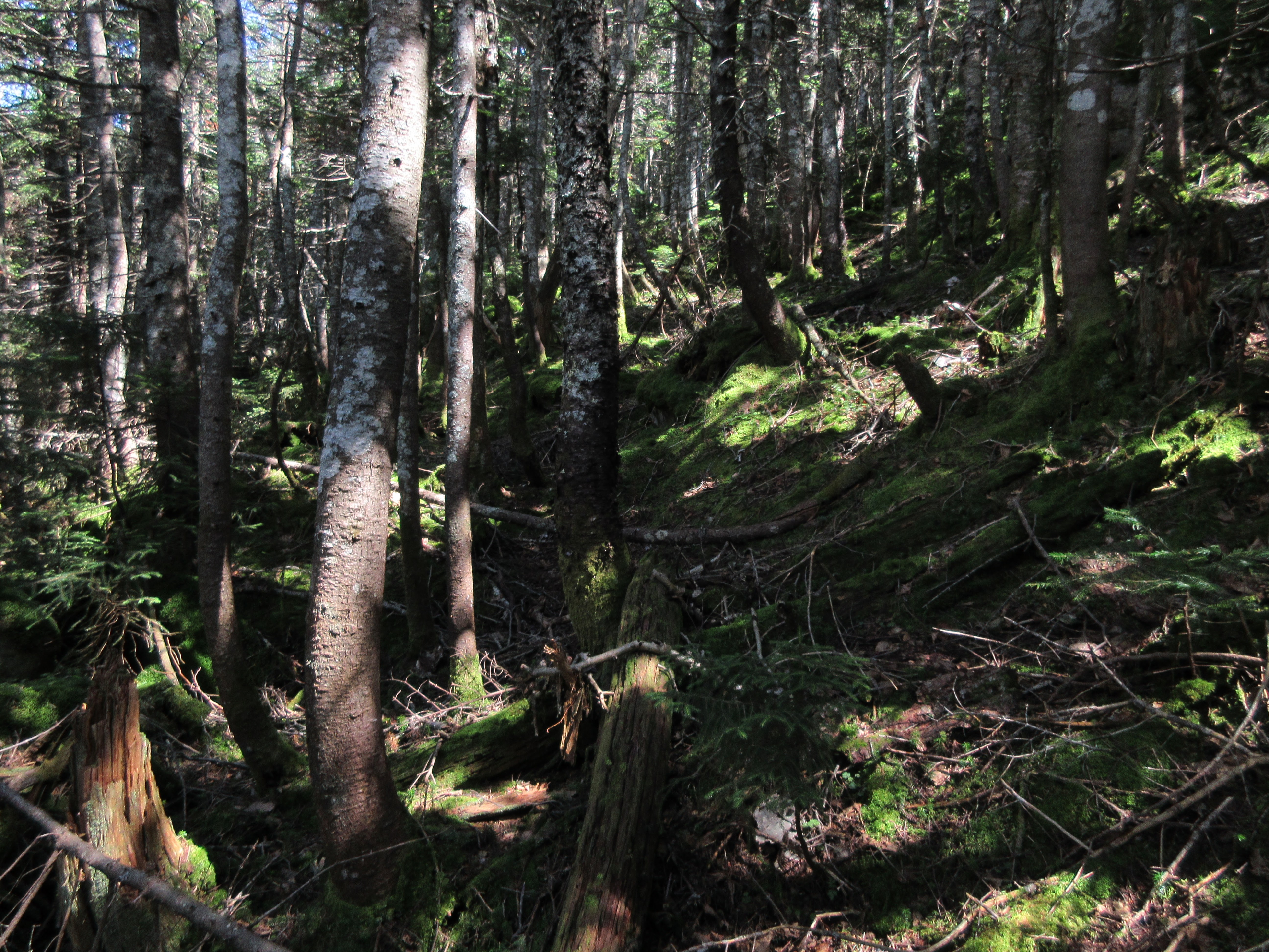
High in the valley, Downes Brook is a jumble of mossy rocks, and the parallel trail is wild and rough, and littered with blowdown. On this hike I saw a total of 6 people up on the ridge, and no one else along the other 10.5 miles of trail walking.


No comments:
Post a Comment