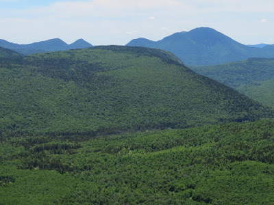
Huh? Yes, there are several excellent viewpoints on Mt. Hale. Unfortunately, the summit is not one of them. On a bluebird June day, I hiked the Hale Brook/Lend-a-Hand/Zealand loop over Mt. Hale and took in magnificent views from two off-trail viewpoints, one a significant bushwhack and the other quite short.
I ascended via the standard route, which makes a steady climb of 2300 ft. in 2.2 miles.
The lower part of the trail is quite pleasant in a fine northern hardwood forest.
There aren't many scenic highlights along HBT, but it does pass some nice small cascades at the first crossing of Hale Brook.
Between the two brook crossings is the birch forest sidehill traverse, infamous for its difficulty in winter.
On the switchbacks above the second crossing.
High on the mountain I left the trail for a bushwhack to the expansive bare ledges near the summit of East Hale (3513 ft. by Lidar measurement). At first the woods were friendly, as they often are on the slopes of Hale.
But I guess I picked the wrong route, as the whack was scrappy most of the rest of the way. I didn't remember this from previous visits, but those were decades ago and the memories of claustrophobic forests tend to fade with time.
Even where the woods were more open, long, bony, prickly spruce branches inflicted a number of scratches.
After thrashing over some bumps and through some saddles, I emerged on the open ledges - staying on rock to avoid trampling vegetation - and it was all worthwhile.
Looking back at the main summit of Hale...
...and the cliffs on its North Peak.
The Presidentials come into view. Like the lower, nearby Sugarloaves, this peak was burned over in the great Zealand fire of 1903.
The prize vista looks south up the Zealand Valley to Zealand Notch and the mighty Mt. Carrigain beyond.
Zealand Notch is framed by Whitewall Mountain and Zeacliff.
Whitewall.
The Willey Range with the Nancy Range in the distance.
To the SW, the long wooded crests of Zealand Ridge and the Guyot-South Twin ridge.
Nice spread of the Presys.
The view NE to Cherry Mountain, Mt. Waumbek and the Dartmouth Range. The ledges of Mt. Oscar in the Rosebrook Range are in the foreground. All told, 21 NH 4000-footer summits could be seen from the East Hale ledges.
Trapped!
Once I started climbing up the main ridge, the woods opened up beautifully.
Back on Hale Brook Trail, a glimpse of Field and Willey.
The final approach to the summit.
When I first climbed Hale in 1978, it was an excellent viewpoint, as shown in a photo in early editions of Daniel Doan's Fifty More Hikes in New Hampshire. It is now safe to say that the summit is completely viewless, even standing atop the cairn.
Too bad the fire tower is long gone.
Doing the loop using Lend-a-Hand Trail makes a hike to Hale much more rewarding.
Beautiful fir forest in the first section.
Blowdown patch that I believe is from the October 2017 storm.
An enjoyable level section on the long south shoulder.
As the trail drops off the end of the shoulder, an obscure spur path leads 30 yards left to a humble but pleasant vista....
...taking in Carrigain Notch and the peaks around it.
From here I made a short but thick whack to a ledge hidden amidst the scrub, needle-in-haystack style, with a sweeping view.
Classic view of Zealand Notch and Carrigain Notch, the two great portals of the eastern Pemigewasset Wilderness. When
Lend-a-Hand Trail was opened in 1934 as a route to connect Zealand Falls Hut with Mt. Hale, this area was more open and Harland Sisk, the AMC
Councillor of Trails, wrote in Appalachia, "At the top of the cliffs the tramper has one of the finest
views in the mountains."
Mt. Chocorua pops up between Mt. Anderson and Mt. Lowell.
Wild view towards the flat humps of South Hale with the long Zealand-Guyot-South Twin ridge beyond.
These slides in a drainage of the Little River valley, between Guyot and South Twin, are among the most remote in the Whites. Someday, maybe.
Nice angle on the Willey Range.
At ~3400 ft. Lend-a-Hand Trail passes through an interesting boggy and ledgy area.
A shoulder of South Hale looms darkly behind the bog.
Looking ahead to Zealand Ridge.
Bunchberry growing right on the trail.
Rocky footing abounds on parts of Lend-a-Hand Trail.
Bog bridges lead across a flat area of boggy spruce forest.
Ledges on Whitewall Brook, next to AMC's Zealand Falls Hut.
Zealand Pond and Zealand Ridge.
View from Zealand Trail across the beaver pond near the A-Z Trail junction, with Mt. Tom in the distance.
Evening light on the long Zealand Ridge.


Great stuff! Who decides whether it makes sense to build a trail to East Hale? Seems worthy enough.
ReplyDeleteHi Paul, It wouldn't be hard to route a trail out there. Will it ever happen? Unlikely.
DeleteGreat pics Steve. I love the way you find these hidden spots with great views. I was first on Hale in 1967. The views were 360 degrees. The steel frame of the fire tower was still standing, but you couldn't climb it.
ReplyDeleteMaineguy
The views must have been great in '67, as they were still pretty good when I first went up there in '78. Wonder if the USFS would consider building a Carrigain-style observation platform up there.
Delete