A lollipop loop using the Sandwich Notch Road, the long-abandoned Old North Road and bushwhacking. Lots of interesting stuff to see out there.
Started out walking a couple of miles up Sandwich Notch Road. The road is not yet open for the season and all was quiet.
Took a side trip down the spur road to Upper Hall Pond, a beauty spot at the foot of the Campton Range.
Two loons were enjoying some quiet time.
Old sign at the Notch height-of-land. The Sandwich Notch Road dates back to 1803 and served a hill farm community that flourished in the early to mid-1800s, and was mostly abandoned by the time of the Civil War.
This foundation was part of the Durgin Tavern site, where Benning Durgin was licensed to sell liquor in 1827. This is one of dozens of historic sites in Sandwich Notch that are described in a booklet published by the Sandwich Historical Society, which can be purchased at http://
Parts of the historic North Road can still be followed. This road led for several miles from Sandwich Notch Road, starting east of Upper Hall Pond, past Guinea Pond, and on to Mt. Israel Road outside of Center Sandwich.
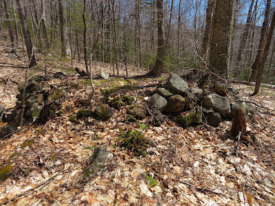
There are many stone piles in the woods, evidence that these lands were once cleared.
Stone walls abound.
This may be a barn foundation associated with the Durgin site.
A "horseshoe tree" pointed out to us on a bushwhack last winter with Sandwich historian Fred Lavigne. This is a relic of logging days, date unknown.
Continuing east on the North Road.
Beautiful spring day.
This water-filled cellar hole was part of the remote Samuel Wallace Farm, located on a ridge NW of Kiah Pond.
The stone well was close to the house.
Apparently a moose was also interested in local history.
One of the larger stone piles along the road, covered in moss.
A second well (foreground) and cellar hole (background) associated with the Wallace Farm. Writing in the 70th Annual Excursion of the Sandwich Historical Society (1989), D. Bruce Montgomery suggested that this home may have been built for Samuel Wallace's son, Asahel.
A long stone wall near the second cellar hole.
Soon I lost all trace of the North Road and bushwhacked down a slope of open hardwoods.
My next destination was a vast beaver meadow NE of Kiah Pond.
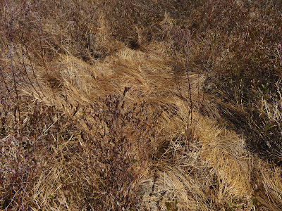
Looked like a moose had been resting here.
A stream meanders through the meadow on its way down to Kiah Pond
.
Mt. Israel in the distance.
From the meadow I bushwhacked up a ridge that parallels the Black Mountain Pond Trail on the west. At the base of a steep slope I came to one of those random picturesque scenes you discover in off-trail travel. The little stream at the base of the mossy cliff drains downslope into the meadow.
Boulder caves.
Elbow trees.
Spring beauties!
Oak forest on the crest of the ridge.
The flat summit of a nameless knob (2204 ft.).
Inviting ridgecrest.
A final ascent through spruce forest led to Black Mountain Pond.
Late afternoon at Black Mountain Pond, overlooked by the craggy face of Black Mountain, the SW shoulder of Sandwich Dome.
A stiff NW breeze was blowing, and the spring peepers were calling from a small beaver pond behind the outlet.
A corner of the Black Mountain Pond Trail on the knoll above the pond. The area around the pond has been heavily overcamped in the past, and hikers are urged to stay out of the marked revegetation areas.
View from the south shore.
Lingering snow in a cold shady spot on the Black Mountain Pond Trail.
On the return bushwhack, I paused to admire a cascade on Algonquin Brook.
Another cascade above.
A venerable yellow birch.
Buried sled runner at an old logging camp site.
I made a short near-sunset side trip off Sandwich Notch Road to Atwood Pond.
A peaceful scene accompanied by a lively chorus of spring peepers.


The history is fascinating and the photos are excellent!
ReplyDeleteYou should publish a history of Sandwich notch. I have never been able to find one.
ReplyDeleteLook for The Road Through Sandwich Notch by Elizabeth Yates, written in 1973.
ReplyDelete