
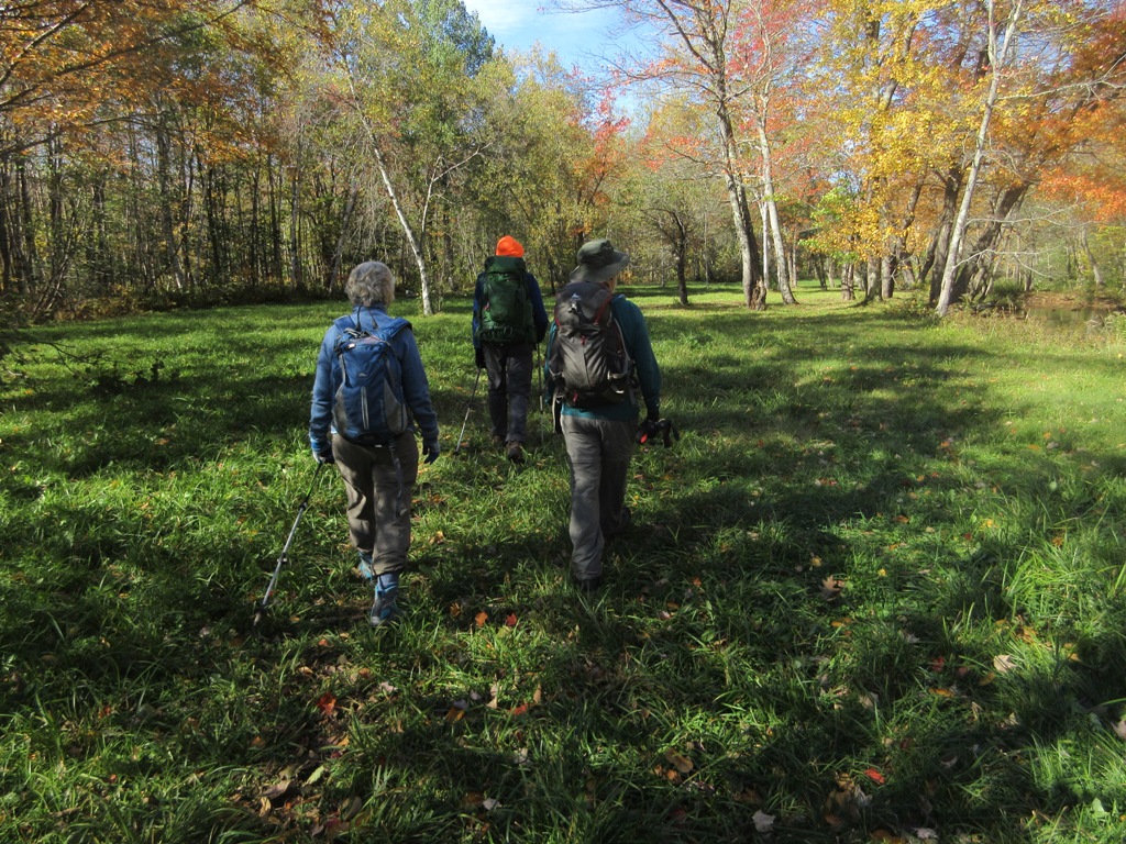
Five of us enjoyed a
spectacular sunny fall day for the 30th annual White Mountain Crop
Hunger Walk, a "hike for hunger" that benefits the programs of Church
World Service. This year's participants included Thom Davis, Dennis
Lynch, Mary Ann McGarry, Gary Tompkins and this correspondent.
Our route followed a 12-mile loop on the east (Maine) side of Evans
Notch, taking in Shell Pond, Blueberry Mountain and 2906-ft. Speckled
Mountain, the highest peak in the Caribou-Speckled Mountain Wilderness.
We enjoyed plenty of views and near-peak foliage.
Since its inception in 1989 our walk has raised more than $81,000 for
the anti-hunger programs of Church World Service, with more than
$20,000 of that provided to local food pantries in the western White
Mountains. We owe the success of our walk to the consistent generosity
of our sponsors. The CROP Hunger Walk theme is “Ending hunger, one step
at a time."
To make a donation for our walk, visit
https://www.crophungerwalk.org/lincolnnh, or mail a check made out to
"Church World Service" to Steve Smith, PO Box 445, Lincoln, NH 03251.
Thanks!
Blueberry Mountain seen from the Shell Pond Loop Trail, near the start of the hike.

An easy two-mile warmup on the Shell Pond Loop Trail.

Burly.

Taking in the view at the edge of Shell Pond.

Vista across the water to the Baldface-Meader ridge.

South and North Baldface.

The Basin Rim.

Mary Ann McGarry is liking the view.

Chatham Trails Association signs. The CTA does a fine job maintaining most of the trails in this area.

A popular rock climbing cliff on Rattlesnake Mountain.

The Shell Pond Trail leads through this idyllic meadow, part of the private Stone House property, whose owners graciously allow hiker access.
A magnificent maple.

Mount Meader looms ahead.

The Stone House, built in the 1850s. Hikers are requested to stay on the trails while traversing the Stone House property.

Rattlesnake Pool, a popular swimming hole on Rattlesnake Brook, located on a side path off the CTA's Stone House Trail.

Into the Wilderness. At about 12,000 acres, this is a relatively small area, but contains many interesting trails and features.

Up on the east side of Blueberry Mountain, a very recent relocation has added about 0.15 mile to the length of the Stone House Trail. The yellow line (from the AMC White Mountain Guide Online) shows the original route of the trail. Thanks to Joanne O'Connor Whitten for the heads-up on this new relo.

The new section features mostly easy grades and good soft footing, bypassing a steep, eroded section of trail.

Geology prof Thom Davis points out a quartz intrusion near the top of Blueberry Mountain (1781 ft.), a southern spur of Speckled Mountain.

Dennis Lynch takes in the SW view from the Lookout Loop on Blueberry Mountain. Kearsarge North and Eastman Mountain in the distance.

Shell Pond nestles in the valley beneath Harndon Hill and Deer Hill.

Gary Tompkins gets the shot, surrounded by blueberry foliage.

Our "official" group photo. Left to right, Thom Davis, Gary Tompkins, Steve Smith, Dennis Lynch and Mary Ann McGarry.

A great spot for lunch.

Thom examines a "perched boulder," with daylight visible beneath.

The first of several view ledges as we headed north up the Blueberry Ridge Trail.

The Carter Range beyond the Basin Rim.

Blueberry Ridge is a wonderful trail, ascending the ridge through patches of spruce woods...

...alternating with open ledges.

Partway up the ridge there's a vast expanse of ledge on the west side of the trail. Speckled hikers should take care to step only on bare rock and avoid trampling vegetation.

Looking SE towards Kezar Lake and Pleasant Mountain.

More ledges!

The spruce-clad summit of Speckled looms close ahead.

New signs at the junction on the ridge.

High elevation fern glade along the Bickford Brook Trail.

Endless views at the summit of Speckled.

The great Red Rock Cliff is prominent to the east.

A surprise visitor.

Rainbow Ridge/Carter Dome/Mt. Hight and Mt. Washington, in silhouette.

A three-way junction just east of the summit.

A wider northeastern view from a ledge area a short distance down the Cold Brook Trail.

Caribou
Mountain with Haystack Mountain below and in front. Two of the more
obscure notches in the Whites are seen here: Haystack Notch and Tyler
Notch.

Summit benchmark.

Northwestern view towards East Royce, the Moriahs and the southern Mahoosuc Range.

The 4.3 mile descent along the Bickford Brook Trail largely follows the old service road built for the former firetower on the summit. Grades are easy to moderate and the footing is generally good, making for an easy way down.

Our route for the day. Click here for much more on Speckled and Blueberry Mountains.

I'm adding this one to my bucket list. Wow!
ReplyDeleteIt's a great loop!
Delete