
The long and leisurely way to climb Whiteface, up the 5-mile valley of Downes Brook - with visits to two logging camp sites and a big slide - and then along the quiet Kate Sleeper Trail to the ridge. Only saw two people in 12 1/2 miles.
The Downes Brook Trail enters the Sandwich Range Wilderness after about 1.5 miles.

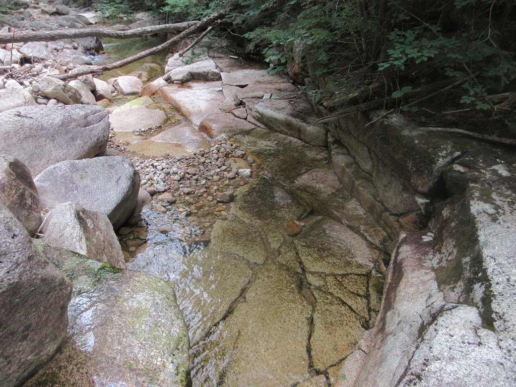
The water level was very low, and all of the 10 crossings of Downes Brook were relatively easy today. In high water, it's best to hike elsewhere.

A mini-gorge just below the sixth crossing.
Cool water.

Artifacts at the first of two logging camp sites located along the trail. These were used by the Conway Lumber Company's Swift River Railroad in the period from 1906-1916. (Please note that these artifacts are protected and it is illegal to remove them from the WMNF. Plus, it deprives other history buffs of the opportunity to view these items.)

A rusted shovel blade.

A length of heavy chain is something I haven't seen often at old logging camp sites.

Among the items here appears to be remnants from loggers' boots.

Part of a crosscut saw blade. No chainsaws in those days.

Following the trail can be tricky at the stream crossings, but someone has built some small cairns to make it easier, as seen on the right in this photo.


A tricky spot at a washout along a high, steep bank.

A piece of rail at the upper logging camp site.Not sure why this was here, as there was no railroad spur line up this valley.

What appears to be pieces from a stove under a fallen birch.

This tree grew up through a hoop, then snapped off recently.

At the 4.5 mile mark I bushwhacked down to the brook and then up onto the largest of several slides that fell off the north ridge of Mt. Whiteface about 1920. Subsequent editions of the AMC White Mountain Guide noted that for a mile downstream the slides destroyed the old logging road that led up the valley.

Looking across at the NE shoulder of East Sleeper.

A wide swath of desolation, still mostly open a century later. Back in 1995 I climbed to the top of the slide and made a gnarly bushwhack to the Rollins Trail on the north ridge of Whiteface. Not today.

A distant view out to the north.

Mt. Washington, Boott Spur, Mt. Tremont/Owls Cliff above Potash Mountain, the Wildcats above Mt. Parker, and Carter Dome.

Nice spot to hang out for a while.

Some revegetation is underway at the base of the slide.

Downes Brook at the base of the slide.

Above the slides the trail passes many small cascades. The footing is rougher, but the scenery is beautiful.

This mossy, rocky side stream issues from a small beaver meadow on a plateau to the west.

A few years ago I snowshoed up to that beaver meadow, and found a view across to the ridge of Mt. Whiteface.

In the latest Google Earth image, the meadow is surrounded by a ring of massive blowdown and likely won't be visited anytime soon.


A spot where the brook is smothered by fallen trees.

The tenth and final crossing of Downes Brook, just below the junction with the Kate Sleeper Trail.

On to the Kate Sleeper Trail, perhaps the most remote path in the Sandwich Range.

This is a wonderful high elevation woods walk.

At the junction of the Kate Sleeper and Rollins Trails is the site of Camp Shehadi, a leanto originally built in 1899 by the Wonalancet Out Door Club. It deteriorated over the years and was eventually removed by the Forest Service in 2002.

Along the Rollins Trail heading for the true summit of Mt. Whiteface.

A small cairn marks the wooded and viewless true summit.

Heading towards the ledgy south summit, a short but very difficult bushwhack led me out to a projecting view ledge.

The true summit rises nearby to the north, with the bumpy Rollins Trail ridge leading away.

Mt. Passaconaway rises majestically above the headwall of the glacial cirque known as The Bowl.

A hazy view of the distant Presidentials.

Eastward to the Wonalancet Range, Mt. Paugus and Mt. Chocorua.

Mt. Moosilauke beyond Mt. Tecumseh.

The high granite ledges at the south summit.

On the topmost ledge an iron bolt and carved triangle still remain from the 1870s U.S. Coastal Survey.

Looking out over the Lakes Region.

Meadowsweet growing in a crack.

Looking down the "white face."

A short way down the McCrillis Trail there is a peek at Flat Mountain Pond and Sandwich Dome.

This picturesque meadow is at the head of Downes Brook, not far from the trail.

These timbers appear to be the remnants of cribbing used on a sled road by the Conway Lumber Company. Logging heavily impacted the Kate Sleeper Trail from about 1913 to 1916.


A scenic spot along Downes Brook, a regular break spot on a hike up this beautiful valley.

No comments:
Post a Comment